Map of Sterling Heights
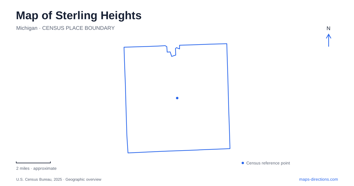
Street tiles load from OpenStreetMap when opened. The blue line shows the 2025 Census boundary.
- State
- Michigan
- Population · July 2025
- 133,931
- Land area
- 36.4 sq mi
- Water area
- 0.3 sq mi
Sterling Heights combines a recognizable major-road grid with a river corridor that follows its own course. The municipal recreation map labels the numbered mile roads, Van Dyke, Mound, Schoenherr and Hayes alongside the Clinton River and its parks. Those two patterns are useful together: roads place an address within the city, while the river explains why recreation destinations and paths do not always follow the same straight lines. Dodge Park is a strong starting reference, but it is only one part of that landscape.
Dodge Park has both a road address and an internal layout
The city lists Dodge Park at 40620 Utica Road. Its map shows the relationship with Dodge Park Road and identifies pavilions, a playground, an amphitheatre, parking and the Clinton River setting. This is a place where the general address answers only the first arrival question. A shelter gathering, performance and trail outing may all use the park while ending at different features within it.
For a Sterling Heights event at the park, retain the facility name supplied by the organizer. “Dodge Park” alone leaves several possible meeting points. The park map's trail loops and bridge symbols are also different from its street approaches. Someone arriving on foot needs the relevant path connection, whereas a vehicle needs a designated parking approach. Reading those categories separately prevents an attractive green-area map from being mistaken for a vehicle-access diagram.
Utica Road links a civic and recreation setting
Municipal planning places the city campus and Dodge Park along Utica Road. The street is therefore more than a route past a single park: it helps orient a cluster of public destinations. A civic appointment should still use its particular building address rather than the park's address across the broader area. The shared corridor is useful context, but it does not establish one entrance for every facility.
The city has also published pedestrian-crossing improvement information for this frontage. The practical map lesson is to identify an actual crossing rather than assume that two places facing the same road have a direct pedestrian connection at every point. Use the street-level arrangement for the final movement. A broad city view can show that destinations belong together geographically without proving the most convenient or accessible way between their doors.
Follow the river through named access points
The Clinton River gives Sterling Heights a connected outdoor setting, but a river line is not itself a public access instruction. The city identifies canoe and kayak access at Rotary Park on Utica Road and North Clinton River Park on Riverland Drive. Those specific names and streets are useful starting points for a water-oriented trip. They distinguish formal facilities from an arbitrary point where a road happens to approach the bank.
A paddle outing and a trail walk also need different map details. The river's course may guide one journey, while a path network and bridge crossings guide another. Do not infer that a mapped walking path provides boat access, or that a launch automatically provides the desired land-route connection. The municipal parks material supplies separate information for river recreation and trails because the activities require different kinds of access.
Clinton River Road is not the river trail
Clinton River Road is a road corridor extending between Van Dyke and Hayes in the city's project information. That source also identifies connections with M-59 and Schoenherr. It is useful for understanding how the river-related part of the city meets the larger road network. However, a similar name does not make the roadway interchangeable with a non-motorized trail beside the water.
This distinction is especially relevant when reading planning or construction documents. A project map may show future path improvements together with existing streets. Before using a line as a route, establish which category it represents. For Sterling Heights, keeping road, river and trail labels distinct is more informative than reducing all three to a single river-corridor destination. Current road restrictions belong in the city's live project information rather than in a permanent geographic description.
Freedom Hill is another recreation and event destination
Freedom Hill County Park belongs to a separate map setting along Metropolitan Parkway, also identified as 16 Mile Road in county recreation material. The county's site map distinguishes its pavilion and other park spaces from the amphitheatre complex. A concert arrival and a casual park visit therefore should not automatically use the same saved endpoint. The facility involved determines the relevant approach and event instructions.
A Sterling Heights overview works best when these places retain their individual identities. Dodge Park provides a Utica Road anchor, the named river parks clarify water access, and Freedom Hill introduces another event and recreation cluster. Use the major-road map to move between areas, then switch to the specific facility or trail map. That combination explains the city without suggesting that a park boundary, riverbank or planning line guarantees unrestricted access.
Map and statistics: U.S. Census Bureau, 2025 Gazetteer, January 2025 generalized place boundaries and Vintage 2025 population estimates. Local references: City of Sterling Heights; Macomb County. Article prepared by Maps & Directions.