Map of Stanton
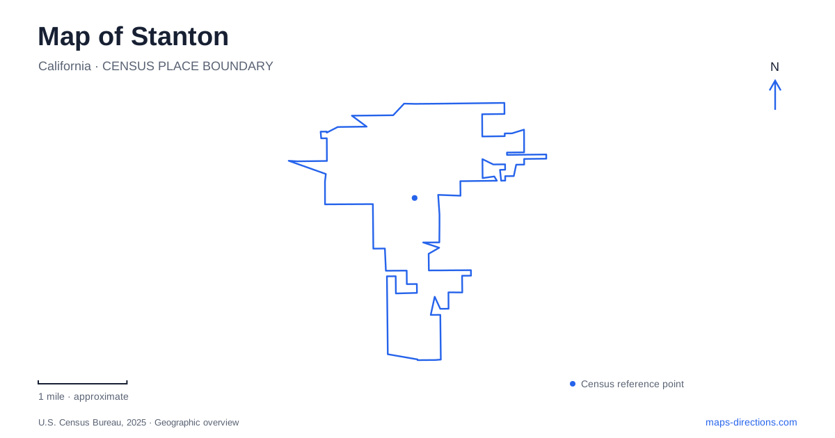
Street tiles load from OpenStreetMap when opened. The blue line shows the 2025 Census boundary.
- State
- California
- Population · July 2025
- 40,161
- Land area
- 3.1 sq mi
- Water area
- 0.0 sq mi
Stanton occupies a compact part of northwestern Orange County, but its public places are distributed among several recognizable streets. Katella Avenue anchors the civic buildings, Western Avenue leads to the largest concentration of recreation facilities, and smaller parks occupy neighborhood sites on Cedar, Date, and Fern. Reading these clusters gives the map more meaning than following the through roads alone. The city developed within a regional transportation network, yet its local geography is especially clear in the relationship between civic addresses and small areas of public open space.
A community incorporated twice
The earlier community was known as Benedict. It became an incorporated city in 1911, then voters chose disincorporation in July 1924 to allow the state to construct roads in the territory. A successful incorporation election followed in May 1956, and the municipality officially returned on June 4 that year. The Congressional Record commemorated this unusual sequence during the city's sixtieth-anniversary celebrations in 2016.
That history helps explain why roads belong in a description of Stanton rather than appearing only as directions between attractions. Decisions about local government and responsibility for transportation were closely connected. The current city is one stage in a longer story of a community defining its place within a growing county, rather than a settlement whose administrative boundaries and institutions remained constant from its first incorporation.
Katella and the civic addresses
City Hall and the civic/community center stand at 7800 Katella Avenue. The county library is listed at 7850 on the same avenue, making this a useful civic reference area. Cedar Street adds another set of nearby public destinations: Veterans Memorial Park at 10970, police services at 11100, and the park and Norm Ross Sports Complex at 11111. These addresses organize several different services around a relatively small portion of the street network.
The memorial park has a central monument, a Wall of Inspiration, and benches. Its commemorative purpose differs from the exercise equipment, picnic shelters, and open green space of the larger park on Cedar. On Date Street, Zuniga Park provides courts and a playground, while Martha Weishaupt Linear Park offers a smaller passive green space. These are complementary pieces of the neighborhood landscape: places for remembrance, active play, and quieter outdoor use, each with a different footprint and purpose.
Western Avenue and the railway edge
Stanton Central Park is at 10660 Western Avenue. The city celebrated its opening in June 2016 with a recreation complex that brought together tennis, a skate park, sports fields, playgrounds, and an exercise loop. A butterfly garden and bandstand added uses beyond organized sport, while picnic shelters and a community building supplied places for groups to gather. The park's mix of facilities explains why it occupies such a prominent position among local public destinations.
The entrance also illustrates the continuing influence of the railway. City council records describe the Western Avenue and Thunderbird Lane entrance signal project and its proximity to a railroad crossing. Coordination with the railroad affected the signal's design and construction process. This is a useful example of transport infrastructure shaping the edge of a modern park: the recreational site may be new, but the surrounding corridor imposes older physical relationships on its access.
A neighborhood park on Fern
Harry M. Dotson Park occupies a smaller site at 10350 Fern Avenue. Its development was documented as an infill project on a vacant 1.2-acre parcel. The design combined play areas, a water-play feature, a picnic shelter, and a half basketball court within a residential setting. This represents a different approach from the broad activity mix on Western Avenue: recreational space inserted into an existing neighborhood instead of a single large community destination.
The pirate-ship play structure gives Dotson a particularly recognizable identity. City recreation material describes climbing, slides, and imaginative play for older children alongside a separate structure for younger children. In Stanton, that distinction matters more to a family choosing an outing than treating every green patch as interchangeable. The park's physical design explains whom it serves and why its small footprint can still contain several kinds of activity.
Seeing the local pattern
A map of Stanton works best when the civic cluster and recreational network are read together. Katella supplies institutional addresses; Cedar and Date hold several public spaces with different purposes; Western concentrates a wider range of recreation; and Fern contributes a neighborhood-scale play destination. The city's incorporation history and railway infrastructure add context to that arrangement. They show how a compact municipality developed public places within a transportation landscape shared with the wider county.
Map and statistics: U.S. Census Bureau, 2025 Gazetteer, January 2025 generalized place boundaries and Vintage 2025 population estimates. Local references: Congressional Record; City of Stanton; California State Clearinghouse. Article prepared by Maps & Directions.