Map of St. Peters
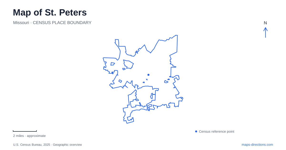
Street tiles load from OpenStreetMap when opened. The blue line shows the 2025 Census boundary.
- State
- Missouri
- Population · July 2025
- 61,479
- Land area
- 22.5 sq mi
- Water area
- 0.0 sq mi
St. Peters is easier to understand as a set of distinct districts than as a town arranged around one square. Old Town preserves the geography of an earlier rail settlement, the City Centre campus concentrates civic and recreation destinations near Mexico Road, and the northern lakeside landscape opens into a much larger park setting. Creeks provide another thread through this pattern. Looking at those four elements together explains why similarly municipal destinations can lead a visitor to quite different parts of the community.
The older settlement along Main Street
Old Town's Main Street belongs to the city's early settlement pattern. Railroad service reached the community in the middle of the nineteenth century, and Depot Street retains a geographic clue to that history even though the old depot itself is gone. The historic district therefore rewards a closer view of individual blocks and street names. A railway-related name is evidence of the area's development, not necessarily a promise that a station still stands there.
For someone examining a map of St. Peters, this older center provides an important distinction from the modern civic complex. Main Street and Depot Street describe the compact historic settlement, while the large recreation and government facilities discussed elsewhere occupy their own campus. Keeping the two centers separate makes local descriptions much clearer. A reference to Old Town is about that earlier street environment; it should not automatically be interpreted as the location of City Hall or the main recreation complex.
Mexico Road and the City Centre campus
City Centre Park brings together a different collection of landmarks: City Hall, the Arts Centre, the Rec-Plex, and parkland. Mexico Road is a principal reference along this setting, while City Centre Park Drive and Boone Hills Road help frame the facilities on the municipal map. The veterans memorial stands near the Mexico Road entrance to City Hall, adding a recognizable feature at the edge of the civic grounds.
Within the park, a pond and gazebo contrast with the larger recreation buildings. Ollie's Fun Forest adds another distinct outdoor destination. These elements are close enough to belong to one campus but sufficiently different that the campus map tells a more useful story than a single large park label. It shows how buildings, green space, paths, and approaches fit together.
This part of St. Peters works well as a geographic reference because multiple civic names converge here. The main Rec-Plex and Rec-Plex South appear separately on the park map, along with nearby Spencer Creek Park. A visitor can use those named buildings and the pond to describe a meeting location precisely. The layout also explains why a municipal address, a recreation appointment, and a playground outing can all involve the same broad area while having different final destinations.
The lake beside Highway 370
Farther into the northern landscape, 370 Lakeside Park occupies a much larger setting. The city describes a roughly 500-acre park around a 140-acre lake, reached from Lakeside Park Drive near Highway 370. Trails, camping areas, pavilions, and water recreation occupy different sections of that space. Here the organizing feature is the lake rather than a street intersection or a group of public buildings.
The scale changes the way the map reads. A shore path can extend around a substantial body of water, while the RV area and recreation facilities occupy particular edges. The official park map distinguishes the lake boat ramp from the creek access associated with the blueway. That distinction is geographically important: paddling on the park lake and entering a flowing creek are different routes through the landscape, even though both begin within the same named park.
St. Peters also places this park within the Mississippi River floodplain. That broader setting helps explain its open character and relationship to nearby waterways. It does not mean that every water feature shown at the park is the Mississippi itself. The lake, tributary channels, and main river belong to different scales of the regional map.
Trace the creeks between recreation areas
The local blueway follows the Dardenne Creek system, with access associated with 370 Lakeside Park, Lone Wolff Park, and Woodlands Sports Park. Sandfort Creek is also part of the northern access geography. These named places create a useful sequence for understanding how recreation sites relate to watercourses rather than simply to roads.
At Woodlands, the city's access description places the approach beside Soccer Field Seven, followed by a walk south along the trail. That combination of athletic fields and creek access illustrates how different uses meet within one park. For a broad overview of St. Peters, trace the creeks alongside the road network: Old Town explains the historic settlement, Mexico Road identifies the civic campus, and the northern waterways reveal a separate landscape of lake, floodplain, and connected recreation sites.
Map and statistics: U.S. Census Bureau, 2025 Gazetteer, January 2025 generalized place boundaries and Vintage 2025 population estimates. Local references: City of St. Peters. Article prepared by Maps & Directions.