Map of St. Louis
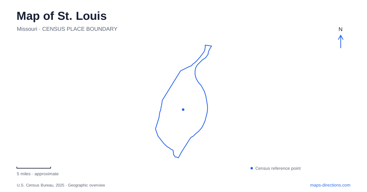
Street tiles load from OpenStreetMap when opened. The blue line shows the 2025 Census boundary.
- State
- Missouri
- Population · July 2025
- 278,144
- Land area
- 61.7 sq mi
- Water area
- 4.5 sq mi
St. Louis can be read through several distinct public landscapes: a monumental Mississippi riverfront, nineteenth-century residential districts and a large western park containing cultural institutions. The Gateway Arch is the most recognizable landmark, but it explains only one part of the city. Eads Bridge records a major change in river crossing, the Old Courthouse holds a difficult national history, and neighborhoods such as Soulard and Lafayette Square show how people built homes and communities beyond the commercial waterfront.
The riverfront links engineering and national history
Eads Bridge was completed in 1874 to a design by James Buchanan Eads. It became the city's first bridge across the Mississippi, introducing a fixed crossing into a landscape long defined by river traffic. Its position beside the downtown waterfront makes it a useful historical counterpart to the much later Arch. One structure answered a practical transport problem; the other became a national monument interpreting westward expansion.
Gateway Arch National Park also includes the Old Courthouse. In 1846, Dred and Harriet Scott began their legal effort there to gain freedom from slavery. Their cases connect this specific building with the wider struggle over slavery and citizenship. The courthouse therefore deserves attention as more than a foreground feature in a photograph of the Arch. Together, the river, bridge, monument and court building place St. Louis within several overlapping national histories: transportation, expansion and the contested meaning of freedom.
Soulard's streets and building lots
Soulard developed from an area of common fields and French farms into an urban neighborhood during the nineteenth century. German and Bohemian immigration contributed to its growth as streets and lots were laid out in a regular grid. The buildings were commonly two-story brick structures placed close to the street on narrow parcels.
Those dimensions help explain the neighborhood's character. Narrow lots and street-edge buildings create a different urban experience from detached houses set deep within large lawns. Federal, Italianate and Second Empire influences appear among the architectural styles associated with the district. Local historic designation in 1972 recognized the importance of this surviving fabric. Reading the pattern of lots and buildings reveals how the neighborhood developed, even without entering a single property. Soulard's history gives St. Louis a residential and immigrant story alongside the larger monuments of the riverfront.
Lafayette Square grows around a park
Lafayette Square is bounded by Chouteau Avenue, Interstate 44, Dolman Street and South Jefferson Avenue. Its central park was dedicated as Lafayette Square in 1851 and renamed Lafayette Park in 1854. Residential development around it accelerated after the Civil War, with substantial houses and carefully planned streets taking shape in the surrounding blocks.
Benton Place, laid out in 1866, is one distinctive example of that residential planning. The park itself gained ornamental features, trees, a lake and recreation spaces, making it a focus for both neighborhood identity and leisure. A devastating tornado in May 1896 damaged the park and surrounding buildings, leaving a major interruption in that development story. Later restoration efforts beginning in the late 1960s helped recover much of the area's historic character.
The neighborhood illustrates a different urban form from Soulard's narrow working streets. Here, the relationship between residences and a landscaped central park is fundamental. Looking at both areas provides a useful comparison of nineteenth-century development within St. Louis, without assuming that all historic neighborhoods were built for the same residents or around the same priorities.
Forest Park operates at another scale
Forest Park was dedicated in June 1876 and covers more than 1,300 acres. Its woodlands, waterways, prairie areas and recreational landscapes create a substantial open-space setting within the city. Cultural institutions including the Missouri History Museum, the art museum and the science center add destinations whose functions extend well beyond ordinary park recreation.
The scale changes how a visitor should read the map. A named institution occupies a particular part of a much larger landscape, with its own approach and surrounding features. Combining several destinations can involve a considerable amount of movement through the park, even though every stop shares the same park name. Paths, waterways and open lawns become part of the journey rather than empty space between attractions.
Comparing the city's public landscapes
The riverfront and Forest Park offer two very different ways to experience St. Louis. One concentrates attention on the Mississippi, a historic crossing and nationally significant buildings; the other provides a broad setting for museums, ecological landscapes and recreation. Soulard and Lafayette Square fill in the residential geography between such major destinations. Their street grids, house forms and park relationships explain how urban life developed at a more everyday scale. A useful map preserves these differences instead of reducing the city to the Arch and a list of unrelated attractions.
Map and statistics: U.S. Census Bureau, 2025 Gazetteer, January 2025 generalized place boundaries and Vintage 2025 population estimates. Local references: National Park Service; City of St. Louis; Forest Park Forever. Article prepared by Maps & Directions.