Map of St. Cloud
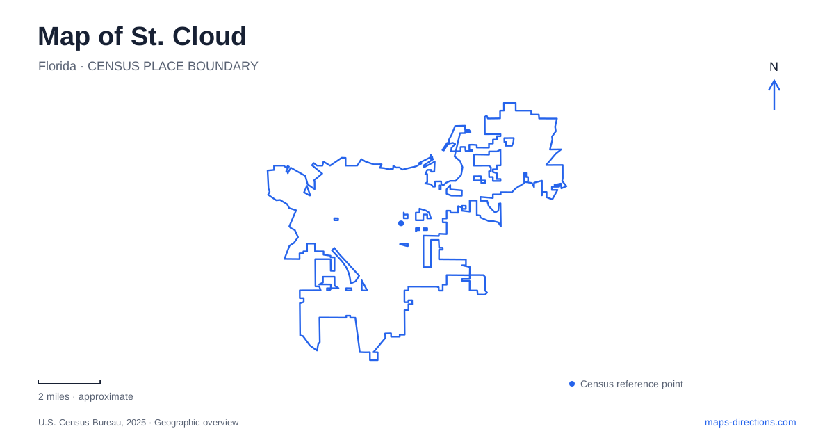
Street tiles load from OpenStreetMap when opened. The blue line shows the 2025 Census boundary.
- State
- Florida
- Population · July 2025
- 74,960
- Land area
- 30.9 sq mi
- Water area
- 0.1 sq mi
St. Cloud, Florida, has a street pattern that tells part of its history before any building is identified. State-named avenues run across numbered streets, and the older grid sits on the southern shore of East Lake Tohopekaliga. The waterfront, downtown blocks, and preserved wetlands provide three distinct ways to experience this part of Osceola County. Keeping those settings together on the map reveals a community shaped by veteran settlement, lake recreation, and the survival of natural habitat amid development.
Why the avenues carry state names
The settlement established in 1909 attracted Union veterans of the Civil War. According to the county historical society's account, the original north-south avenues were named for Union states, including New York, Pennsylvania, and Massachusetts. Names associated with former Confederate states were added as the community expanded east and west. The avenue names are therefore more than convenient labels: they preserve the geography imagined by the early developers and settlers.
For finding an address in the older part of St. Cloud, the combination of a named avenue and numbered cross street is especially useful. It places a destination within a recognizable grid while retaining the historical sequence behind that grid. The area also contains residential blocks, so the original town should not be imagined as exclusively a shopping district. Downtown activity occupies a portion of a broader historic neighborhood beside the lake.
The downtown rectangle
The city's designated entertainment district has precise boundaries: 9th Street to the north, 13th Street to the south, Florida Avenue to the east, and Massachusetts Avenue to the west. This rectangle gives a practical scale to the phrase downtown. Brick streets, wide sidewalks, planting, and decorative lighting distinguish the district from a generic highway shopping area.
Historic architecture adds another layer. The former Veterans Memorial Library opened in 1923 and was designed by Ida Ryan and Isabel Roberts, partners in Orlando's first architecture practice founded by women. Its civic purpose is a reminder that the town developed shared institutions as well as homes for retired servicemen. A walk through central St. Cloud can consequently be read through both commercial storefronts and buildings created for community life, with numbered streets providing a straightforward way to locate their relationship to one another.
Lakeshore Boulevard and the public waterfront
Lakefront Park is listed at 1104 Lakeshore Boulevard, north of the historic district. It gathers a sand beach, marina, boat ramp, fishing pier, playground, and splash pad into a waterfront recreation setting. More than two miles of bicycle path give the shore a linear character: the experience extends beyond a single lawn or pavilion.
Dan Tarrell Memorial Point adds a projecting waterside destination with benches and temporary boat tie-outs around the basin. This is useful geographic detail for someone meeting a group at the waterfront, since the point and the playground describe different portions of the same larger park. Historically, Ohio Avenue also led to the Joyland Beach pier and dance hall. Early boat and bathing facilities were lost to fires and rebuilt, showing that recreation along this shore has a much longer history than the modern park equipment suggests.
Peghorn's wetland and working heritage
At 2101 Peghorn Way, Peghorn Nature Park preserves a different setting within St. Cloud. The city developed the 58-acre passive park around environmental and local heritage education. Its name refers to cattle once raised in the area with horns shaped like wooden pegs, a detail that connects the landscape to ranching rather than lakeside leisure.
Nature trails and wetlands sit alongside a heritage village with an old schoolhouse, cannery, and blacksmith area. Community gardens and an outdoor classroom extend the educational role. The combination helps explain why this green area merits more attention than its outline alone: it presents both habitat and the everyday practices associated with an earlier rural community. It offers a different reason to leave the downtown grid than a visit to the marina.
Runnymede and the surviving lake landscape
Lake Runnymede Conservation Area lies at 4600 Rummel Road, alongside its namesake lake and near East Lake Tohopekaliga. Acquired by the county in 2007, the preserve includes land associated with the former community of Wharton, established in 1885, and later used for cattle grazing. Short trails pass through oak woodland, dry sandy scrub, and wetter ground.
That range of habitats gives the map of St. Cloud depth beyond the town blocks. Peghorn emphasizes wetland education and rural heritage; Runnymede protects a varied natural landscape; Lakefront Park concentrates developed waterside recreation. Together with the state-named avenues, these places explain how the local street system and its surrounding lakes belong to one connected geographic story.
Map and statistics: U.S. Census Bureau, 2025 Gazetteer, January 2025 generalized place boundaries and Vintage 2025 population estimates. Local references: Osceola History; City of St. Cloud; Florida Department of State; Osceola County. Article prepared by Maps & Directions.