Map of Spring Hill
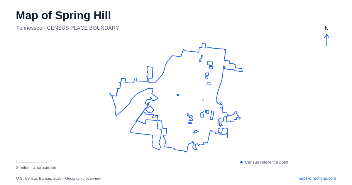
Street tiles load from OpenStreetMap when opened. The blue line shows the 2025 Census boundary.
- State
- Tennessee
- Population · July 2025
- 61,336
- Land area
- 29.7 sq mi
- Water area
- 0.0 sq mi
Spring Hill occupies both Maury and Williamson counties south of Nashville. That two-county setting is one of its most useful map facts: municipal identity and county boundaries do not coincide. The road network introduces another distinction, with Main Street carrying the older town corridor and Saturn Parkway reflecting the importance of modern manufacturing. Parks, historic properties, and residential areas sit within that framework rather than around a single compact visitor district.
Main Street and the highway names beneath it
Main Street is also identified as US 31 and State Route 6 in city transportation documents. Recognizing those overlapping names helps connect a local address to the broader highway map. A direction mentioning the numbered route may refer to the same corridor that another description calls Main Street. This is especially useful when comparing a regional map with a closer view containing business and civic labels.
Kedron Road provides a connection between Main Street and Saturn Parkway. Its role is easy to see when both endpoints remain visible: it links the older north–south road to the major parkway rather than functioning only as a neighborhood street. For a map of Spring Hill, that connection is a useful starting point because it shows how different generations of the road network fit together. Main Street addresses and parkway-oriented destinations can be close in regional terms while relying on distinct local approaches.
Saturn Parkway links Interstate 65 with the General Motors manufacturing area. The industrial landscape is therefore a major part of the city's geography, not simply one factory marker among residential blocks. The parkway's name preserves the earlier Saturn identity associated with the plant. Beechcroft Road is another important reference around that manufacturing setting, appearing in the city's documentation of connections between industrial properties and the regional road system.
A historic property on the Main Street corridor
Rippa Villa stands at 5700 Main Street on the Maury County side of the city. Its grounds contain much more than the prominent house. The city's history describes a carriage house, a surviving building associated with enslaved residents, a Freedmen's Bureau schoolhouse, cemetery, and agricultural structures. Those features give the property a landscape history that extends beyond the architecture of the main residence.
On a Spring Hill map, the estate offers a geographic link between the highway corridor and the area's agricultural past. A broad property outline contains several places whose histories and original purposes differ. Reading it as a historic landscape encourages attention to those relationships rather than reducing the site to a photograph of one building. The surrounding road network belongs to the modern city, while the grounds preserve evidence of older patterns of work, residence, education, and land use.
The county distinction remains relevant here. A property can be clearly within the city while also being described through Maury County. Neither description cancels the other. Keeping municipal and county boundaries as separate map layers is particularly helpful when researching local history or locating public services.
Three parks, three local settings
Evans Park is on Maury Hill Street. Its baseball fields, playground, dog park, and memorial butterfly garden create a recreation destination with several distinct uses. Harvey Park, on Miles Johnson Parkway, offers another setting with a walking trail, picnic shelters, and playground. The city describes Harvey as centrally located, making its road name a useful reference when comparing residential destinations nearby.
Fischer Park at Port Royal is on Port Royal Road. Its larger recreation layout includes athletic fields, courts, a walking route, splash-pad area, and a veterans plaza. The park's full name is useful because local references may emphasize either Fischer or Port Royal. They describe the same municipal facility, not two parks requiring separate stops.
For families exploring Spring Hill, these three road names are a practical way to organize choices: Maury Hill Street for Evans, Miles Johnson Parkway for Harvey, and Port Royal Road for Fischer. Each park combines activities differently. Keeping the site names paired with their roads helps make sense of an event listing or recreation schedule without assuming that every city activity takes place at the largest park.
Putting the districts together
A useful overview of Spring Hill keeps Main Street, Kedron Road, Saturn Parkway, and the three park locations in view together. This reveals the relationship between the older highway corridor, industrial access, and everyday recreation spaces. The historic estate adds another layer along Main Street, while the county boundary explains why surrounding references alternate between Maury and Williamson. With that framework established, a closer map can concentrate on the particular grounds, building, or park area that matters for the visit.
Map and statistics: U.S. Census Bureau, 2025 Gazetteer, January 2025 generalized place boundaries and Vintage 2025 population estimates. Local references: City of Spring Hill. Article prepared by Maps & Directions.