Map of Spokane
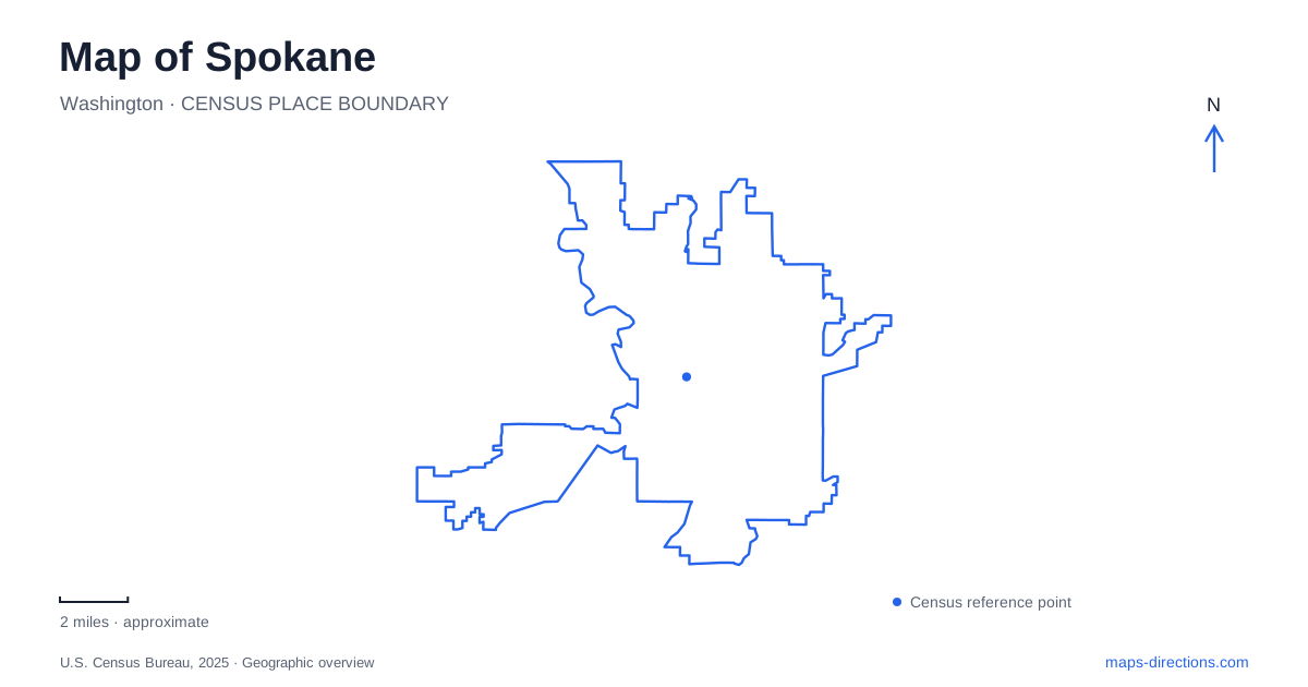
Street tiles load from OpenStreetMap when opened. The blue line shows the 2025 Census boundary.
- State
- Washington
- Population · July 2025
- 230,783
- Land area
- 68.8 sq mi
- Water area
- 0.7 sq mi
Spokane's downtown map revolves around falling water, islands and bridges. Riverfront Park occupies land once covered by railway facilities, while the Centennial Trail follows the river into adjoining neighborhoods and the gorge. Away from that central water corridor, Browne's Addition preserves a residential architectural setting, and Manito Park brings a collection of gardens to the South Hill. These places offer distinct scales of exploration: an island park, a linear route, neighborhood streets and a large horticultural landscape.
The falls before the park
Spokane Falls was a gathering and fishing place for Indigenous people long before the modern city. Later industrial development placed mills, factories and railway infrastructure around the water. The present park landscape emerged from a substantial transformation, especially the removal of rail yards and cleanup associated with Expo '74.
Havermale Island had held the Great Northern Railroad Depot. The depot was demolished for the exposition, but its 1902 clock tower survived and remains a visible reference within the park. The tower's position makes more sense with that earlier station footprint in mind: it was once part of a much larger building, not originally a freestanding park ornament.
The U.S. Pavilion and gondolas also connect the waterfront with the 1974 world's fair. The Looff Carrousel arrived from the former Natatorium Park in 1975, adding another transplanted piece of local recreation history. Riverfront's landmarks therefore come from different periods and purposes, even though they now share a common public landscape.
Bridges and viewpoints through downtown
A close map of Spokane shows how the islands and river channels shape pedestrian movement. Views from one bank differ from those reached by crossing to the other, and the falls are experienced from several levels rather than from a single viewing platform.
Near the Washington Water Power building, the Post Street crossing reaches the Centennial Trail side of the river. The path descends toward a viewing area beneath the Monroe Street Bridge, with Huntington Park visible across the water. Continuing toward Kendall Yards changes the view again, framing the falls with the bridge's arches. This progression makes the trail a way to understand the river's depth and direction, not just a route past an attraction.
The downtown portion of the Centennial Trail also connects toward Gonzaga University, the Riverpoint area and Mission Park. Those names help place the park within a wider east-west corridor. A short waterfront outing can remain near the falls, while a longer walk or ride follows the river beyond the central islands and into other urban settings.
Browne's Addition and the high river edge
Browne's Addition presents a different part of Spokane's development. The neighborhood has been a National Register historic district since 1976, and a local historic district designation followed in 2019. Its preserved residential fabric makes the streets themselves part of the experience, with individual buildings contributing to a larger neighborhood character.
The Campbell family chose this area for their home in 1898. The English Tudor Revival house stood back from the street behind a park-like front yard, while the rear grounds overlooked the river far below. A gazebo, pond and rockery formed part of that landscape. This arrangement illustrates the neighborhood's relationship to elevation: the river remained a visual presence even where houses were separated from its banks by a substantial drop.
Reading the house and grounds together provides a different perspective from the river-level trail. Here, the water helped shape a residential view and designed garden rather than an industrial site or public waterfront path.
Manito's gardens and older park features
Manito Park was established in 1904 and developed from a recreation area that once included a zoo into a major horticultural destination. Its five principal gardens are the Nishinomiya Tsutakawa Japanese Garden, Duncan Garden, Rose Hill, Lilac Garden and Ferris Perennial Garden. Each occupies a distinct part of the grounds, so the park map is useful for planning a route among different garden styles.
The Gaiser Conservatory adds seasonal indoor displays, while Mirror Pond, playgrounds and open landscape broaden the park beyond formal planting beds. Loop Drive and its bridge provide another orientation feature near the rose garden. The basalt office building, constructed in 1912, preserves an early layer of park architecture among later horticultural development.
For a Spokane itinerary, Manito offers a clear change from the downtown river corridor. Paths move between cultivated gardens and more open park spaces rather than tracing a waterway. Choosing a few garden areas allows time to appreciate their different forms, while the conservatory, pond and historic building help connect them into a coherent landscape instead of a checklist of separate floral displays.
Map and statistics: U.S. Census Bureau, 2025 Gazetteer, January 2025 generalized place boundaries and Vintage 2025 population estimates. Local references: City of Spokane; Visit Spokane; Northwest Museum of Arts and Culture. Article prepared by Maps & Directions.