Map of Spokane Valley
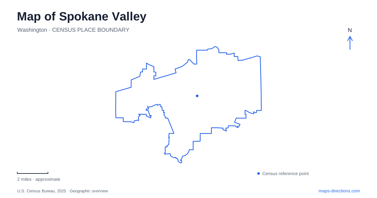
Street tiles load from OpenStreetMap when opened. The blue line shows the 2025 Census boundary.
- State
- Washington
- Population · July 2025
- 108,405
- Land area
- 37.7 sq mi
- Water area
- 0.3 sq mi
Spokane Valley can be read through two contrasting east-west landscapes. Sprague Avenue and the Appleway Trail organize movement through the built-up urban area, while the Spokane River and Centennial Trail follow a more varied corridor of parks, rock outcrops, and water. Mirabeau Point connects public facilities with that river landscape, and the former Opportunity Township Hall preserves an older community identity along Sprague. These places provide a useful structure for a map: a commercial and civic spine, a reused railway alignment, and a separate river-oriented recreation system.
Sprague Avenue and the older community map
City Hall uses 10210 East Sprague Avenue, giving the municipal government a clear address on a principal urban corridor. Farther along the same avenue, the Spokane Valley Heritage Museum stands at 12114 East Sprague. The museum acquired the historic Opportunity Township Hall in 2004, two years after the institution was founded. Its building therefore preserves a community name and a civic function older than its present museum use.
The museum's collections include maps, photographs, documents, and artifacts relating to the wider region. Its stated research area extends beyond the municipality, including Millwood and Liberty Lake. That distinction is helpful when historical sources use the word valley broadly: an older regional account may describe several communities rather than the boundaries of one modern city. Opportunity Township Hall offers a physical anchor for interpreting that history without treating every nearby place name as a separate contemporary municipal center.
Appleway's railway inheritance
The Appleway Trail follows an east-west urban route parallel to the Sprague Avenue corridor. Much of it occupies the former Milwaukee Railroad right-of-way, transforming an industrial transportation alignment into a paved shared-use path. The city describes a 5.8-mile route from Farr Road to Tschirley Road, with a further paved connection toward Liberty Lake. This makes the trail useful for understanding the city's elongated form as well as for recreation.
University Road, Pines Road, Best Road, and Tschirley provide named trail-access points with parking. A pedestrian-activated HAWK signal assists the crossing at Pines. These crossings divide the long corridor into practical segments and connect it with the surrounding street network. They also show why a linear trail can function differently from a park loop: the route passes through several local areas and crosses roads as it travels along the former railway alignment.
For Spokane Valley, the trail's staged development is part of its geographic history. The University-to-Pines section opened first in 2015, followed by other sections and a Farr-to-University extension in 2021. Current municipal notices describe a further western extension toward Dishman Mica Road as a project in development. That proposed continuation should be distinguished from the established route described by the city's trail page.
Mirabeau's public campus and exposed bedrock
Mirabeau Point Park occupies roughly 55 acres at 13500 Mirabeau Parkway. Its components include Mirabeau Meadows, Mirabeau Springs, Discovery Playground, and CenterPlace Regional Event Center. CenterPlace uses 2426 North Discovery Place, giving the public campus a second useful street reference. The city locates this cluster north of Interstate 90 and east of Pines Road, near the river and the Centennial Trail.
The landscape has changed uses: the park was once the site of Walk in the Wild Zoo. Today's municipal trail guide adds a geological reading to that history. It describes resistant Newman Lake Gneiss bedrock surrounded by sand, gravel, and boulders deposited by major floods. Walking paths expose these features at a scale that can be understood within the park itself. The rocks are therefore more than scenery; they explain why this particular landform stands out within the surrounding valley deposits.
Discovery Playground adds an accessible, multisensory play environment to the campus. Its designed activity areas differ from the natural trails and exposed rock elsewhere in the park. A detailed site map helps show how those uses fit together within one municipal destination.
The river trail's regional reach
The Centennial Trail places Spokane Valley within a much larger recreational corridor. Washington State Parks describes the Washington route as extending approximately 40 miles from Nine Mile Recreation Area to the Idaho border, following the river through urban and natural settings. The route continues in Idaho toward Coeur d'Alene under a separate trail name.
Mirabeau supplies local access to that regional system, while Appleway serves a different alignment through the urban interior. Comparing the two reveals how river geography and railway history produced separate paths across the same broader landscape. Alongside Sprague's civic and historical addresses, these corridors make Spokane Valley's map a record of both natural landforms and successive transportation uses.
Map and statistics: U.S. Census Bureau, 2025 Gazetteer, January 2025 generalized place boundaries and Vintage 2025 population estimates. Local references: City of Spokane Valley; Spokane Valley Heritage Museum; Washington State Parks. Article prepared by Maps & Directions.