Map of Spartanburg
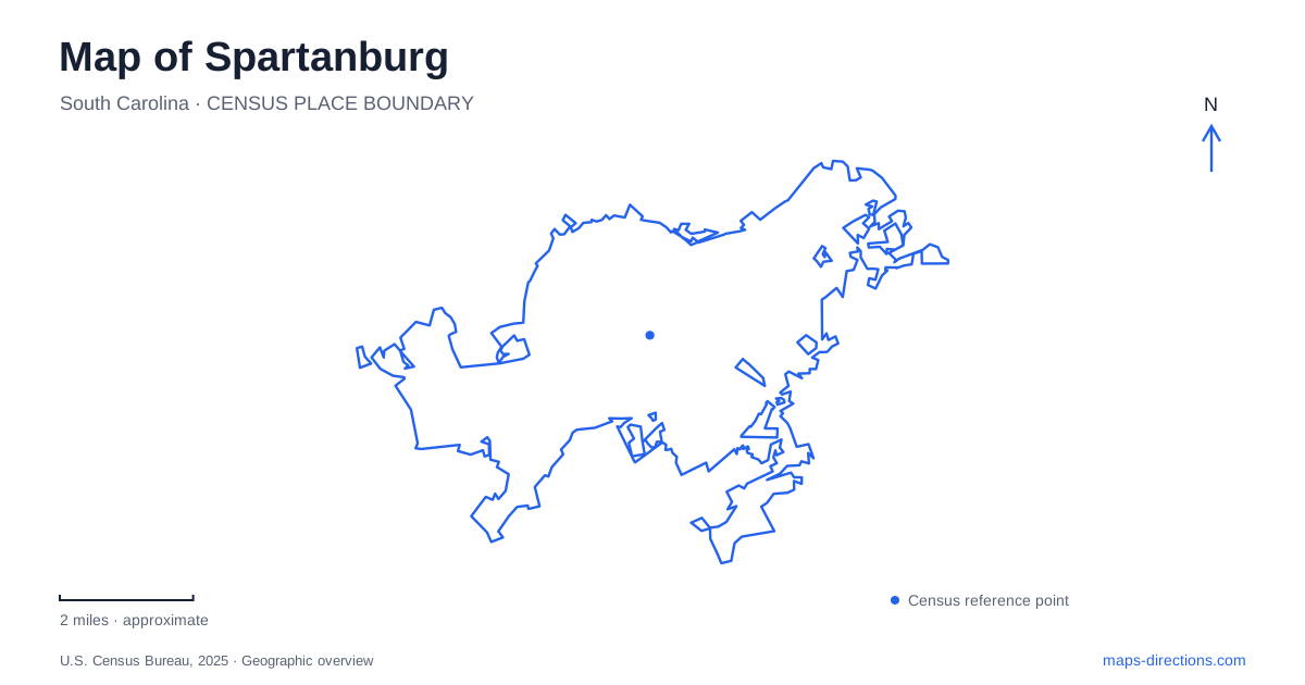
Street tiles load from OpenStreetMap when opened. The blue line shows the 2025 Census boundary.
- State
- South Carolina
- Population · July 2025
- 39,978
- Land area
- 20.4 sq mi
- Water area
- 0.1 sq mi
Spartanburg's Hub City nickname describes an actual transportation history. Railways radiated from the city, joining an older commercial center to a much wider region. The present landscape keeps parts of that pattern: a surviving passenger depot, a former railway converted for walking and cycling, and mill-associated routes beside creeks. Other places, especially the Seay House, preserve a rural history that the railroad nickname alone cannot explain.
Morgan Square and the railway city
Municipal historic-district material describes slow growth in the first half of the nineteenth century followed by expansion after the railway connection to Columbia in 1858. The lines spreading outward helped establish the Hub City identity. Morgan Square remained a focus of commerce and public life, and the historic district created in 1983 formalized attention to the surrounding commercial area.
On a map of Spartanburg, the square and rail corridors represent related but different parts of this growth. The square is a civic and commercial gathering place; railway infrastructure connected the city to outside markets. Their relationship helps explain why the downtown landscape contains both compact commercial blocks and larger transportation spaces. Neither feature alone tells the full story of the city's development.
The Magnolia Street depot
Union Station on Magnolia Street dates to 1904. Amtrak's station history identifies three railways that used it: Southern, Clinchfield, and Charleston and Western Carolina. That combination makes the building a particularly clear reminder that the city served several rail connections, rather than a single line running through an otherwise isolated town.
The station is a useful landmark when comparing the modern street network with historic railway maps. Its location belongs to the working transport landscape beyond the square's commercial frontages. The building's age and association with several rail companies also explain why a depot can be important even when current passenger service has a different scale from the traffic that originally supported it.
A railway alignment reused for everyday movement
The Mary Black Foundation Rail Trail lies between South Pine Street and Union Street, with access from East Henry Street and Country Club Road. PAL lists the paved route at about 1.9 miles and identifies the dog park, skate park and Rail Yard Community Park among its associated spaces. Its narrow, linear form makes sense when understood as a former rail corridor rather than a conventional park laid out around one central lawn.
This is one of the clearest changes of use visible on a Spartanburg map. The transportation alignment survives while the activity along it has changed. A line once associated with moving goods and passengers now links neighborhood recreation and everyday walking. The trail's relatively direct geometry contrasts with the more winding routes following nearby creeks and terrain.
The larger passage uses several kinds of route
The Hub City Passage of the Palmetto Trail combines greenways, bicycle lanes and sidewalks through the urban area. It incorporates the rail trail and Liberty Trail while connecting educational and medical destinations. The passage is therefore a joined route through different environments, not a single secluded woodland path of uniform width or surface.
The trail operator also identifies Chinquapin Greenway as a spur near the Interstate 585 crossing. Such branches matter when tracing the network: a spur can serve a local destination without being the main through alignment. Reading the passage as a series of connected segments makes its urban character clearer and avoids treating every adjoining green line as part of one continuous off-road trail.
Creek slopes and mill neighborhoods
The Beaumont Mill Village Pathway climbs from Lawson's Fork Creek and the Drayton Mills Trails toward Adams Park. PAL describes switchbacks on the climb, followed by streets and sidewalks past the mill village homes toward Pine Street and Daniel Morgan Avenue. The change from creekside route to hillside neighborhood is part of the trail's geography.
For Spartanburg, this connection brings industrial history into the everyday streetscape. Mill buildings, workers' housing and creek valleys occupy related positions, but they are not all on the same level or served by the same type of path. The switchbacks are a practical response to that terrain, while the neighborhood section reveals the residential landscape connected with the mills.
The Seay House's different historical scale
At 106 Darby Road, the Seay House preserves a more domestic and agricultural story. Current interpretation focuses on sisters Ruthy, Sarah and Patsy Seay, who inherited and operated the family property. Research shifted attention away from an earlier emphasis on a Revolutionary War veteran toward the women's lives during the 1880s and 1890s.
The historical association describes their work in farming, household management, lending and land management. This gives the modest house a significance that is different from a grand plantation residence or railway landmark. It records women's economic activity and rural life within what became an urban setting.
A map of Spartanburg can thus connect several scales of history: regional railways, downtown commerce, neighborhood trails and one family's farm. Keeping those scales visible produces a fuller picture of the city than relying on its transportation nickname alone.
Map and statistics: U.S. Census Bureau, 2025 Gazetteer, January 2025 generalized place boundaries and Vintage 2025 population estimates. Local references: City of Spartanburg; Amtrak Great American Stations; PAL; Palmetto Trails; Spartanburg County Historical Association. Article prepared by Maps & Directions.