Map of South Jordan
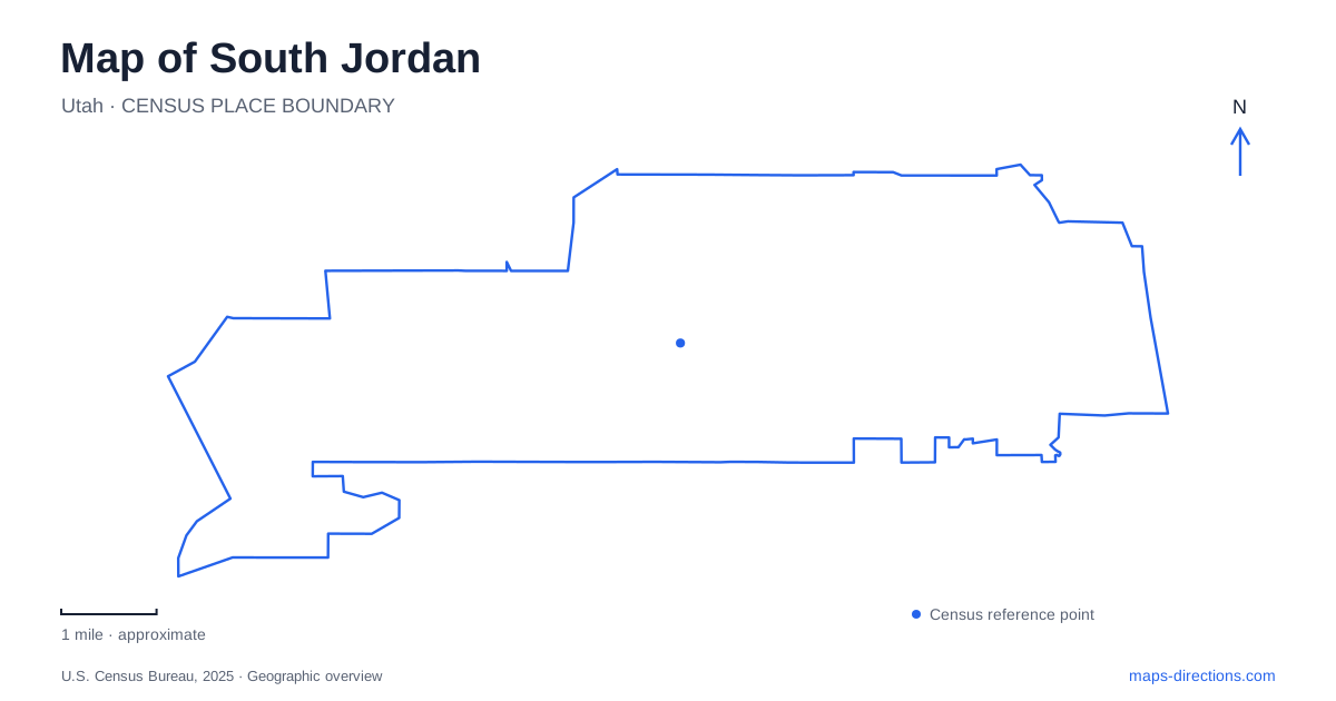
Street tiles load from OpenStreetMap when opened. The blue line shows the 2025 Census boundary.
- State
- Utah
- Population · July 2025
- 87,614
- Land area
- 25.8 sq mi
- Water area
- 0.1 sq mi
South Jordan contains several landscapes shaped by water, but they belong to different periods and serve different purposes. The Jordan River and early irrigation works explain the agricultural settlement. Community fishing ponds and trails occupy part of the river corridor. Farther into Daybreak, a constructed lake and watercourse organize newer neighborhoods. The city's museum and baseball park add cultural destinations to this pattern. Reading these places separately is the first step toward understanding how the city has changed.
The settlement's irrigation story
Alexander and Catherine Beckstead settled beside the river in 1859, establishing a dugout home in the bluffs along its western bank. Irrigation allowed farming to develop beyond that immediate riverside setting. The Beckstead Ditch, begun in 1859, carried diverted river water to agricultural land; its importance appears in both local history and historic water records.
Water infrastructure consequently belongs near the beginning of South Jordan's story. A ditch is more than a narrow line on a map: it records how land could be used and where cultivation became practical. The city's historical account describes alfalfa and grain as early crops, followed by sugar beets in the twentieth century. Those changes are a reminder that the present suburban landscape sits over a former agricultural one. Understanding the river and irrigation system helps connect the older settlement with areas that now look very different.
The Gale Museum preserves the local sequence
The Gale Museum stands at 10300 South Beckstead Lane in a building that previously served as a branch library. It opened as a museum in June 2006. Its exhibits explain the community's development, including an early-settlement presentation and hands-on interpretation of domestic work beside the irrigation ditch. The institution's name also preserves an older local identity: settlers used the nickname Gale in 1859, and the early station and post office carried that name.
This gives the museum a particular role on a map of South Jordan. It is a place to connect modern street names and neighborhoods with the earlier settlement, rather than simply another indoor attraction. The reused library building also adds a later civic layer to the site. Its history combines the subject of the exhibits with the changing public purpose of the building that contains them. A visit therefore offers context for the surrounding city as well as objects from its past.
Riverfront ponds form a separate recreation setting
The city lists its fishing ponds at 11200 South Riverfront Parkway. Their location places them within the broader riverfront landscape, which also contains trails and natural open space. The ponds should remain distinct from the river channel itself and from the constructed waters of Daybreak farther west.
That distinction is helpful when interpreting the city's water features. A community fishery, a river corridor and a residential lake can all appear blue on a map while having different management and access arrangements. The riverfront setting continues the long relationship between public space and the waterway that helped support settlement. It provides an eastern reference point against which the city's later neighborhoods can be understood.
Oquirrh Lake and the public shoreline paths
Oquirrh Lake is a constructed, 67-acre freshwater feature in Daybreak's Lower Villages. Paths and bridges connect the surrounding landscape with parks and village centers. The development's published guidance makes a useful distinction: paths around the lake are open to public use unless signs indicate otherwise, while use of the water is governed by association rules for residents and their guests.
A map of South Jordan should not turn the lake's large blue shape into an assumption of unrestricted boating access. The shoreline network and the water itself are related amenities with different conditions. Fishing is also limited to designated bank areas. These details matter because the lake is both a neighborhood organizing feature and a recreation setting. Its location is easy to see at city scale, but the permitted ways to use it become clear only at the level of paths, banks and access points.
The Watercourse is another designed landscape
Daybreak's Upper Villages contain the Watercourse, described by the developer as a mile-long network of channels, cascades and ponds. It is man-made, like Oquirrh Lake, but it has a different shape and location. The two should not be merged into one continuous natural waterway simply because both belong to the same development.
Their contrasting forms show different approaches to organizing public-facing neighborhood space. One concentrates water in a large lake; the other distributes it through a longer sequence of smaller features. Comparing them with the river and historic irrigation ditch reveals several generations of water design within the same city.
Baseball adds a new Daybreak destination
The Bees' current ballpark is at 11111 South Ballpark Way, in the Downtown Daybreak area. The Ballpark at America First Square opened for the team's 2025 season. Its current address is important because older references to the team's former Salt Lake City stadium describe a different location.
The ballpark adds another reason to read South Jordan as a city with multiple centers. The museum, riverfront ponds, lake neighborhoods and stadium each occupy their own setting. Together they show the transition from irrigated farmland to a community with established civic places and newer recreation districts, while preserving the water-related geography that connects much of the local story.
Map and statistics: U.S. Census Bureau, 2025 Gazetteer, January 2025 generalized place boundaries and Vintage 2025 population estimates. Local references: Salt Lake County; Utah Division of Water Rights; City of South Jordan; Daybreak; Salt Lake Bees / Minor League Baseball. Article prepared by Maps & Directions.