Map of South Gate
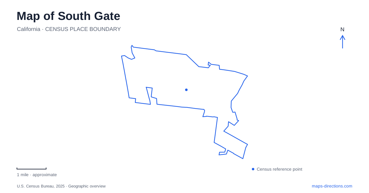
Street tiles load from OpenStreetMap when opened. The blue line shows the 2025 Census boundary.
- State
- California
- Population · July 2025
- 90,071
- Land area
- 7.2 sq mi
- Water area
- 0.1 sq mi
South Gate belongs to the closely connected urban landscape southeast of central Los Angeles, yet its streets preserve a particular history of farms, residential subdivisions and manufacturing. The Los Angeles River and nearby freeway corridor create a major organizing line, while Tweedy Boulevard, Southern Avenue and the civic buildings on California Avenue help distinguish different parts of the city. Hollydale adds another layer: a neighborhood with its own development story and a longstanding identity within the municipality.
From fields to residential and industrial blocks
Land once within Rancho San Antonio later supported dairies, orchards and vegetable farms. Residential plot sales began in 1917, and incorporation followed in 1923. Manufacturing expanded alongside housing, particularly during World War II, with workers and returning veterans contributing to a postwar building boom. That sequence helps explain today's mixture of residential blocks, industrial parcels and commercial corridors. Employment developed within the community rather than remaining solely in distant urban centers.
Tweedy Boulevard provides a direct connection with the earlier landholding period. Its name recalls the Tweedy family, who acquired a substantial tract in the nineteenth century. The familiar Tweedy Mile name therefore carries a piece of local history into an active commercial street. It is one of the clearest examples of an older landscape surviving through a modern place-name.
Parks as anchors within a developed city
South Gate Park occupies 96.8 acres at 4900 Southern Avenue, making it the largest municipal park. Its scale distinguishes it from the smaller neighborhood spaces scattered among residential streets. Recreation facilities and gathering areas form a substantial public destination within a densely developed setting, rather than a narrow green strip left between roads.
The farmers market's location at Tweedy Boulevard and Pinehurst Avenue marks the southeastern corner of the park. That corner is useful for understanding the park's relationship with surrounding commerce: recreation and everyday shopping meet at a recognizable street junction. Southern Avenue identifies another side of the same large site, so the park can be understood through several edges rather than one central map pin.
Smaller parks serve a different geographic role. Cesar Chavez Park on Southern Avenue covers nine acres, while Circle Park on Garfield Avenue covers four. The contrast shows a distributed system, with local open spaces supplementing the larger recreation grounds. Their importance lies partly in proximity to nearby blocks, not simply in the number of facilities listed for each site.
Hollydale's neighborhood identity
Hollydale developed as a planned community in the early 1920s, with streets, houses, shops and factories near railroad tracks. Its early growth slowed during the Depression before industrial activity and housing construction expanded again. Although incorporated into South Gate early in its development, the neighborhood retained a distinct identity. That history helps explain why the Hollydale name appears repeatedly on a map instead of functioning as an incidental subdivision label.
Hollydale Regional Park occupies 56 acres at 5400 Monroe Avenue. Its recreation landscape includes sports areas, play spaces and a dog park, with the latter reached from the Century Boulevard side. The smaller Hollydale Community Park is a separate facility on Industrial Avenue, with a community center and neighborhood recreation space. These two parks serve different scales of activity within the same named area.
Urban Orchard and the river corridor
Urban Orchard introduces a newer public landscape between the Los Angeles River, Firestone Boulevard, the freeway and the neighboring mobile home community. Its design combines recreation with stormwater treatment. Orchard planting, native vegetation, a constructed wetland and walking and cycling paths give the project functions beyond a conventional sports park.
For South Gate, the project changes how a heavily engineered river corridor can be used. Capturing and treating runoff brings water management into a public setting where planting and environmental education are visible. The city's project material describes a broader phased vision, while later council documentation records the first completed facilities opening in July 2025. That distinction matters: the completed park should not be confused with a promise that every element of the longer-term plan is already finished.
Educational gardening programs illustrate the park's role as a community venue. The address on West Frontage Road also locates it within the river and freeway landscape, separate from the older central recreation grounds.
Civic history and the Azalea identity
The museum and art gallery on California Avenue provide a civic setting for local history and cultural activity. The city's Azalea identity adds another recognizable thread: the Azalea Society of America certified it as an Azalea City in 2006, acknowledging the flower's role in community landscapes and celebrations.
Together, these features give South Gate a map that can be read through successive changes in land use. Family landholdings survive in street names, industrial growth shaped the blocks, neighborhood parks support daily life, and the river corridor now includes a place for environmental learning. Hollydale's separate history remains part of that larger story.
Map and statistics: U.S. Census Bureau, 2025 Gazetteer, January 2025 generalized place boundaries and Vintage 2025 population estimates. Local references: LA County Library; City of South Gate; Los Angeles County. Article prepared by Maps & Directions.