Map of South Fulton
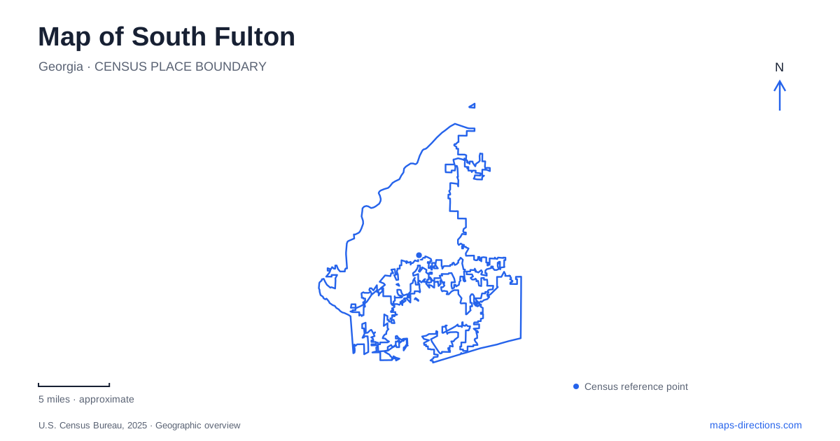
Street tiles load from OpenStreetMap when opened. The blue line shows the 2025 Census boundary.
- State
- Georgia
- Population · July 2025
- 112,820
- Land area
- 92.9 sq mi
- Water area
- 1.3 sq mi
South Fulton is a city of established communities whose local names and roads remain important to understanding the map. Its municipal incorporation in 2017 brought together places with much older histories, including railway settlements, crossroads communities, and river crossings. Today's cultural venues and parks occupy this inherited landscape. A useful itinerary follows the individual community and facility addresses, with particular attention to names such as Sandtown, Cliftondale, Welcome All, and Wolf Creek.
Roads that preserve earlier settlement patterns
The city's comprehensive plan explains how several communities developed around different kinds of movement. Fife, Stonewall, and Red Oak grew around the railway and its commercial activity. Bethlehem, Cliftondale, and Friendship developed as social centers at road intersections. Sandtown's history involved a river crossing serving agricultural activity along the Chattahoochee.
These origins help explain why the map has several centers of local identity. The communities developed around specific routes and functions before they became part of one municipality. Their names are therefore more than labels for subdivisions. They provide clues to the older geography beneath the modern road network.
South Fulton preserves some of those identities in its public facilities. Sandtown Park and its gymnasium are at 5320 Campbellton Road SW, while Cliftondale Park is at 4645 Butner Road. Plotting both shows how community names attach to distinct local destinations rather than to a single central civic district. The addresses are also useful when comparing an event announcement with the wider community name used in conversation.
Arts on New Hope Road and music on Merk Road
Southwest Arts Center occupies 915 New Hope Road SW. Its spaces include a performance theater, gallery, dance studio, music room, and classrooms. This combination supports both public performances and the work of artists and students. A class visit, exhibition, or theater evening can share the same campus while using different parts of it.
The center's role gives New Hope Road a cultural reference point on the city map. It also illustrates why the word “southwest” in an institution's name should be read as part of its identity, rather than as a complete set of directions. The street address locates the actual campus within the larger metropolitan area.
Wolf Creek Amphitheater is a separate performance destination at 3025 Merk Road SW. The nearby Tom Lowe Trap, Skeet and Sporting Clays Range uses 3070 Merk Road, while Wolf Creek Golf Course is at 3000 Union Road. These facilities share a broad recreational setting and some familiar local names, but their addresses organize different activities. Within South Fulton, distinguishing Merk Road from Union Road is more useful than relying on the Wolf Creek name alone.
Boat Rock's protected granite landscape
Boat Rock Preserve is identified in the official visitor guide at 1221 Boat Rock Road. Its granite boulders create a landscape unlike the playing fields and landscaped grounds of the city's recreation centers. The Southeastern Climbers Coalition owns and manages the climbing property, which it helped protect after nearby residential development threatened access.
In 2005, the coalition purchased 7.8 acres, with a climber donating an additional 4.5 acres. That preservation history explains the close relationship between the boulder field and neighboring homes. The natural feature survived through a specific land acquisition, rather than simply remaining within a large undisturbed public forest.
Access uses the coalition's designated parking area and gate procedure. Visitors must complete its gate-code and responsibility form, and the manager explicitly prohibits parking in the Summit of Cascade Hills neighborhood to reach the rocks. This is a site-specific access requirement worth resolving before arrival. On a map of South Fulton, the preserve's boundary and managed entrance are part of understanding the destination itself.
Everyday recreation across several communities
Welcome All Park and its multipurpose facility are at 4255 Will Lee Road. Its natatorium adds an indoor swimming destination to the public recreation network. Burdett Park and gymnasium use 2945 Burdett Road, while the Burdett Tennis Center is listed separately at 5975 Old Carriage Drive. The shared Burdett name therefore covers facilities reached from different streets.
Other parks extend the network across the city. Cedar Grove Park is on Rivertown Road, and the Cascade Library Pocket Park sits at 3665 Cascade Road SW. Their names retain the relationship between public space and surrounding community geography, even when the scale of the facilities differs substantially.
Reading South Fulton through these roads produces a practical local map: Campbellton and Butner for community parks, New Hope for the arts campus, Merk and Union for distinct recreation venues, and Boat Rock Road for the protected boulder field. The pattern reflects the city's older communities as well as the public places that serve them today.
Map and statistics: U.S. Census Bureau, 2025 Gazetteer, January 2025 generalized place boundaries and Vintage 2025 population estimates. Local references: City of South Fulton; City Convention and Visitors Bureau; Southeastern Climbers Coalition. Article prepared by Maps & Directions.