Map of South Bend
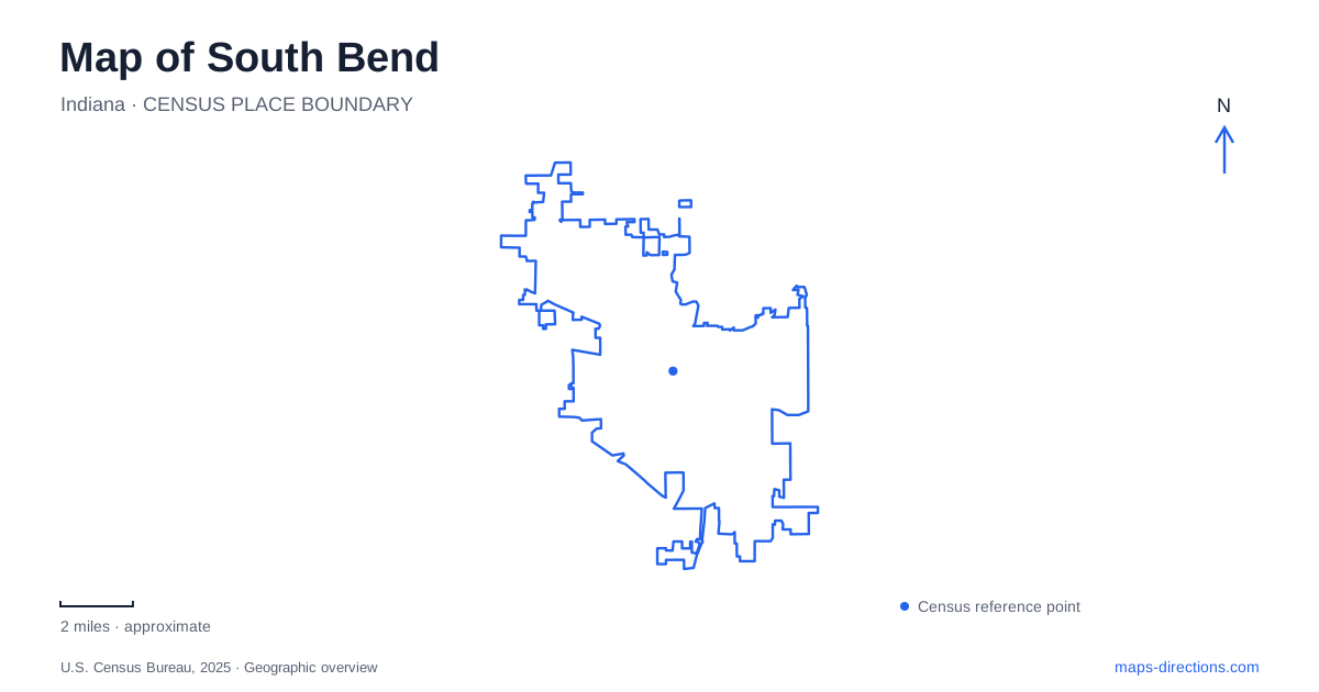
Street tiles load from OpenStreetMap when opened. The blue line shows the 2025 Census boundary.
- State
- Indiana
- Population · July 2025
- 103,201
- Land area
- 41.9 sq mi
- Water area
- 0.4 sq mi
South Bend's most revealing map combines the St. Joseph River with the streets shaped by manufacturing. The riverfront supplies parks and recreation, while West Washington Street preserves the residential world of industrial families. South of downtown, factory landmarks tell a different part of the same story. These areas form a useful framework for exploring beyond a single attraction: the east bank, the museum district to the west, and the former production landscape along Main, Lafayette, and Sample streets.
Two kinds of recreation beside the river
Howard Park occupies a riverfront setting in the East Bank Village, with the St. Joseph River along its western edge. Its riverwalk belongs to a wider network connecting downtown parks. The ground slopes toward the water, creating an amphitheater-like setting for the event lawn. This relationship between lawn, river, and surrounding streets makes the park an effective place to understand the east bank's layout.
The park's ice trail and adjoining ice pond serve different purposes within the same recreation space. The trail curves and changes elevation, while the pond provides a more conventional skating area. Their seasonal use contrasts with the riverwalk's role as a route through the district. St. Louis Boulevard is another useful orientation point beside the park; its back-in angled parking arrangement is worth recognizing before approaching by car.
Farther along the riverfront, the East Race Waterway at 126 North Niles Avenue is an engineered whitewater course. Its roughly 2,000-foot length and controlled headgates distinguish it from the main river. Rafting depends on the facility's operating season and program arrangements, which should be confirmed with the operator before traveling. A South Bend map can still use the waterway as a geographic landmark, but an older rafting photograph should not be taken as confirmation that trips are operating.
West Washington's museum block
The Oliver Mansion, also called Copshaholm, stands in a district of large late-nineteenth-century houses. Its property occupies much of the block bounded by Washington Street, Chapin Street, Laurel Street, and Thomas Street. The house faces Washington, while the surrounding grounds and museum buildings extend farther into the block. Thinking in terms of this complete block makes the arrangement easier to understand than treating the mansion as an isolated street-front house.
Completed in 1896, the Joseph D. Oliver residence uses Richardsonian Romanesque forms, including substantial masonry, projecting bays, and a prominent corner turret. Nearby museum facilities add industrial and regional history to the domestic setting. The Studebaker National Museum uses 201 Chapin Street and connects with the History Museum building. South Bend's museum district therefore brings together the vehicles produced by industrial enterprise and the residential environment created by that prosperity.
Following production south of downtown
The Studebaker story begins near the river at South Michigan Street and East Jefferson Boulevard, where the brothers established their blacksmith shop and carriage factory in 1852. Production later moved south. This shift is visible in the addresses preserved by the Studebaker-Bendix Heritage Trail: the administration building is at 635 South Main Street, and the body assembly building is at 635 South Lafayette Boulevard.
The two buildings served different functions. Solon Beman designed the 1906 administration building, while Albert Kahn designed the 1923 body assembly building. Sample Street crosses the larger former factory landscape, which grew to about 120 acres. Connecting these points on a map turns a corporate name into a sequence of actual places: an early downtown workshop, offices and engineering activity, body manufacturing, and a broad production complex. South Bend's industrial heritage is distributed across these streets rather than contained entirely inside the museum.
A campus connection and an airport connection
The Link trail connects the University of Notre Dame with downtown through the East Bank Village. The tourism bureau describes a dedicated walking, running, and cycling route of about 1.3 miles between the campus area and downtown. This adds a northward connection to the riverfront picture and offers a way to understand the relationship between the university and the central city without relying solely on driving corridors.
The airport provides a separate regional connection. The South Shore rail line links its terminal with Chicago and communities across northwestern Indiana. Airport guidance places the train-related facilities at the eastern end of the terminal; current terminal information also identifies Door H with the train station area. That arrangement joins air and rail travel at one facility rather than requiring every regional arrival to begin downtown.
Together, these connections expand a map of South Bend beyond its historic core. The river parks organize local recreation, West Washington gathers museums and estate architecture, the southern factory streets explain the city's manufacturing footprint, and the campus trail and airport railway connect those local places to a larger region.
Map and statistics: U.S. Census Bureau, 2025 Gazetteer, January 2025 generalized place boundaries and Vintage 2025 population estimates. Local references: Visit South Bend Mishawaka; City of South Bend / National Park Service; Studebaker National Museum; South Bend International Airport. Article prepared by Maps & Directions.