Map of Sierra Vista
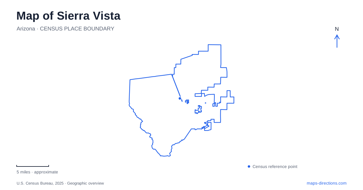
Street tiles load from OpenStreetMap when opened. The blue line shows the 2025 Census boundary.
- State
- Arizona
- Population · July 2025
- 44,907
- Land area
- 152.4 sq mi
- Water area
- 0.3 sq mi
Sierra Vista is closely connected to Fort Huachuca, but its wider landscape includes mountain canyons and a river corridor with very different habitats. The developed city grew east of the military post. Beyond its streets, the Huachuca Mountains rise toward canyon trails, while the San Pedro River supports a ribbon of vegetation across the surrounding dry country. These relationships make direction especially useful: a visit toward the fort, a canyon outing, and a trip toward the river involve different settings and access arrangements.
The post and the community beside it
Camp Huachuca was established in 1877 and later became a fort associated with the Buffalo Soldiers. Following a period of closure after World War II, the post reopened in 1954. The community developing to its east incorporated in 1956, and the fort was annexed into the city in 1971.
That municipal relationship explains why a map of Sierra Vista includes a large military area alongside civilian streets. Being within the same city does not make the installation an ordinary through-route. Fort Huachuca remains an active post, and its visitor access process is separate from traveling along the public commercial corridors. The Army identifies the Van Deman Gate as the location of its Visitor Control Center. For a museum or on-post trail visit, establish access arrangements before treating the installation roads as part of an itinerary.
Fry Boulevard and the West End's social history
The West End provides a more personal connection with the community that grew near the fort. In 2025, the city dedicated property at the southeast corner of Fab Avenue and Fry Boulevard as Henry Jones Legacy Park. Jones was a former Buffalo Soldier who patrolled the community at night after the fort closed in 1947, before municipal incorporation brought a local government.
The city's account places his patrol between Seventh Street and the fort gates. That detail gives the commemorative site a geographic meaning: it stands within the part of town associated with his service. For Sierra Vista, the dedication records civilian community protection as well as military history. The corner is worth understanding through that surrounding corridor, rather than only as a named green space. The dedication identifies the property and its purpose; it does not by itself establish that every planned park improvement has been completed.
A linear park leading toward Brown Canyon
Garden Canyon Linear Park follows a natural floodplain through the city's southwestern area and connects toward Brown Canyon Trail. Municipal trail information identifies access around St. Andrews Drive and shows the route continuing toward Brown Canyon Ranch. Beyond the ranch, the Brown Canyon loop becomes steeper and more technically demanding.
This progression matters when choosing a walk or ride from Sierra Vista. The city-side linear route and the mountain loop are connected, but they offer different terrain. A gentle beginning does not describe the whole outing. Brown Canyon Ranch itself occupies grassland on the northeastern flanks of the Huachuca Mountains, with oak and juniper nearby. Its ranch-house setting provides an intermediate point between the developed city and the more demanding trails beyond.
The similarly named Garden Canyon on Fort Huachuca has a different access context. Keep the municipal linear park and the on-post canyon distinct when looking up a route, especially when a search result uses only the shortened canyon name.
Ramsey Canyon's moisture changes the vegetation
Ramsey Canyon Preserve is reached from Highway 92 by turning onto Ramsey Canyon Road. The Nature Conservancy lists its address as 27 East Ramsey Canyon Road in Hereford. The preserve lies near the city but has its own location, management, and visitor arrangements.
A spring-fed stream, northeast-facing orientation, and high canyon walls create a relatively moist, cool setting. Sycamores and maples occur near plants associated with drier surroundings, including yuccas and agaves. This is part of the region's sky-island pattern, where mountain relief produces striking habitat changes over comparatively short distances. A regional road map shows the approach; a canyon trail map better explains the climb and the movement between those habitats.
The San Pedro offers a river-centered outing
East of Sierra Vista, San Pedro House serves as a visitor contact point for the San Pedro Riparian National Conservation Area. The restored ranch house also contains a nature store operated by the Friends of the San Pedro River. Trails lead from the house toward the river and ponds, with interpretation about plants, wildlife, and water systems.
Here the organizing feature is the river rather than a mountain ascent. The house's earlier ranching and farming role adds a human history to the riparian landscape. Plan a visit around the trail network and river conditions: the Bureau of Land Management notes seasonal flooding and summer monsoons. This completes a useful geographic contrast with the canyons, showing how both elevation and flowing water shape the area's outdoor destinations.
Map and statistics: U.S. Census Bureau, 2025 Gazetteer, January 2025 generalized place boundaries and Vintage 2025 population estimates. Local references: City of Sierra Vista; U.S. Army Fort Huachuca; US Forest Service; City tourism center; The Nature Conservancy; Bureau of Land Management. Article prepared by Maps & Directions.