Map of Shreveport
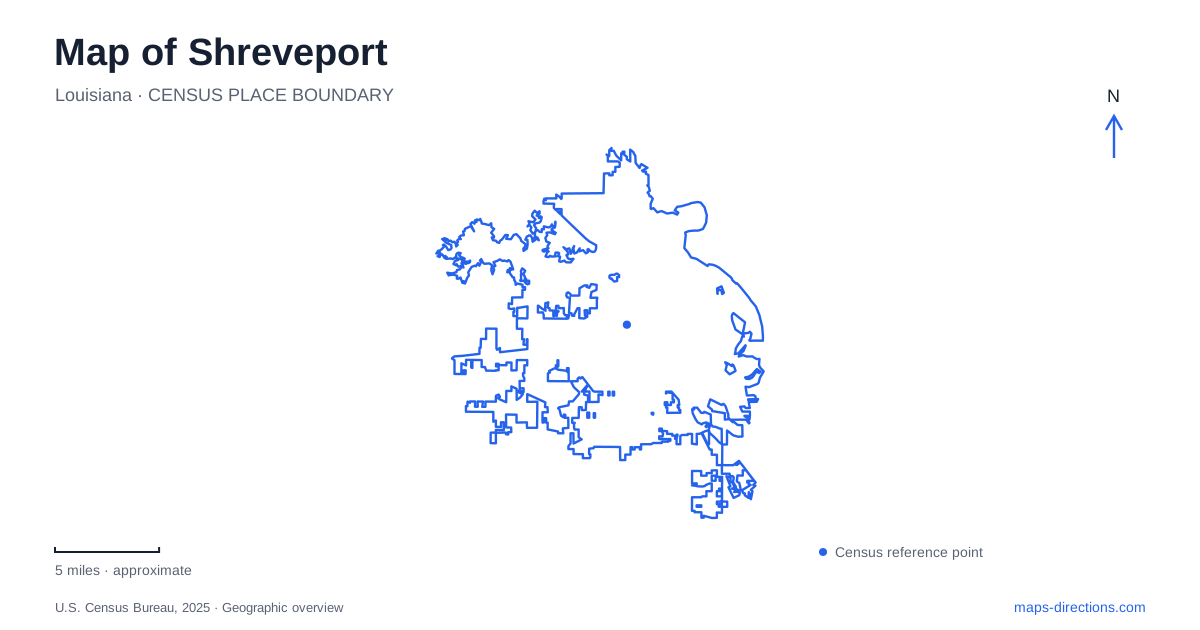
Street tiles load from OpenStreetMap when opened. The blue line shows the 2025 Census boundary.
- State
- Louisiana
- Population · July 2025
- 175,902
- Land area
- 108.2 sq mi
- Water area
- 15.7 sq mi
Shreveport began where a navigable stretch of the Red River met an overland route toward Texas. That relationship between water and inland movement remains a useful starting point for its map. The original downtown grid, a preserved pumping station, a celebrated performance hall, and museums farther from the river describe different kinds of local development. Looking at their locations together reveals a city shaped by commerce, public infrastructure, broadcasting, and cultural institutions, with much more to its geography than a single waterfront entertainment district.
The river explains the original grid
The Shreve Town Company founded the settlement in 1836 after work led by Henry Miller Shreve improved navigation through the Red River's extensive log obstructions. The town's site also connected with the Texas Trail. Its initial layout contained 64 blocks, with streets extending west from the river and south from Cross Bayou.
Those two waterways explain the orientation of the historic business district. The grid was laid out in relation to a river landing and a tributary rather than as an abstract rectangle unrelated to terrain. Cross Bayou therefore deserves attention alongside the larger Red River when interpreting the old center.
This geographical starting point helps distinguish Shreveport from Bossier City across the river. The neighboring cities share a metropolitan setting, but a river crossing is part of a journey between their respective downtown areas. A broad regional map can make the waterfronts appear like one destination cluster even though the water remains a real dividing feature.
Preserved machinery and the public water supply
The McNeill Street Pumping Station dates to 1887 and now forms part of the Water Works Museum. Its steam-powered equipment remained in service until 1980, preserving an unusually long record of industrial technology. The machinery is important because it shows how water was supplied to a growing urban population, complementing the river's better-known role in transport.
The site offers a different kind of historical evidence from a furnished house or an art gallery. Pumps and associated equipment were built to perform necessary work, and their continued presence makes that function legible. They show how an expanding city required infrastructure behind its commercial buildings and residential streets.
For Shreveport, the waterworks connects the landscape's waterways with the practical systems that supported urban life. It adds an industrial chapter to a map otherwise dominated by entertainment venues and museums.
A memorial hall that became a broadcasting landmark
The Municipal Auditorium stands just west of downtown at 705 Elvis Presley Avenue. Dedicated in November 1929 to those who served in the First World War, its Art Deco architecture and elaborate brickwork reflect a civic memorial purpose that preceded its musical fame.
The Louisiana Hayride began broadcasting from its stage in April 1948. Performers associated with the program included Hank Williams, Johnny Cash, and Elvis Presley, whose first Hayride appearance occurred in October 1954. The weekly program ended in 1960, while the building continued to host performances and other public events.
This history gives Shreveport a cultural landmark whose significance extends beyond the musicians' names. A locally situated stage reached distant audiences through radio, turning a civic building into part of a much larger musical network. Its location west of the riverfront also broadens the historical circuit beyond the original waterfront blocks.
A circular museum and a garden setting
The Louisiana State Exhibit Museum at 3015 Greenwood Road was completed in 1939 as a New Deal public works project. Its circular Modernist building contains dioramas depicting agriculture, industry, and natural resources. The museum's artists combined sculpture, painted backgrounds, lighting, and scaled figures to present scenes based on research and photographs of actual places.
These displays make the museum useful for understanding the wider state as well as the building itself. They present working landscapes and economic activities in three dimensions, placing local urban history within a larger Louisiana context.
The R.W. Norton Art Gallery offers a contrasting environment of art and planted grounds. Forty landscaped acres contain pines, oaks, a stream, a pond, and extensive azalea plantings. Outdoor paths and sculpture complement collections inside the museum, so the grounds are part of the institution's identity rather than incidental landscaping.
Taken together, these places give a map of Shreveport a clear set of historical layers: the river-oriented street plan, the machinery of public water supply, a memorial auditorium transformed by radio, and cultural institutions with distinctive architectural and garden settings. Their different roles explain why worthwhile destinations are distributed across the city instead of gathering around one central square.
Map and statistics: U.S. Census Bureau, 2025 Gazetteer, January 2025 generalized place boundaries and Vintage 2025 population estimates. Local references: City of Shreveport; Louisiana Secretary of State; Municipal Auditorium; Louisiana State Exhibit Museum; R.W. Norton Art Gallery. Article prepared by Maps & Directions.