Map of Shoreline
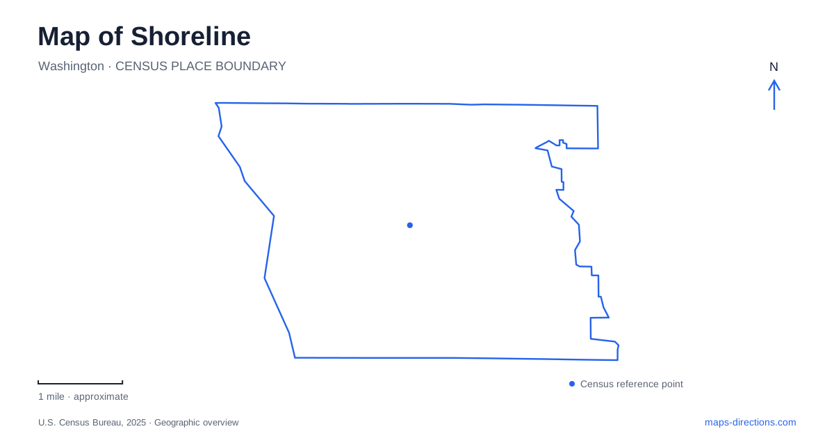
Street tiles load from OpenStreetMap when opened. The blue line shows the 2025 Census boundary.
- State
- Washington
- Population · July 2025
- 66,542
- Land area
- 11.6 sq mi
- Water area
- 0.8 sq mi
Shoreline offers several different north-south landscapes: Puget Sound at Richmond Beach, the Aurora Avenue corridor with the Interurban Trail, and the light-rail stations associated with Interstate 5. Numbered east-west streets connect these settings, but each corridor has its own history and destinations. A useful map keeps the coastal parks, inland civic places and regional transport network visible together without assuming they form one continuous waterfront district.
Richmond Beach from terrace to water
Richmond Beach Saltwater Park is reached at 2021 NW 190th Street. The municipal directory identifies open-water access, unpaved trails, picnic areas, public art and a terrace with a view. These facilities occupy different parts of the park, allowing an outing to concentrate on the upland setting or continue toward the beach.
A pedestrian bridge provides the route across the railroad to the beach area. This is a defining detail of the coastal landscape: the railway lies between portions of the park and the water. The bridge connects them, whereas the rail corridor itself is not a walking route. City recreation instructions distinguish the lower parking area near the bridge from the picnic shelter on the beach side.
The neighborhood also has Richmond Beach Community Park, a separate destination from Saltwater Park. A city walking itinerary begins at the community park near NW 197th Street and continues toward the waterfront, demonstrating how the two belong to a wider neighborhood walk. Their similar names reflect a shared neighborhood, not a single park entrance.
A garden shaped by a family collection
Kruckeberg Botanic Garden is at 20312 15th Avenue NW. Its origins lie in the four-acre property of botanist Art Kruckeberg and his wife Mareen. The garden grew from their interests and plant collecting into a public botanical destination, giving this residential area a landscape whose significance is rooted in horticulture rather than a large sports complex.
For Shoreline, the garden offers a complementary outdoor experience to Richmond Beach. One destination directs attention to planted collections and the legacy of individual gardeners; the other opens onto the Sound and its beach environment. Their different purposes explain why the garden appears as a compact destination while the coastal park has a more extensive arrangement of slopes, paths and water access.
The Interurban and Aurora corridor
The Interurban Trail provides a paved north-south route near Aurora Avenue North along a Seattle City Light corridor. Municipal planning describes it as a connection among neighborhoods, parks, shopping, employment and transportation, useful for both practical journeys and recreation. Its linear shape allows it to pass through developed surroundings without simply duplicating the route of every local street.
This corridor also carries evidence of earlier regional travel. The historical museum holds images of the Seattle-Everett Interurban railway at North 175th Street and Aurora Avenue around 1910. Comparing that historical transport landscape with the present trail reveals how routes can remain influential after their original vehicles disappear. The path is part of modern neighborhood movement as well as a reminder of an older regional connection.
The museum moved; the history remains local
Shoreline Historical Museum is now at 18501 Linden Avenue North. It began as a bicentennial project in 1975 and initially occupied the 1912 Ronald School building at 749 North 175th Street. After decades there, the school district bought the building back for reuse in a high-school setting, and the museum relocated.
This history explains a possible discrepancy in older visitor references: the former school and the current museum address identify different sites. The institution's collections connect them through local history, but a present-day museum visit belongs on Linden Avenue. Preserving that distinction allows the old school to retain its historical significance without confusing it with the museum's operating location.
Two stations in the regional rail network
Shoreline South/148th and the North/185th station provide two separate Link boarding points. Sound Transit's current station lists place both on the 1 and 2 lines, with routes continuing through Seattle before reaching different southern or eastern destinations. The street numbers are useful identifiers when comparing a neighborhood approach with the regional rail map.
The city has completed walking and cycling improvements on 5th Avenue NE connecting NE 175th Street toward the northern station. Those local approaches matter alongside the rail line itself: they connect the regional service to surrounding streets. Together with Aurora's trail corridor and Richmond Beach's coastal spaces, the stations show Shoreline as a set of connected landscapes whose transport history continues to evolve.
Map and statistics: U.S. Census Bureau, 2025 Gazetteer, January 2025 generalized place boundaries and Vintage 2025 population estimates. Local references: City of Shoreline; Kruckeberg Botanic Garden; Shoreline Historical Museum; Sound Transit. Article prepared by Maps & Directions.