Map of Shelton
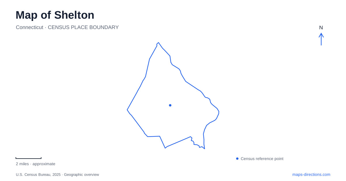
Street tiles load from OpenStreetMap when opened. The blue line shows the 2025 Census boundary.
- State
- Connecticut
- Population · July 2025
- 42,880
- Land area
- 30.6 sq mi
- Water area
- 1.3 sq mi
Shelton makes more sense when its riverfront and inland landscape are read together. The Housatonic supplied an industrial waterfront, while Huntington retained a farming identity farther inland. Between them, dammed brooks and wooded corridors became part of the modern trail network. These are connected stories rather than unrelated attractions. The canal, the reservoir dams, and a relocated farmhouse show how water, manufacturing, agriculture, and preservation have successively influenced the city's map.
A riverfront shaped by power and transport
Canal Street follows the industrial side of Shelton's history. The nineteenth-century canal system served factories along the Housatonic, and its surviving locks help explain the difference between the canal's water level and the river. A city account describes three sequential lock chambers that could raise boats approximately ten feet. The masonry belongs to a working system designed to move goods and support manufacturing, rather than an ornamental waterfront feature.
The canal corridor has also become a focus of redevelopment. The city's 2025 economic-development account identified further Riverwalk extension, Canal Street and Wooster Street reconstruction, and Canal Lock Park development as priorities. Those proposals should be understood as stages in a changing waterfront. They explain why the river edge can contain old industrial structures, newer residences, and public-space projects in close succession. They do not establish that every proposed path or rail crossing is already complete.
Following the water back uphill
Curtiss Brook links the waterfront story to the inland reservoirs. The municipal Trails Committee identifies Pine Lake, Silent Waters, and Hope Lake as dammed portions of the brook or its branches. Water from the brook enters the canal and spills through the locks. Upstream, the changes in elevation become visible in dams, ravines, and trail crossings. Looking at these smaller waterways adds an explanation that the much more prominent Housatonic alone cannot provide.
Pine Lake occupies higher ground than the former waterfront factories. The committee's account explains how that height allowed water pressure to serve industrial needs, including firefighting. Near the pedestrian bridge, remains of the valve gatehouse foundation preserve evidence of that system. Below the dam, the brook descends into a ravine alongside the orange-blazed Curtiss Brook Trail. The contrast between a quiet reservoir surface and the descending stream is a useful way to recognize the terrain that made the water system work.
Reservoir paths and old shorelines
The Recreation Path offers a different view of Shelton from the downtown riverbank. At Silent Waters, it follows the old dam, where much of the reservoir's former water has been drained. A section that looks like a wooded walk today once followed a much larger body of water. The remaining shallow pond and the bridge across its spillway therefore mark only part of the historical reservoir landscape.
Farther along the path, Hope Lake also appears under the name Nells Rock Reservoir. The route passes behind the lake and briefly shares its course with the red-blazed Oak Valley Trail. These overlapping names and trail segments reflect different uses of the same landscape: a water-supply feature, a recreation destination, and a junction in a larger walking network. They are particularly useful details when matching a printed trail map with signs encountered on foot.
Huntington's preserved farming story
The History Center at Ripton Road and Cloverdale Avenue introduces the agricultural side of the city. Its Brownson House was moved there in 1971 from its earlier corner location on the avenue bearing the city's name and Old Shelton Road. The Wilson Barn, by contrast, belongs to the donated farm property itself. The group of buildings is therefore a preservation collection with both relocated and original elements.
The house is interpreted around 1913, when Harry and Gertrude Brownson were farming, rather than solely around its early nineteenth-century construction. Trap Falls School adds another relocated building: the 1872 school originally stood near Huntington Street before the nearby reservoir existed. Together, the buildings make rural work and daily travel visible alongside the better-known manufacturing history of the riverfront.
The gorge and the broad river
At Indian Well State Park, the landscape changes again. The park lies on the western bank of the Housatonic, with a river beach and picnic grove, while its name refers to a waterfall, rocky pool, and gorge. The blue-blazed Paugussett Trail crosses the property, adding a woodland walking route to the waterfront recreation area. The state identifies the name's romantic legend as likely folklore, not established Indigenous history.
For a map-based visit to Shelton, this distinction is useful: the waterfall setting and the broad river shore are two features within one park. Indian Well Road supplies the park address, and the state lists winter vehicle restrictions. Combining that geography with the canal and reservoir landscapes reveals several different ways water has shaped the community.
Map and statistics: U.S. Census Bureau, 2025 Gazetteer, January 2025 generalized place boundaries and Vintage 2025 population estimates. Local references: City of Shelton; Shelton Trails Committee; Shelton Historical Society; Connecticut DEEP. Article prepared by Maps & Directions.