Map of Sheboygan
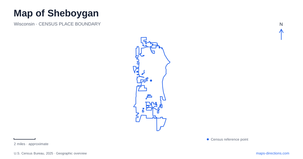
Street tiles load from OpenStreetMap when opened. The blue line shows the 2025 Census boundary.
- State
- Wisconsin
- Population · July 2025
- 49,376
- Land area
- 16.2 sq mi
- Water area
- 0.2 sq mi
Sheboygan is organized by a river meeting Lake Michigan, with downtown streets, harbor facilities and beaches occupying different edges of that meeting place. The lake supplies a clear eastern reference, but the river bends through the city and creates a more complicated pattern inland. Eighth Street, Broughton Drive, New York Avenue and Lower Falls Road help separate the central waterfront from the cultural and natural destinations farther from shore.
The riverfront and Eighth Street crossing
Eighth Street is a useful downtown spine because it also crosses the river. The city's architectural history records a bridge here as early as 1855, followed by successive replacements as transport needs changed. The present crossing continues that long-established connection between the commercial center and the district on the opposite bank. Its movable center span accommodates boat traffic, a visible reminder that the river is a navigation corridor as well as a boundary between streets.
South Pier forms a distinct riverfront destination, with a boardwalk and businesses facing the water. From there, the river mouth and the open lake describe different parts of the view. In planning a walk through Sheboygan, retain the distinction between following a riverbank and reaching a lakeshore beach: the two experiences meet near the harbor, but their paths and destinations are not interchangeable.
Deland Park and the preserved schooner
Deland Park at 715 Broughton Drive occupies the Lake Michigan waterfront in the Harbor Centre district. The site combines beach access with marina activity, a public boat launch, play areas and the Harbor Trail. Its recreation facilities make it a more developed waterfront setting than a remote stretch of shoreline. Broughton Drive is therefore a useful road reference for a lake-oriented outing that also includes the harbor.
The recovered remains of the Lottie Cooper add a historical stop beside the marina. Built in 1876, the schooner was lost during a Lake Michigan gale in 1894. Its recovered structure is displayed on land in the park. This is an especially useful map distinction: the attraction is a preserved shipwreck display, not an underwater site that requires a boat or diving equipment to see. It makes the dangers and working life of the old lake trade tangible within a modern recreation area.
Art at two separate addresses
The John Michael Kohler Arts Center occupies 608 New York Avenue, while its companion Art Preserve is at 3636 Lower Falls Road. These are separate destinations within the cultural geography of Sheboygan. The downtown center presents changing exhibitions and performances; the preserve focuses on artist-built environments, bringing substantial bodies of work together in installations that retain the relationships between individual objects.
The distinction is more than a difference in building names. Someone interested in a particular artist's environment may need the Lower Falls Road site, whereas an advertised downtown exhibition may be on New York Avenue. Both institutions include artist-designed washrooms, making functional spaces part of the artistic experience. Comparing the actual exhibition location before arranging the route is more useful than assuming that everything under the organization's name occupies one downtown campus.
A railway route through the city
The Shoreland 400 Rail Trail follows a former Union Pacific corridor through the interior of the city. A converted railroad trestle near Erie Avenue carries the route across the river, giving walkers and riders a crossing with a different history and scale from Eighth Street. North Avenue and Pennsylvania Avenue describe the main corridor's ends in county information.
The section between Wisconsin Avenue and Pennsylvania Avenue is a useful named segment when planning a route through Sheboygan. Its former railway alignment helps explain the path, but an older trail map does not establish access through every block. Consult the county's segment-specific guidance and identify a return or alternative route if work affects a crossing. This keeps the corridor's historical geography separate from assumptions about an uninterrupted through trip.
Inland habitats and the southern dunes
Maywood Environmental Park at 3615 Mueller Road introduces the Pigeon River landscape. Its ecology-center deck overlooks that river, and trails pass through habitats including prairie, maple forest and ponds. The park's ski trails connect with Evergreen and Quarry parks. During winter, some routes are reserved for skiing, while walking and snowshoeing use trails that are not groomed for that purpose.
Kohler-Andrae State Park provides another kind of nature outing south of the city, with Lake Michigan dunes, beach, pines and wetlands. The dune cordwalk and nature trails interpret a shoreline landscape less urban than Deland Park. State-park vehicle admission and occasional crowd-related access restrictions apply separately from municipal park arrangements.
These places complete a map of Sheboygan that extends beyond the harbor postcard view. The downtown river crossing, developed lakefront, separate art campuses, former railway and Pigeon River habitats each reveal a different structure within the city and its surrounding recreation landscape.
Map and statistics: U.S. Census Bureau, 2025 Gazetteer, January 2025 generalized place boundaries and Vintage 2025 population estimates. Local references: City of Sheboygan; Visit Sheboygan; John Michael Kohler Arts Center; Sheboygan County; Maywood Environmental Park; Wisconsin DNR. Article prepared by Maps & Directions.