Map of Scottsdale
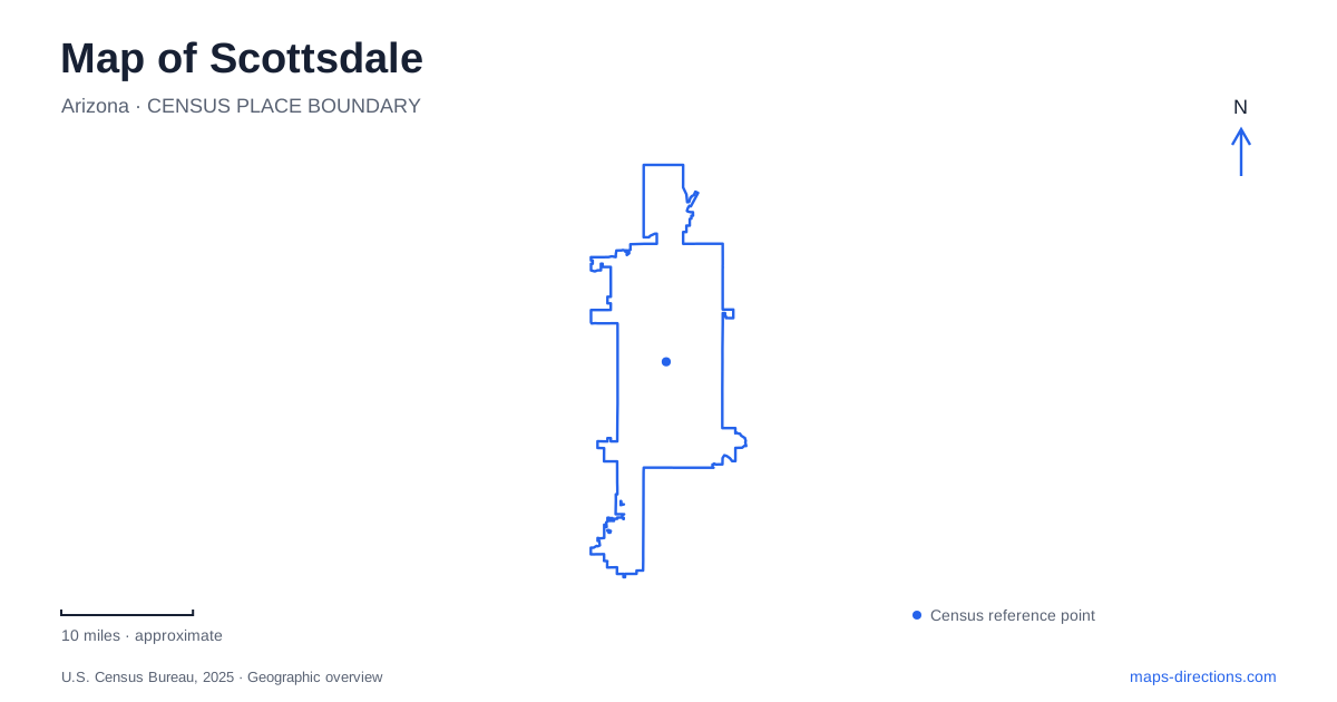
Street tiles load from OpenStreetMap when opened. The blue line shows the 2025 Census boundary.
- State
- Arizona
- Population · July 2025
- 243,006
- Land area
- 184.0 sq mi
- Water area
- 0.4 sq mi
Scottsdale combines a compact cultural center with a much larger desert landscape. Old Town groups shops, galleries, museums and public spaces within roughly a square mile, while the McDowell Sonoran Preserve spreads across tens of thousands of acres farther north. Between these scales are designed landscapes shaped by water management and architecture. The Arizona Canal, Indian Bend Wash and Taliesin West each help explain a different relationship between settlement and the desert, giving a map several useful organizing features beyond its main roads.
Old Town's connected districts
Old Town Scottsdale is described by the tourism bureau as nine walkable and bikeable districts. Their names indicate different concentrations of activity: the Arts District includes galleries and Western Spirit, Historic Old Town contains early buildings and western-themed businesses, and the Fifth Avenue area combines shops with the Bob Parks Horse Fountain. Waterfront and Southbridge occupy the Arizona Canal's banks.
Those distinctions are useful without turning every district boundary into a hard divide. The arts corridor along Main Street and Marshall Way can be combined with other nearby blocks, while a canal-side walk follows a different alignment from the street grid. Civic Center contributes lawns, public art and cultural venues to this compact area. A detailed Old Town map therefore shows a sequence of contrasting public spaces, not merely a single shopping street.
The greenbelt is also a drainage system
Indian Bend Wash creates a long recreational corridor through Scottsdale. The city describes an eleven-mile greenbelt of parks, lakes, paths and golf courses, with more than two dozen crossings separated from major road traffic. Vista del Camino and Eldorado parks are among the recreational spaces associated with its southern section.
The greenbelt's open shape is a product of flood management. The broader project includes inlet, outlet and collector channels, carrying water toward the Salt River. A large grassy swale accommodates recreation while retaining its drainage function. This explains why wide open land persists through developed neighborhoods and why the park system follows a continuous north-south alignment instead of appearing only as scattered blocks.
On a map, the Arizona Canal and Indian Bend Wash can both look like linear recreational features. Their underlying roles differ: one is an engineered canal, while the other is a managed flood corridor with associated parks. The flood-response plan even identifies the canal's passage beneath the wash, showing how the two water systems intersect rather than simply continuing into one another.
Architecture fitted to the foothills
Taliesin West occupies a separate setting at 12621 North Frank Lloyd Wright Boulevard. Wright began the site in 1937 in what were then rural foothills. Its low buildings used local rock set in forms with cement and desert sand, a construction method known as desert masonry. The materials and horizontal forms were intended to relate the buildings to the surrounding landscape.
This part of Scottsdale is best understood through the relationship between the architectural complex and its terrain. Taliesin West is a visitor site with tours, but its significance is not confined to rooms or individual structures. The spaces between buildings, their low profiles and the open desert setting are central to the design. A site plan reveals those relationships more clearly than a street address alone, especially when compared with the denser public spaces of Old Town.
Several entrances into a very large preserve
The McDowell Sonoran Preserve encompasses more than 30,500 acres and over 230 miles of multi-use trails. Its scale requires choosing a trailhead according to the intended area and route. Gateway is on North Thompson Peak Parkway and includes the accessible Bajada Nature Trail. Lost Dog Wash is reached from North 124th Street, while Tom's Thumb uses North 128th Street.
The city's trail maps distinguish northern and southern areas, mark private-property boundaries and separate service roads from recreational trails. They also show difficulty ratings rather than treating every line as an equivalent walking path. Gateway and Tom's Thumb, for example, enter different portions of the mountain landscape; a citywide map gives their separation, while the preserve map explains the terrain between them.
Reading the northern access pattern
Pima Dynamite has entrances from Pima and Dynamite roads, and Fraesfield is on East Rio Verde Drive. These northern approaches provide additional ways into the preserve network. They also vary in facilities: the city lists drinking water at Pima Dynamite, but not at Fraesfield, Granite Mountain or Tom's Thumb.
Brown's Ranch Trailhead has its own parking and trail-circulation arrangements, which should be checked against the preserve's access information. Its label identifies a specific starting point within the wider desert landscape. For Scottsdale's northern desert, the combination of current trailhead information and the detailed preserve map is what turns the broad protected area into a specific outing, with a chosen starting point, terrain and return route.
Map and statistics: U.S. Census Bureau, 2025 Gazetteer, January 2025 generalized place boundaries and Vintage 2025 population estimates. Local references: Experience Scottsdale; City of Scottsdale; Frank Lloyd Wright Foundation. Article prepared by Maps & Directions.