Map of Schertz
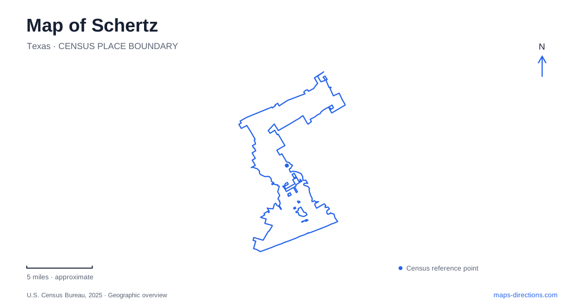
Street tiles load from OpenStreetMap when opened. The blue line shows the 2025 Census boundary.
- State
- Texas
- Population · July 2025
- 45,978
- Land area
- 37.9 sq mi
- Water area
- 0.2 sq mi
Schertz has a historic center shaped by commerce and railways, alongside a much broader landscape of neighborhood parks, creek-side open space, and major road corridors. Main Street tells one part of the story; the Cibolo Creek parks tell another. The most useful map distinguishes places intended for organized recreation from areas where trails follow woodland and water, rather than treating every park label as the same type of destination.
Main Street preserves the commercial story
The city's history connects the settlement's growth with agriculture, a general store, cotton processing, and the arrival of the railway. A post office followed the railway in 1882. The older name Cut-Off remained until the community officially adopted its present name in 1899.
One surviving commercial landmark identified by the city is the red-brick building at Main Street and Lindbergh Avenue. It began as William's Mercantile and later operated as Sippel's Hardware. This gives the historical account a location that can be related directly to the street map, rather than leaving it as a sequence of dates.
Main Street and nearby FM 78 should also be read with the railway corridor in view. The city's sector planning documents discuss how limited crossings affect connections between them. This is a lasting geographic consideration even as individual streets are improved: the railway is part of the town's origin and part of the physical structure of the center.
Oak Street provides a recreation cluster
Pickrell Park is at 701 Oak Street and includes a pool, pavilions, playgrounds, and a walking trail. Thulemeyer Park, at 901 Oak Street, is another nearby recreation destination with a sports focus. Their addresses establish a recognizable cluster without implying that both parks have identical facilities.
For a map of Schertz, this is a useful distinction between an address-based park visit and a longer nature outing. A gathering at a pavilion or a game at a sports field is anchored to a particular facility. The creek trails discussed elsewhere in the city's park information have a different purpose and geographic extent.
Keeping the individual park name with the event or activity avoids making Oak Street itself the destination. The road connects the places; the facility determines where the visit actually takes place.
Cibolo Creek has separate public access settings
Cut-Off Park, in the 700 block of FM 1518, contains open space and large oak trees and serves as a trailhead for the Cibolo Creek Primitive Trails. Its name also echoes the community's earlier name, connecting a recreation location with the settlement history.
Crescent Bend Nature Park is separately located at 12805 West Schaefer Road. Its trails, bird blinds, and fishing areas encourage close observation of the creek landscape. The parks master plan describes multiple habitats and identifies the site as a certified firefly habitat, emphasizing conservation alongside recreation.
These two places should not be combined into one assumed continuous outing. The master plan discusses a future connection between Crescent Bend and the wider creek trail network. That future intention is different from an established route. A map of Schertz should preserve the separate access addresses while showing how both places relate to Cibolo Creek.
Roadside paths and wooded paths serve different trips
Forest Ridge Park, at 17529 Wiederstein Road, contains a trail through a linear wooded area and connects with the FM 3009 sidewalks. Oak Forest Park, in the 4200 block of FM 3009, supplies another shaded path connection to that road corridor. These links allow neighborhood recreation to relate to everyday movement along a major street.
Mary Whitfield Burks Park illustrates a different access pattern. The city identifies it as a small fitness-oriented park reached only on foot or by bicycle from the Schertz Parkway trails. A street address in its listing should therefore not be interpreted as a promise of a conventional drive-in parking entrance.
The distinction is practical: some parks are destinations reached by vehicle, while others function as stops within a walking or cycling route. Their role in the network matters as much as their size.
A woodland destination on Longleaf Parkway
Heritage Oaks Park, at 11700 Longleaf Parkway, offers a wooded walking setting with mature oaks and cedar elms, a pond, and picnic facilities. It provides another alternative to the athletic areas and creek-side nature parks, with the trees and pond organizing the experience within the grounds.
A map of Schertz can thus be read through several clear relationships: historic commerce beside the railway, recreation on Oak Street, separate Cibolo Creek access areas, and trails that connect wooded spaces to major roads. These distinctions make the local geography understandable before choosing a route or an activity.
Map and statistics: U.S. Census Bureau, 2025 Gazetteer, January 2025 generalized place boundaries and Vintage 2025 population estimates. Local references: City of Schertz. Article prepared by Maps & Directions.