Map of Santa Rosa
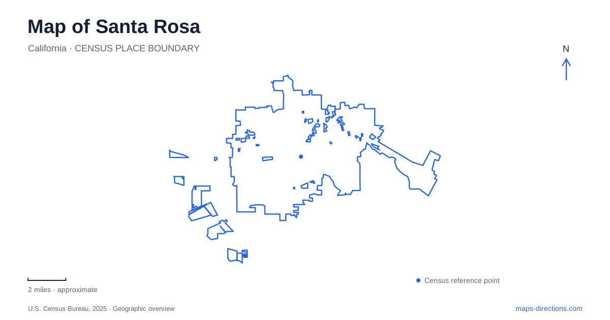
Street tiles load from OpenStreetMap when opened. The blue line shows the 2025 Census boundary.
- State
- California
- Population · July 2025
- 179,437
- Land area
- 42.6 sq mi
- Water area
- 0.2 sq mi
Santa Rosa brings together a railroad district built in local stone, gardens associated with a pioneering horticulturist, and a museum rooted in the daily life of a cartoonist. East of those urban destinations, lakes and wooded hills form a connected recreation landscape. These are not interchangeable sightseeing stops: their locations reflect transport, creative work, plant cultivation, and the preservation of open space. Reading them as separate geographical clusters helps explain the city beyond its position in Sonoma County wine country.
Basalt buildings around the railroad depot
Railroad Square developed around the train depot at the western end of Fourth Street. Its surviving stone buildings include the 1904 depot, the Western Hotel from 1903, Hotel La Rose from 1907, and the Railway Express building completed in 1915. Italian immigrant masons used basalt from quarries to the east and near Kenwood. The materials therefore connect the commercial district to the surrounding landscape as well as to the railway.
The 1906 earthquake and subsequent fires caused major destruction, followed by rebuilding. The district's visible history consequently spans buildings that survived the disaster and those constructed afterward. Dates on individual structures are more revealing than a blanket description of the area as nineteenth-century downtown.
The Prince Memorial Greenway follows the creek between City Hall and Railroad Square. Its terraces, landscaping, paths, and public art transformed a former concrete flood channel into a public corridor. This gives central Santa Rosa a second organizing line alongside Fourth Street: the creek route provides a different view of the relationship between the civic center and the railway district.
A home landscape devoted to plants
Luther Burbank Home and Gardens preserves a much more intimate working environment. Burbank bought the property in 1884 and used it as a home and a base for horticultural activity. The surviving greenhouse originated in 1889, with a later addition. Its small scale makes the experimental work easier to imagine than a general account of plant breeding alone.
The property's subsequent history is also visible through the house. Burbank moved out in 1906, after which it served office and storage functions. His widow Elizabeth later remodeled it and lived there from 1927 until 1977. Many displayed furnishings came through her estate, so the interiors represent more than one period of occupation.
For Santa Rosa, this garden is both a botanical destination and a record of how a domestic property supported specialized work. The house, greenhouse, and grounds belong to one historical setting, although guided interiors and outdoor garden access follow separate arrangements.
The neighborhood behind the comic strip
The Charles M. Schulz Museum stands at 2301 Hardies Lane near the ice arena associated with the cartoonist. This location has a biographical explanation: Schulz spent decades working in this immediate environment. His family built the arena and Warm Puppy Café in 1969, and the museum joined the site in 2002.
Inside, original comic strips and a recreation of the drawing studio connect the published characters with the tools and routines of their creator. Across the street, Snoopy's Home Ice represents another part of that working life, including his interest in hockey. These neighboring institutions make a coherent local cluster rather than a museum placed arbitrarily beside an unrelated sports venue.
The museum's approach uses West Steele Lane and Hardies Lane, north of the historic downtown districts. That distinction is helpful when organizing a day in Santa Rosa: the Schulz campus has its own neighborhood setting, separate from the railroad buildings and Burbank property.
Three different waters in the eastern parks
Spring Lake Regional Park covers 320 acres and contains a 72-acre lake plus a separate three-acre swimming lagoon. The distinction between those waters is essential: a label for the larger lake does not describe the purpose or location of the managed swimming area. County maps also show adjoining Howarth Park and connections toward Trione-Annadel State Park.
Farther into the state park, Lake Ilsanjo is another body of water entirely. This 26-acre artificial lake developed during Joe and Ilsa Coney's ownership, and its name combines theirs. The former ranch also contained quarries and an extensive network of roads and trails, portions of which influenced later recreational routes. The state acquired 4,100 acres in 1971 to establish the park.
These eastern landscapes broaden a map of Santa Rosa from urban blocks into a terrain of lakes, former ranch roads, and hills. A county recreation park, a municipal park, and a state park meet here, so neighboring paths can cross management boundaries even while remaining part of one outdoor outing.
Map and statistics: U.S. Census Bureau, 2025 Gazetteer, January 2025 generalized place boundaries and Vintage 2025 population estimates. Local references: City of Santa Rosa; Luther Burbank Home and Gardens; Library of Congress; Charles M. Schulz Museum; Sonoma County Regional Parks; California State Parks. Article prepared by Maps & Directions.