Map of Santa Maria
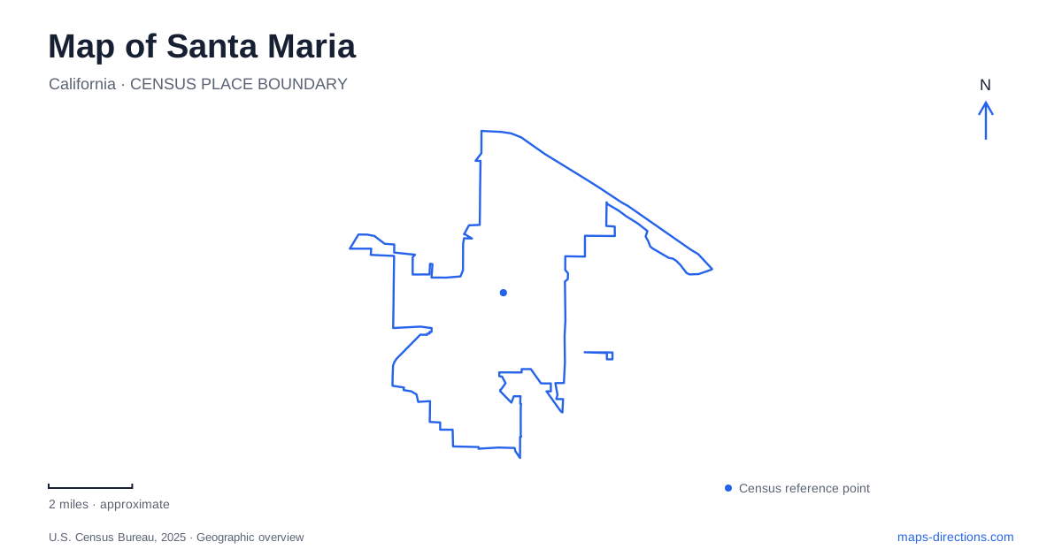
Street tiles load from OpenStreetMap when opened. The blue line shows the 2025 Census boundary.
- State
- California
- Population · July 2025
- 111,390
- Land area
- 22.8 sq mi
- Water area
- 0.6 sq mi
Santa Maria's central crossroads at Broadway and Main Street provide a useful starting point for reading the city. Broadway carries State Route 135, while Main Street carries State Route 166, so ordinary street names and highway numbers overlap in downtown directions. Beyond that center, McClelland Street groups several public destinations, the airport preserves a separate aviation story, and Los Flores Ranch leads into the Solomon Hills south of the urban area.
Broadway, Main Street, and the civic addresses
The intersection of Broadway and Main has long been a focus of downtown planning. The city's streetscape study compares older blocks with the later Town Center development, showing how the shopping center altered parts of the earlier street pattern around Church and Cypress streets. This helps explain why the central map does not read as an uninterrupted grid of small blocks.
For practical orientation, Broadway supplies the north–south reference and Main Street the east–west one. The highway numbers remain useful when approaching from outside the city, while the street names are more helpful for nearby addresses. Understanding both forms of identification makes it easier to connect regional directions with the downtown map.
City Hall is at 110 East Cook Street, south of the Main Street crossroads. The main public library is at 421 South McClelland Street, with entry and parking on McClelland and a two-level parking structure. These addresses place public services within a specific civic area rather than at an abstract city-center marker. A visitor with municipal business and a library stop can use Cook and McClelland as the local references.
A family-oriented stretch of McClelland Street
Several community destinations continue along South McClelland Street. The Abel Maldonado Youth Center is at number 600, and the Recreation and Parks Department is at 615. Farther along, the Discovery Museum occupies 705 South McClelland. The sequence gives this street a concentration of public and family-oriented uses within central Santa Maria.
The children's museum interprets local subjects through hands-on displays. Produce, ranching, and the area's barbecue tradition appear alongside imaginative play and science activities. That combination connects a family visit with the surrounding valley's agricultural identity. It is a different kind of museum experience from viewing historic objects behind glass, with participation central to the exhibits.
The library and children's museum therefore make distinct stops on the same street. Their nearby addresses make the grouping easy to see, but each serves its own purpose. McClelland is a useful place to examine closely when an itinerary includes community activities, rather than relying only on the larger Broadway corridor for orientation.
Aviation history on Airpark Drive
The Museum of Flight stands at 3015 Airpark Drive at the public airport. Its collection focuses on aviation history and the Central Coast's contributions to aerospace, including the area's flight-training heritage. Displays connect early flying, military aviation, and later aircraft development.
One local thread is G. Allan Hancock's flight academy. Another is the museum hangar's connection with the film The Rocketeer. These subjects give the airport area a historical and cultural role beyond passenger travel. A map of Santa Maria can therefore include the airport as a visitor destination even when no flight is part of the trip.
Airpark Drive is the relevant museum address. The airport's passenger facilities use their own approach and building locations, so the museum belongs to a specific part of the aviation grounds. Plotting it separately from the downtown museums shows how the city's cultural destinations are distributed across several settings.
Los Flores Ranch in the Solomon Hills
Los Flores Ranch Park lies about eight miles south of Santa Maria, on the east side of US 101 in the Solomon Hills. The park's paths include routes originally associated with ranching and oil operations. That earlier working landscape helps explain the mixture of dirt paths and paved roads used for recreation today.
The city directs visitors south on US 101 to Clark Avenue, then to Dominion Road. Its published park-access notice gives 6271 Dominion Road as the destination. This highway-and-rural-road approach is substantially different from navigating the numbered addresses around downtown's civic buildings.
Hiking, mountain biking, horseback riding, and birdwatching are among the park's activities. Equestrian access and horse facilities are marked on the ranch trail map, while the broader landscape includes rolling terrain and viewpoint routes. The internal trail map is therefore the next useful scale after the road approach, especially when selecting an outing suited to a particular activity.
Together, Broadway and Main, the McClelland Street institutions, Airpark Drive, and the Clark Avenue–Dominion Road approach reveal four different parts of Santa Maria's geography. They connect the city's civic center with its agricultural, aviation, and working-landscape histories without treating the surrounding valley as one continuous downtown destination.
Map and statistics: U.S. Census Bureau, 2025 Gazetteer, January 2025 generalized place boundaries and Vintage 2025 population estimates. Local references: City of Santa Maria; Santa Maria Valley tourism; Santa Maria Museum of Flight. Article prepared by Maps & Directions.