Map of Santa Fe
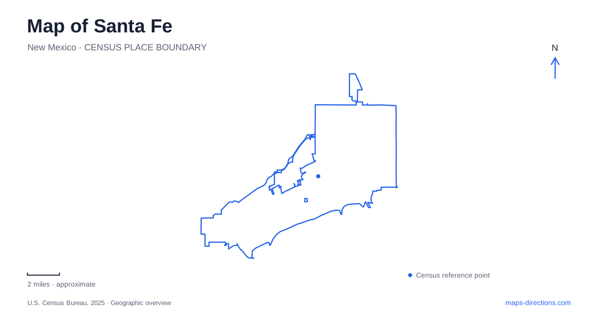
Street tiles load from OpenStreetMap when opened. The blue line shows the 2025 Census boundary.
- State
- New Mexico
- Population · July 2025
- 89,837
- Land area
- 52.2 sq mi
- Water area
- 0.1 sq mi
Santa Fe is organized around a historic plaza, but its geography cannot be reduced to a single square. The river, old trade routes, railway grounds and neighborhoods of former homes each explain a different part of the city. Its elevation, around 7,000 feet, places the capital in a high landscape rather than the low desert setting sometimes imagined by visitors. A useful reading of the map connects the compact civic center with the cultural districts and water systems extending beyond it.
A plaza at the meeting of trade routes
The Plaza became a focus of government, commerce and public gathering after the Spanish colonial capital was established in 1610. José de Urrutia's 1766 map shows a simple square surrounded by the Palace of the Governors, a chapel and residences. That early image is a reminder that the familiar landscaped public space developed over time; its present appearance is not an unchanged survival from the seventeenth century.
Long-distance connections gave the square importance beyond its immediate streets. Trade linked the city with Chihuahua along El Camino Real de Tierra Adentro and, later, with Missouri markets along the overland trail. The central square therefore belonged to a much larger economic geography. Merchants, government officials and residents used a place whose role depended on movement across enormous distances, even though the surviving downtown can feel physically compact.
The palace and its living portal
On the north side of the Plaza, the Palace of the Governors provides a strong visual edge. Its long, low adobe form contrasts with the open ground in front of it. Now part of the New Mexico History Museum, the building carries the complicated history of Spanish, Pueblo, Mexican and American authority. Describing it only as picturesque architecture would omit the changing political relationships that shaped its use.
In Santa Fe, the palace portal also remains a working cultural and commercial space. The museum's Native American Artisans Program reserves it for Native artisans selling work made by themselves or members of their households. The distinction is meaningful: these are contemporary makers participating in a regulated program, not anonymous historical figures in a reconstructed marketplace. The building joins interpretation of the past with present-day artistic livelihoods.
Canyon Road's houses, gardens and galleries
Canyon Road offers a different arrangement from the Plaza. Its gallery district follows a roughly half-mile stretch where many former private homes now contain art spaces. The sequence of adobe buildings, gardens and small entrances gives the area a domestic scale, even though its cultural role reaches far beyond the neighborhood.
El Zaguán illustrates this transformation. In 1854, merchant James Johnson joined buildings to accommodate his family; the property later acquired its present name, referring to a passage or hallway. Its garden dates to the nineteenth century, and the Historic Santa Fe Foundation now maintains an archival and preservation presence there. Nearby Gormley Lane leads toward the Acequia Madre neighborhood, with surviving warehouse buildings recalling a general store established in 1903.
Patrick Smith Park supplies another connection, reachable from Canyon Road or Alameda Street. Its tree-lined open ground and river access show that this district includes everyday neighborhood recreation as well as galleries. Cultural frontage and residential landscape remain closely interwoven.
Railway land beyond the old center
The Railyard represents a later transportation chapter. Railway grounds that once handled passengers, freight and fuel now contain arts spaces, gathering areas and landscaped public land. The park includes 28 individual gardens, a children's play area and spaces for public art, providing a deliberately varied landscape within the former working yard.
The Baca District marks the southern part of this larger railway geography. It once held coal and fuel storage for the Denver & Rio Grande and New Mexico Central railways. An old rail alignment connected it with the northern yard across land now associated with the School for the Deaf. This history explains why the Railyard should be read as an extended district with several components, rather than one building or plaza.
For Santa Fe, reusing railway land has created another cultural center without erasing the older Plaza's importance. The two districts reflect different periods of transportation and urban development, and their differing street and parcel patterns remain part of that story.
Water from the upper watershed
The river brings the surrounding terrain into the city. Its watershed includes streams, arroyos and other drainage channels across about 285 square miles. The smaller municipal upper watershed contains reservoirs that support drinking-water treatment and deliveries to traditional acequias, or irrigation channels.
The city's Living River work also directs some available flows toward the river corridor. A mapped watercourse here consequently represents a managed system as well as a natural drainage line. Flow varies, and the river's appearance at one location does not describe the entire watershed.
Reading Santa Fe through these connected places reveals several overlapping structures: the Plaza's trade and government history, the palace's living arts program, Canyon Road's adapted homes, the railway districts and the water network that sustains the landscape. Their relationships make the city understandable beyond its most familiar architectural image.
Map and statistics: U.S. Census Bureau, 2025 Gazetteer, January 2025 generalized place boundaries and Vintage 2025 population estimates. Local references: National Park Service; New Mexico History Museum; Tourism Santa Fe; City of Santa Fe. Article prepared by Maps & Directions.