Map of Santa Clarita
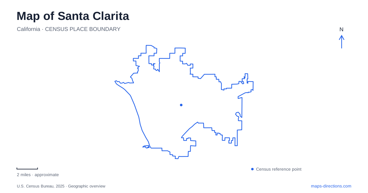
Street tiles load from OpenStreetMap when opened. The blue line shows the 2025 Census boundary.
- State
- California
- Population · July 2025
- 228,430
- Land area
- 73.6 sq mi
- Water area
- 0.1 sq mi
Santa Clarita is a city assembled from several recognizable communities rather than one historic center surrounded by anonymous suburbs. Newhall, Saugus, Valencia and Canyon Country were included when the city incorporated in 1987. Their names remain essential on maps, addresses and local destinations. The river system, canyon roads and older transportation routes help explain how these places relate to one another, while historic sites reveal development that long predates incorporation.
Four communities within a wider valley
The municipal boundary and the broader valley are different geographic ideas. The city's planning materials distinguish its four communities from county communities such as Castaic, Stevenson Ranch, Val Verde and Agua Dulce. Those places may appear together in regional descriptions without sharing the same municipal government. This matters when reading a valley-wide map that includes neighborhoods, open space and destinations beyond the city line.
Valencia's planned development and Canyon Country's Soledad Canyon Road corridor give two contrasting reference points. Saugus carries a name connected with Henry Mayo Newhall's Massachusetts birthplace, while Newhall preserves the valley's older town history. The names are more useful than treating every destination as being in a single central district. They identify different development patterns and provide a framework for understanding how the valley's roads connect established communities.
Main Street and the screen-western legacy
Old Town Newhall gives Santa Clarita a compact cultural district organized around Main Street. The Walk of Western Stars runs along public sidewalks on both sides of that street. Begun in 1981, it honors figures from Western film, television and radio through stars set into the pavement. Because it is distributed along the sidewalks, its geography is a walking sequence rather than a monument with one viewing point.
The district also includes The MAIN, a city cultural venue. A parking structure on Ninth Street between Railroad Avenue and Main Street provides another useful reference for the street layout. Railroad Avenue's position alongside the older commercial streets makes the district's transportation context visible even when a visit centers on shops, performances or film history. The area's identity combines an actual townscape with the entertainment industry's later interpretation of the American West.
Hart Park's buildings and hillside
William S. Hart Park connects that film history with the former home of a silent-screen actor. The city assumed ownership from Los Angeles County in 2025. Its grounds contain historic buildings, trails, picnic areas, camping facilities and a barnyard, so the park has several distinct uses rather than functioning only as a house museum.
The Ranch House and the hilltop mansion should be distinguished when reading older visitor information. The Ranch House, mansion and other historic structures have separate preservation histories and visitor arrangements, even though they share the larger estate. The broader park landscape can therefore remain active while access to individual buildings follows a different timetable. Within Santa Clarita, this is a particularly clear example of a historic estate becoming a public place with both preservation and recreation responsibilities.
River routes beneath the road network
The regional river trail forms the backbone of the city's trail system. Connecting paths reach parks, shopping areas, schools and employment destinations, while neighborhood paseos add shorter links. These routes create a second circulation system beside the roads, one designed around walking, cycling and other recreational movement.
The South Fork Trailhead lies off the south side of Magic Mountain Parkway, between Valencia Boulevard and Railroad Avenue, on the river's west bank. Iron Horse Trailhead is reached from the north side of the parkway near Tourney Road. Keeping these two locations distinct explains how nearby trail access points serve different sides of the road and river setting. Underpasses along the Santa Clara River and its tributaries can flood during severe rain, so the attractive continuity of the mapped network is subject to actual water conditions.
Gold history in the canyon landscape
Placerita Canyon adds an older story to the surroundings of Santa Clarita. California's historic landmark record identifies Francisco López's March 1842 discovery near the Oak of the Golden Dream as the state's first authenticated gold discovery. It preceded the better-known Sutter's Mill discovery by six years. The account connects the find with particles of gold attached to wild onion roots.
The landmark record also distinguishes the canyon site from a commemorative plaque near Interstate 5 and Lyons Avenue. These are separate locations associated with the same event, a useful detail when following historic map markers. The canyon, river paths, preserved estate and Main Street together reveal how Santa Clarita combines natural corridors with several generations of settlement, transportation and cultural history.
Map and statistics: U.S. Census Bureau, 2025 Gazetteer, January 2025 generalized place boundaries and Vintage 2025 population estimates. Local references: City of Santa Clarita; U.S. Department of Housing and Urban Development; California Office of Historic Preservation. Article prepared by Maps & Directions.