Map of Santa Barbara
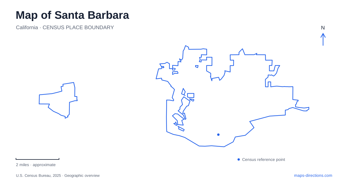
Street tiles load from OpenStreetMap when opened. The blue line shows the 2025 Census boundary.
- State
- California
- Population · July 2025
- 86,422
- Land area
- 19.5 sq mi
- Water area
- 18.0 sq mi
Santa Barbara's waterfront is a sequence of distinct places rather than one interchangeable beach destination. A map can show the harbor, Stearns Wharf, East Beach and Cabrillo Pavilion together, yet an arrival point suitable for one may be inconvenient for another. The useful first step is to identify the part of the waterfront involved in the visit. Once that is clear, the named streets and parking areas help turn a broad coastal destination into a location that can actually be reached and recognized.
Use the waterfront's separate anchors
The city's waterfront parking map distinguishes the harbor, wharf and beach facilities. It also labels State Street, Garden Street, Castillo Street, Milpas Street and Cabrillo Boulevard. These names provide more useful references for a meeting than the phrase “by the ocean.” Someone waiting near the harbor is not necessarily close to a person approaching the pavilion, even though both may describe their location as the waterfront.
On a map of Santa Barbara, preserve enough of the shoreline in view to see these relationships before zooming into an individual parking lot. A close view is helpful for the final approach, but it can hide the fact that another similarly named facility lies along a different section of the coast. Establish the larger destination first, then inspect the last few streets.
Cabrillo Boulevard gives the coast a street address
The municipal coastal planning material describes Cabrillo Boulevard's relationship to the shoreline and identifies the Mission Creek crossing. The creek is a useful reminder that the waterfront is not merely a straight strip of pavement beside sand. Bridges and channels shape the connections between adjacent blocks, and a destination on the opposite side of a water feature needs an actual crossing rather than a line drawn toward it.
For map reading, follow the named road through this area and distinguish it from waterfront paths. A path that looks continuous beside the coast may suit a pedestrian journey without answering a driver's access question. Conversely, a road route can deliver a vehicle to the neighborhood while leaving a final walk to the chosen beach or facility. Keep those two stages visible in the plan.
The pavilion identifies a particular beach destination
Cabrillo Pavilion is listed at 1118 East Cabrillo Boulevard. The city describes a beachfront building with event space upstairs and other facilities on the lower level. This is a much more precise destination than an undifferentiated East Beach pin. It also illustrates why an address does not entirely answer an arrival question: a visitor attending an event may need a different part of the building from someone using beach facilities.
For a Santa Barbara gathering, share the venue name, street address and the part of the facility being used. The city's description of East Beach Cabrillo West places that beach section east of Milpas Street beside the Cabrillo West parking lot. These local references can resolve uncertainty when a map presents several beach, building and parking symbols close together.
Parking names deserve their own check
The municipal parking directory lists Cabrillo East, Cabrillo West and Garden Street separately. The broader waterfront parking map also identifies harbor and Leadbetter parking areas. Treat these as individual destinations. Choosing a lot because its name contains “Cabrillo” does not establish that it is the most suitable arrival point for every attraction along the boulevard.
This distinction matters especially when saving or sharing a pin. A venue address, a parking entrance and the place where friends meet can be three different locations. Labeling each separately avoids a common navigation problem: a driver reaches the attraction marker but still has no clear approach to the intended parking facility. Consult current posted rules for the selected lot; a geographical overview should not be mistaken for a promise about spaces, prices or vehicle restrictions.
Read State Street as a connection, with current rules
State Street supplies another recognizable orientation line between the central area and the waterfront. City planning considers connections with the Funk Zone and waterfront, demonstrating why these districts appear together in discussions of downtown movement. Their relationship is useful for understanding a wider outing, but a district name is still less exact than a venue address.
Because street arrangements are the subject of active planning, this Santa Barbara overview does not assume that every part of State Street is available for every travel mode. Use current routing and signs for the actual journey. For an itinerary combining downtown and the coast, record the destination on each end and decide how the connecting trip will be made rather than assuming a continuous driving line through the most familiar street name.
Turn a coastal overview into an arrival plan
A practical Santa Barbara map plan has three scales: the stretch of waterfront, the relevant approach streets and the final facility entrance. At the widest scale, separate the harbor, wharf and eastern beach destinations. At street scale, use the named intersections and creek crossings. At the final scale, distinguish parking, building and meeting point. That sequence keeps the attractive coastal panorama useful without allowing it to blur the specific place where the journey needs to end.
Map and statistics: U.S. Census Bureau, 2025 Gazetteer, January 2025 generalized place boundaries and Vintage 2025 population estimates. Local references: City of Santa Barbara. Article prepared by Maps & Directions.