Map of Santa Ana
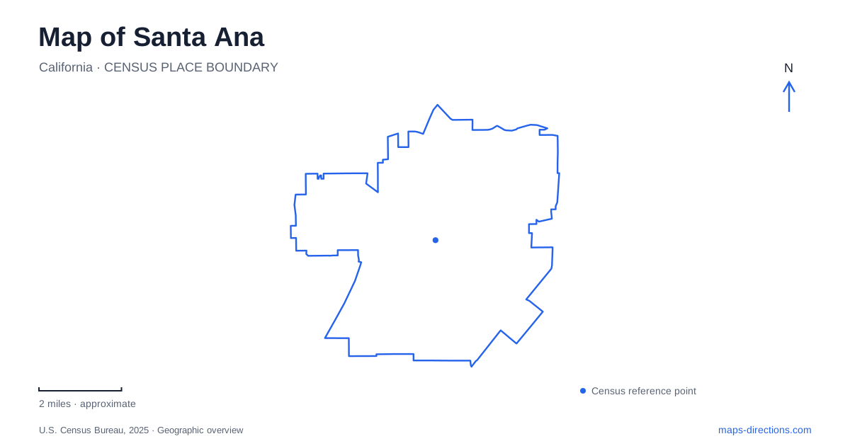
Street tiles load from OpenStreetMap when opened. The blue line shows the 2025 Census boundary.
- State
- California
- Population · July 2025
- 315,586
- Land area
- 27.4 sq mi
- Water area
- 0.0 sq mi
Santa Ana's map brings together a county government center, historic commercial streets, artist workspaces, and residential neighborhoods with distinctive architecture. Main Street and Broadway provide useful downtown references, but cultural destinations also extend north toward the Bowers Museum and Santiago Creek. The city is particularly interesting where older buildings have acquired new public roles: a market became an art center, a courthouse became a history destination, and a family property became a museum.
Downtown's overlapping cultural districts
The downtown area includes the Civic Center District, Artists Village, Calle Cuatro, and the East End. Calle Cuatro is Fourth Street, so the Spanish name and the numbered street refer to the same commercial corridor. Its businesses and cultural activity contribute a strong Latino presence to downtown life. Nearby galleries, studios, restaurants, and public art give the broader center several complementary identities.
The Santora Building, a 1929 Spanish Colonial Revival landmark at Second Street and Broadway, houses art spaces within an ornate historic setting. The Yost dates to 1912 and supplies another longstanding entertainment landmark. These buildings make the early twentieth-century city visible within the contemporary arts and dining scene.
A map of Santa Ana can therefore be read through intersections and individual buildings rather than rigid boundaries between visitor districts. The labels describe clusters of activity within the same connected street network. Fourth Street, Second Street, and Broadway offer a useful framework for exploring that network without losing the relationship between the commercial and artistic parts of downtown.
A former market becomes an arts institution
Grand Central Art Center occupies a 1924 building at 125 North Broadway. Originally a central market, the block-long structure was restored through a partnership between the city and California State University, Fullerton. The art center opened in 1999, combining exhibition, educational, and residential functions.
The building's reuse is more than a change of tenant. Studios and living spaces for graduate artists place creative production within the district, while galleries and other public programs bring visitors into the same setting. The former market's substantial footprint allowed these different uses to coexist.
This is also an institutional geography worth recognizing: the center belongs to a university based in another city, yet its downtown location is an essential part of its purpose. On the local map, North Broadway identifies the art center more precisely than searching only for the university's main campus.
The courthouse and the county's public history
The Old Orange County Courthouse was dedicated in 1901. Built of granite and red sandstone, it became the traditional home of county government and remains a prominent historical landmark. Its approximately 30,000 square feet now accommodate historical interpretation, archives, and government functions.
The county purchased the site in 1893 from William Spurgeon, the city's founder. A county jail was constructed before the permanent courthouse, illustrating how the administrative complex developed in stages. The restored building makes that history accessible within Santa Ana's civic landscape rather than removing it to an isolated heritage park.
Its location on the boulevard bearing the city's name places it within the central street grid, where public offices and historic commercial blocks can be understood together. The courthouse's stone exterior also contrasts with the Spanish Colonial Revival character of the Santora Building, showing that downtown architecture reflects several periods and purposes.
Bowers Museum north along Main Street
Bowers Museum occupies the corner of Twentieth and Main streets. Charles and Ada Bowers left their home and land for the creation of a museum, and the institution opened in 1936 with an initial emphasis on Orange County history. It later expanded its focus to art and cultures from around the world, reopening in substantially enlarged form in 1992.
The museum retains extensive local historical collections alongside that broader mission. This gives a visit two different scales: objects and exhibitions can connect the region with global cultures, while archival material preserves the record of nearby communities. The museum's position north of downtown makes Main Street a useful connecting reference within Santa Ana, even though the galleries occupy a separate setting from the Artists Village.
A creek corridor at the northern edge
Santiago Park forms a 35-acre linear open space along Santiago Creek near the city's northern edge. The city identifies it as its wilderness park, with native landscape and paths occupying a corridor shaped by drainage rather than rectangular blocks. Park improvements in its central and western sections include a path connection toward Main Street.
The creek landscape adds an environmental layer to a map otherwise dominated by cultural buildings and urban neighborhoods. Its elongated form helps explain both the trail alignment and the opportunities for connections from surrounding streets. Together, the park, northern museum, historic courthouse, and downtown arts buildings show Santa Ana as a city whose public places preserve several kinds of history: governmental, commercial, cultural, and natural.
Map and statistics: U.S. Census Bureau, 2025 Gazetteer, January 2025 generalized place boundaries and Vintage 2025 population estimates. Local references: Travel Santa Ana; California State University Fullerton; OC Parks; Bowers Museum; City of Santa Ana. Article prepared by Maps & Directions.