Map of Sandy
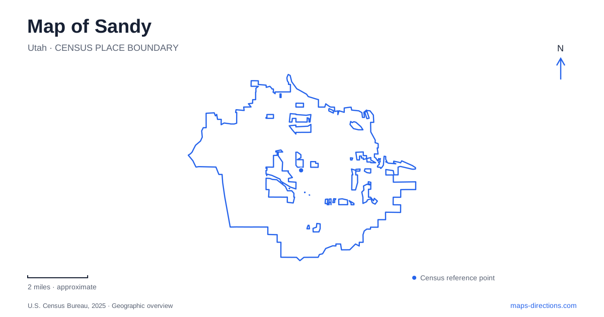
Street tiles load from OpenStreetMap when opened. The blue line shows the 2025 Census boundary.
- State
- Utah
- Population · July 2025
- 92,386
- Land area
- 24.3 sq mi
- Water area
- 0.0 sq mi
Sandy's map places large event venues along a valley transport corridor and a long natural park among residential neighborhoods farther east. State Street, I-15, the TRAX Blue Line, and the numbered road grid provide the broad framework. Within that framework, a soccer match, theater performance, museum visit, and woodland walk require quite different local routes. The most revealing comparison is between the concentrated venues near State Street and the east–west reach of Dimple Dell.
Events along State Street and Monroe
America First Field stands at 9256 South State Street, between 9000 South and 9400 South. It is the home venue for Real Salt Lake, and its location gives those two cross streets a practical role in understanding stadium arrivals. The team's directions identify different approaches from I-15 depending on the direction of travel, while parking areas have their own event arrangements.
The stadium's internal geography matters for accessibility. Its West and North gates provide accessible entry, while the Spanish Stairs gate does not. The club also describes a shuttle from City Hall, picking up along Monroe Street and serving the stadium's west curb. These details make the west side particularly relevant to a visitor using that service; the State Street address alone does not convey the whole arrival pattern.
Farther south, Hale Centre Theatre uses 9900 South Monroe Street. The venue opened this building in November 2017 and presents productions on distinct stages. Its box-office information differentiates the Young Living Centre Stage from the Jewel Box and other performance spaces, with schedules that can differ. A theater ticket therefore carries two useful pieces of local information: the Monroe Street destination and the specific stage within it.
Mountain America Expo Center, at 9575 South State Street, forms another event destination in the same broad corridor. Its five exhibit halls serve conventions and specialty shows. The expo building, theater, and stadium explain why this part of the map contains several large visitor destinations close together, each with its own event footprint.
A sequence of light-rail stops
The Blue Line offers a second way to read this corridor. Historic Sandy station stands at 165 East 9000 South. The Expo stop is at 9375 South 150 East, while Sandy Civic station uses 115 East Sego Lily Drive. Crescent View lies farther south at 361 East 11400 South. The increasing south numbers help make the station sequence understandable even before looking at the rail line itself.
These are light-rail stations. South Jordan's FrontRunner station, at 10351 South Jordan Gateway, belongs to the regional commuter-rail system instead. Both systems appear on metropolitan transit maps, but their lines, platforms, and destinations differ. Choosing a trip by the station name and service is more reliable than treating every rail symbol in the south valley as interchangeable.
A smaller historical address
The Sandy Museum is at 8744 South Center Street. The city describes a historic building containing two floors of displays and an exhibition shed outside. That modest site offers a different scale of visit from the large venues to its south. Its position north of the 9000 South reference line also helps place the older center in relation to the modern event corridor.
The museum's artifacts give a reason to pause in the historic area rather than using it only as a route between larger destinations. A close street view is useful here: Center Street and the nearby numbered roads describe a local setting that can disappear beneath stadium and convention labels on a wider map.
Dimple Dell across the neighborhoods
Dimple Dell Regional Park stretches east to west through residential areas. Salt Lake County describes 630 acres of natural open space with more than 15 miles of trails for walkers, bicyclists, and horseback riders. The long shape is its defining map feature, extending the outdoor landscape across multiple neighborhood approaches.
Wrangler Trailhead at 10350 South 1300 East has parking, restrooms, picnic tables, and a drinking fountain. The Dimple Dell Road trailhead at 2765 East Dimple Dell Road provides parking and restrooms, while Mount Jordan at 2940 East Mount Jordan Road has parking but lacks those other listed facilities. These access points distribute visits along the park instead of concentrating everyone at one end.
The Dimple Dell Recreation Center, at 10670 South 1000 East, is a separate indoor recreation destination with pools. Keeping it distinct from the regional park is particularly useful for families choosing between swimming and a trail outing. On a map of Sandy, the shared name reflects nearby recreation opportunities, but the addresses lead to different experiences: an indoor facility on 1000 East and an extended natural corridor reached through several trailheads.
Map and statistics: U.S. Census Bureau, 2025 Gazetteer, January 2025 generalized place boundaries and Vintage 2025 population estimates. Local references: Utah Royals; Real Salt Lake; Hale Centre Theatre; Visit Salt Lake; Utah Transit Authority; Sandy City; Salt Lake County. Article prepared by Maps & Directions.