Map of San Mateo
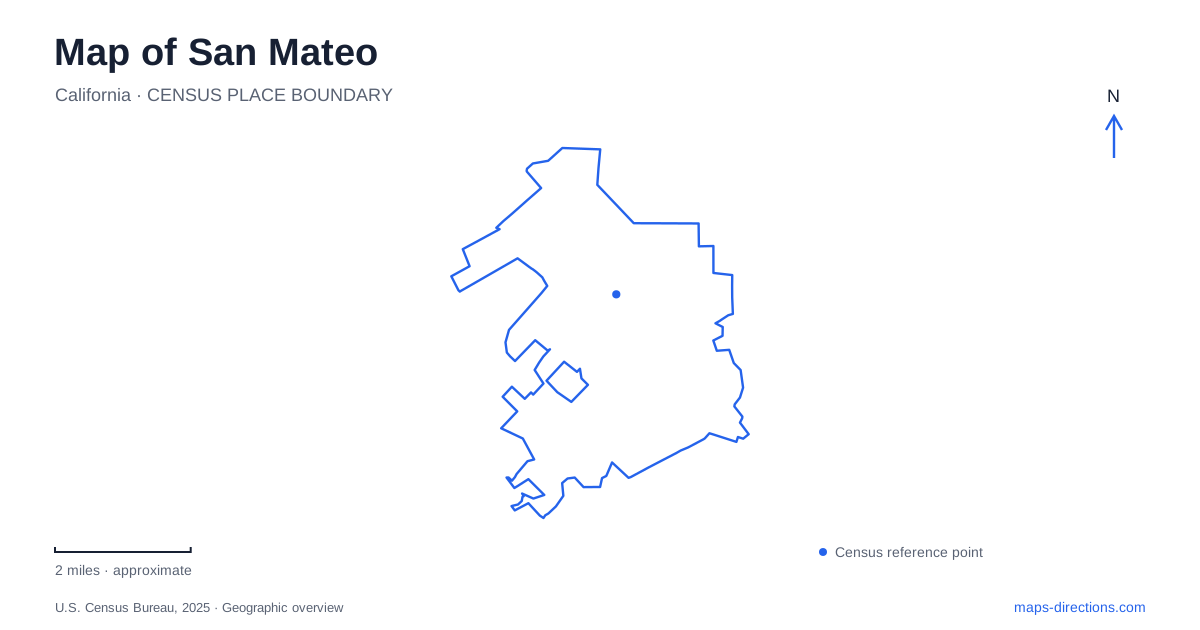
Street tiles load from OpenStreetMap when opened. The blue line shows the 2025 Census boundary.
- State
- California
- Population · July 2025
- 103,337
- Land area
- 12.1 sq mi
- Water area
- 3.7 sq mi
San Mateo offers two very different ways to understand a Peninsula city: the numbered avenues and railway stops of its urban center, and the paths, marshes, and recreation areas beside San Francisco Bay. Downtown's pedestrian blocks concentrate activity into a small street grid, while the shoreline spreads it across larger open spaces. A useful map should show both scales. The railway provides another organizing line, with separate station areas serving downtown, Hayward Park, and Hillsdale rather than a single stop for every local destination.
B Street's pedestrian blocks
The downtown pedestrian mall occupies B Street between First and Third avenues. The city established the permanent arrangement in 2021. It consists of two blocks, from First to Second and from Second to Third, with east–west traffic still crossing at the numbered avenues. This produces a distinctive pattern: a walkable north–south restaurant corridor interrupted by ordinary street crossings.
That detail matters when reading a downtown driving route. B Street's familiar name continues through the district, but the pedestrian section cannot be treated as an uninterrupted vehicle route. The reserved fire and service lane also has a different purpose from general traffic circulation. On a walking map, the numbered cross streets provide a simple way to describe a meeting place without confusing the two blocks. San Mateo's compact central grid is especially legible when these pedestrian segments are visible alongside the railway.
A former estate becomes a public garden
Central Park, at 50 East Fifth Avenue, adds a landscaped destination near the downtown streets. Its origins lie in the city's 1922 purchase of the Kohl Mansion property, a 16.3-acre estate. That history explains why the park is more than a leftover rectangle between roads: it represents a substantial piece of former private land incorporated into the public center.
The Japanese Garden introduces a more intimate scale inside the larger park. Nagao Sakurai, who had worked at Tokyo's Imperial Palace, designed a setting with a granite pagoda, tea house, koi pond, and bamboo grove. These features reward a slower circuit than the surrounding commercial blocks. The playground and picnic area have their own facility arrangements, separate from admission to the Japanese Garden. A restriction affecting those recreation facilities should not be interpreted as a description of the whole garden or every park path.
Three railway addresses, three local areas
San Mateo station is at 385 First Avenue, making it the railway reference for the downtown grid. Hayward Park station, farther along the line, uses 401 Concar Drive. Hillsdale station has its own setting at East 28th Avenue. These names identify separate arrival points, even though all belong to the same rail corridor.
The Hillsdale location is particularly important when comparing an older map with a present-day one. The replacement station opened in 2021 between 28th and 31st avenues, north of the former station. The associated grade-separation project raised the railway above East 25th Avenue and completed east–west street connections at 28th and 31st. Those connections changed the local street network as well as the train platforms. A railway symbol alone therefore leaves out an important part of the neighborhood's geography: the avenues passing beneath the tracks help connect the two sides.
Coyote Point's peninsula landscape
For a bayfront outing in San Mateo, Coyote Point Recreation Area supplies a different set of landmarks. The county lists its address as 1701 Coyote Point Drive. The recreation area combines a beach promenade, marina, breakwater, and salt-marsh environment, so the shoreline contains several distinct experiences within one destination.
The Magic Mountain playground and CuriOdyssey add family destinations away from the simple idea of a waterfront walk. The latter combines science and wildlife exhibits. Aircraft approaching the nearby international airport are another conspicuous part of this bay setting. On a map, the promenade and marina help explain the shape of the point, while the recreation facilities explain why a visitor might spend time inland from the water's edge.
Marsh paths at Seal Point
Seal Point Park lies at 1901 J. Hart Clinton Drive within the city's Shoreline Parks. Its network accommodates walking, cycling, and bird watching, with a boardwalk beside bay marshes and a three-acre dog park. The Bay Trail is another useful label here, connecting the park's identity to a wider shoreline route.
San Mateo's waterfront is thus better understood through named places than through one broad coastal label. Coyote Point emphasizes its projecting shoreline, marina, and clustered attractions; Seal Point combines recreational paths with a marsh-edge landscape. Together with the downtown pedestrian blocks, estate garden, and three railway neighborhoods, these places reveal a city whose map changes character substantially between its commercial center and the bay.
Map and statistics: U.S. Census Bureau, 2025 Gazetteer, January 2025 generalized place boundaries and Vintage 2025 population estimates. Local references: City of San Mateo; Caltrain; County of San Mateo. Article prepared by Maps & Directions.