Map of San Jacinto
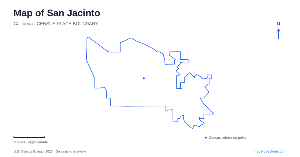
Street tiles load from OpenStreetMap when opened. The blue line shows the 2025 Census boundary.
- State
- California
- Population · July 2025
- 56,014
- Land area
- 25.9 sq mi
- Water area
- 0.2 sq mi
San Jacinto's map brings together an old agricultural town, a college campus on State Street, and historic properties associated with the Estudillo family. The same place-name also appears on a much larger wildlife area near Lakeview, making geographic scale especially important. Downtown history can be explored through a compact group of streets and heritage grounds, while the wetlands require a separate regional outing. Starting with those distinctions helps turn a collection of familiar names into an understandable local landscape.
Heritage grounds and the Estudillo house
The Estudillo Mansion is a two-story brick house built for Francisco Estudillo in 1885. The city's visitor information gives the mansion and garden address as 150 South Dillon Avenue. The property recalls the era when the Estudillo family's ranching interests occupied extensive land across the valley. Its surviving architecture provides a much more concentrated point of reference than the enormous historic land grants from which the surrounding landscape developed.
The mansion suffered serious damage in the 1992 Landers–Big Bear earthquakes. The city later took ownership and completed an interior and exterior restoration in 2009. That recovery is part of the building's history, explaining why its present role as a public heritage place depends on deliberate preservation work as well as its nineteenth-century origins.
Around it, the Water Conservation Education Garden introduces a different kind of interpretation. Plantings are arranged broadly by climatic setting and grouped according to water needs. Native California species appear alongside plants suited to similar conditions elsewhere. The grounds thus connect a historic house with a practical question still relevant to the valley: how water use shapes the planted landscape.
A museum with its own address and wider story
The San Jacinto Museum stands within Francisco Estudillo Heritage Park but lists its address separately at 695 Ash Street. The distinction is useful when planning a museum visit within the larger heritage grounds. The collection grew from displays assembled for visitors to the Ramona Pageant, and a permanent museum was established in 1940 after public support for the idea.
Its exhibits address both natural and human history. Materials from local families, institutions, and businesses sit alongside subjects such as the 1937 Soviet transpolar flight that ended in a nearby dairy field. That aviation episode is a particularly distinctive part of the local story: a valley associated with farming briefly became the endpoint of an international journey.
The museum's history also helps explain the town plan. The land association laid out the modern community at Five Points in 1883, and railroad arrival followed in 1888, the year of incorporation. Those events give San Jacinto a development sequence that can be read through its older streets and civic institutions. The exhibits provide context for that sequence beyond what surviving building names alone reveal.
State Street and the first college campus
The college campus at 1499 North State Street occupies another important part of the city map. MSJC began serving students in 1963 and opened this campus in 1965, making it the district's first. State Street is also labeled Highway 79 on the campus map, so the local street and numbered highway references point to the same approach here.
For someone visiting San Jacinto for study, a campus event, or student services, the building-level map becomes more useful than the district's name. The college operates other campuses in places including Menifee, Temecula, and Banning. The North State Street address specifically identifies this location, where programs include automotive education and child development. It also contains familiar campus services such as the library, bookstore, and counseling resources.
This educational setting adds a later layer to the town's agricultural and railroad history. It is not part of the museum grounds or a downtown heritage complex, even though all three may appear in a short list of local destinations.
Wetlands require a different approach
The San Jacinto Wildlife Area is reached at 17050 Davis Road in Lakeview. The state directs visitors east along Ramona Expressway and then north on Davis Road to the checking station; it explicitly states that Davis Road has no access from the north. That route is a concrete reason to locate the property independently rather than relying on the shared regional name.
The reserve includes restored wetlands and supports waterfowl and wading birds, with reclaimed water used to enhance habitat. It combines wildlife observation with regulated hunting uses, so it is a managed habitat rather than a municipal picnic park. Rain can make the approach road muddy or impassable, and the state warns of limited cellular service.
These places reveal different scales of the same region: preserved ranch-era grounds, a community museum, a mid-twentieth-century college campus, and extensive wetland habitat. Reading the addresses and road relationships together keeps those scales clear and gives each outing a specific geographic purpose.
Map and statistics: U.S. Census Bureau, 2025 Gazetteer, January 2025 generalized place boundaries and Vintage 2025 population estimates. Local references: City of San Jacinto; Mt San Jacinto College; California Department of Fish and Wildlife. Article prepared by Maps & Directions.