Map of San Francisco
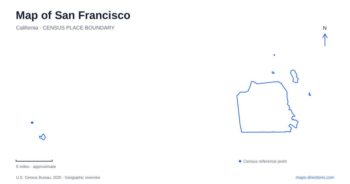
Street tiles load from OpenStreetMap when opened. The blue line shows the 2025 Census boundary.
- State
- California
- Population · July 2025
- 826,079
- Land area
- 46.7 sq mi
- Water area
- 185.2 sq mi
San Francisco combines bay-side destinations, ocean-facing parkland and neighborhoods whose hills change the meaning of a short distance. Its compact outline can disguise those differences. A useful overview should keep the Embarcadero, the Presidio, Golden Gate Park and the Mission visible as separate settings. Each offers a different way to understand the city: a waterfront transport corridor, a former military landscape, a long urban park and a network of culturally distinctive streets.
The Embarcadero is the mainland side of an island visit
Alcatraz is an island destination, but the journey begins at Pier 33 on the Embarcadero near Bay Street. The National Park Service places the departure southeast of Fisherman's Wharf and identifies the authorized ferry connection. That location belongs on the mainland portion of the itinerary, while the island belongs to the water crossing that follows. They are two stages of one visit, not alternative search results for a driving endpoint.
For San Francisco waterfront orientation, this also separates a famous district from a precise departure pier. Fisherman's Wharf is a broader nearby area; Pier 33 is the specific boarding location. The park service notes that there is no parking at the pier itself. Its directions describe the F-line streetcar relationship along Market Street and the Embarcadero, providing a public-transport connection to the waterfront rather than an assumption of terminal parking.
The Presidio has an upper landscape and a shoreline
Presidio Tunnel Tops occupies space on and around the Presidio Parkway tunnels. Its purpose includes connecting the center of the park with Crissy Field at the waterfront. The visitor map identifies the Main Post, lawns, overlooks, the Outpost play area and the Field Station as parts of this transition. A road corridor that once divided spaces is now overlain by public parkland.
Crissy Field Overlook provides another way to understand the terrain. The Presidio describes it as a point above the former airfield on the Promenade trail toward the Golden Gate. Below lie grass, beaches, trails and former aircraft hangars. Those levels help explain why the overlook and the waterfront are different experiences even when their map labels sit close together. One surveys the shoreline; the other occupies it.
Park routes distinguish coast, bluff and interior
The Presidio publishes separate trail, bicycle and transit maps. Its trail map includes the California Coastal Trail, Bay Area Ridge Trail and Batteries to Bluffs Trail, while its broader visitor map identifies Baker Beach, Mountain Lake, the Main Post and Crissy Field. These are distinct landscapes within one park: ocean frontage, an inland lake, historic buildings and bay shoreline.
On a San Francisco map, the Presidio's northwestern position can tempt a visitor to treat it as merely the approach to the bridge. The internal destinations show why that is incomplete. A visit focused on Baker Beach uses a different part of the park from one centered on Tunnel Tops, and a ridge walk differs from the waterfront promenade. The park's own route layers reveal those choices more clearly than the city outline.
Golden Gate Park stretches toward the ocean
The recreation department describes Golden Gate Park as a roughly three-mile-long space reaching from the Haight-Ashbury area toward Ocean Beach. Richmond and Sunset are among the adjoining neighborhoods. The narrow Panhandle continues the green-space pattern eastward between Fell and Oak streets, from Stanyan to Baker. This creates a recognizable east–west feature that contrasts with the smaller neighborhood parks elsewhere in the city.
Inside the park, the Music Concourse forms a cultural focus between the de Young Museum and California Academy of Sciences. The Conservatory of Flowers supplies another architectural landmark. These destinations occupy only part of the overall park, so a museum visit and an ocean-end outing have different geographic centers. The park also includes car-free routes; its detailed access map distinguishes them from roads available to drivers.
Neighborhood streets explain the southern and central districts
The Mission offers a street-based way to read San Francisco. The visitor bureau identifies Mission Street as a principal commercial corridor, Valencia Street for shops and cafes, and 24th Street for a strong concentration of Latino-owned businesses. Murals at the Women's Building and in neighborhood alleys add destinations embedded in the street fabric rather than enclosed within a single attraction campus.
Elsewhere, Pacific Heights rises from the Fillmore and overlooks the Marina, with Alta Plaza Park providing a high viewpoint. That relationship illustrates how elevation contributes to neighborhood identity. Two nearby addresses may belong to different slope positions and offer very different walking experiences, something a plain two-dimensional street grid does not fully communicate.
A San Francisco itinerary gains clarity when it follows these physical distinctions: pier and island, bluff and shoreline, park corridor and neighborhood street. The named places then have understandable relationships to one another, and the map explains the city's form rather than reducing it to a list of famous landmarks.
Map and statistics: U.S. Census Bureau, 2025 Gazetteer, January 2025 generalized place boundaries and Vintage 2025 population estimates. Local references: National Park Service; Presidio Trust; SF Recreation and Parks; San Francisco Travel. Article prepared by Maps & Directions.