Map of San Bruno
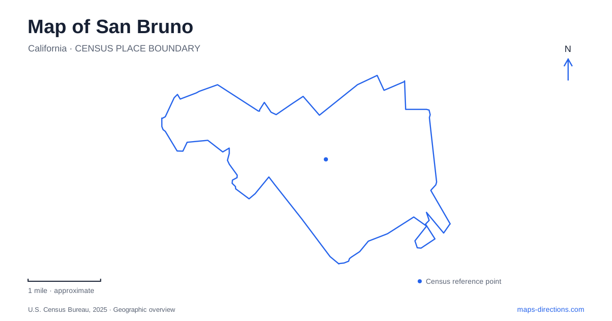
Street tiles load from OpenStreetMap when opened. The blue line shows the 2025 Census boundary.
- State
- California
- Population · July 2025
- 42,305
- Land area
- 5.5 sq mi
- Water area
- 0.0 sq mi
San Bruno developed where long-established Peninsula routes met, and that transportation geography still helps explain the city. El Camino Real, San Mateo Avenue, the railway and the later BART system organize different parts of the built landscape. Farther into the foothills, Crystal Springs Road brings a contrasting sequence of recreation grounds and wooded parkland. A useful map connects these settings while preserving the history attached to each, especially the former Tanforan racetrack site.
A road junction before the modern city
The junction of El Camino Real and San Mateo Avenue was a place to serve travelers long before the surrounding residential city took shape. In the early 1850s, James Thorpe established a shelter for watering and changing horses there. The roadside business later became Uncle Tom's Cabin, a well-known establishment that survived until its demolition in 1949. The junction's importance grew from movement between San Francisco and San Jose rather than from a formally designed civic square.
The railway reached the area in 1863. Housing expanded after the 1906 San Francisco earthquake and fire, and incorporation followed in 1914. These successive changes help explain the layered geography of San Bruno: an older road corridor, a railway corridor and neighborhoods developed during different periods. The modern map retains those lines even though the travelers' facilities and surrounding land uses have changed substantially.
El Camino Real is also State Route 82. The city's transit-corridor study identifies it as the principal north-south surface road and places the 1912 groundbreaking for an early state-highway paving project at its junction with San Mateo Avenue. The same location therefore links the age of horse travel with the development of California's road system.
Two stations with different approaches
The Caltrain station is at 833 San Mateo Avenue. BART's station is at 1151 Huntington Avenue, beside the Tanforan area. These are two separately located stations serving different rail systems. Naming the operator alongside the city is more useful than treating a search for a station as a single destination.
This distinction matters particularly when planning a journey through San Bruno on foot. San Mateo Avenue and Huntington Avenue provide different arrival addresses, and the Tanforan memorial belongs to the BART station setting. Caltrain's stop belongs to the Peninsula railway corridor. Comparing those locations before planning the local portion of a trip gives a clearer picture of which streets and historical places surround the arrival point.
Remembering Tanforan at the station
The former Tanforan racetrack and its surroundings carry a history that cannot be understood from today's transport and commercial uses alone. In 1942, the government converted the track and stalls into a temporary detention center. Nearly 8,000 people of Japanese descent were imprisoned there before transfer to longer-term incarceration camps.
A memorial on the BART station's exterior plaza was dedicated in August 2022. Inside the station, the exhibition “Tanforan Incarceration 1942; Resilience Behind Barbed Wire” presents memories and interpretations of that history. It includes work pairing Dorothea Lange's historical photographs with contemporary portraits by Paul Kitagaki Jr. and interviews with the people depicted. For San Bruno, this places remembrance within an everyday transportation space, keeping the experiences of those incarcerated visible at the site rather than separating them into an unrelated museum elsewhere.
Recreation along Crystal Springs Road
City Park is located at Crystal Springs Road and Oak Avenue. The municipal park department describes it as the city's largest park, with picnic sites, two play areas, sports fields, tennis courts and a walking track. Its recreation facilities make it a community gathering landscape with a broad range of activities concentrated in one area.
Junipero Serra Park, farther along Crystal Springs Road at number 1801, is managed by San Mateo County. The county emphasizes its oak foothill plant community, wildflowers and El Zanjon Creek. Its views extend across the bay landscape toward the airport and Mount Diablo. These features give it a different character from the sports and picnic facilities of City Park, even though the two parks occupy adjoining parts of the same general corridor.
The county park's elevation is part of the experience. It provides a wider perspective on the developed Peninsula and airport surroundings, while the municipal grounds concentrate on recreation closer to neighborhood streets. Road and parking work can affect vehicle access to the county property, so its current access notice is relevant when planning a visit.
A city understood through its connections
A map of San Bruno becomes more informative when the road junction, two rail stations, Tanforan memorial and foothill parks are considered together. Each reflects a different relationship with movement: roadside service, regional commuting, forced wartime removal, and outdoor recreation. Those distinctions turn familiar road names and station symbols into a clearer account of how the city developed and how its places relate today.
Map and statistics: U.S. Census Bureau, 2025 Gazetteer, January 2025 generalized place boundaries and Vintage 2025 population estimates. Local references: City of San Bruno; Caltrain; BART; San Mateo County. Article prepared by Maps & Directions.