Map of San Bernardino
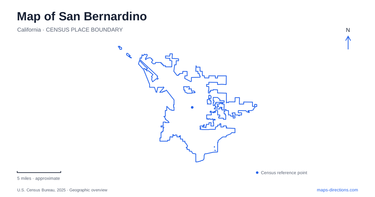
Street tiles load from OpenStreetMap when opened. The blue line shows the 2025 Census boundary.
- State
- California
- Population · July 2025
- 222,044
- Land area
- 62.1 sq mi
- Water area
- 0.3 sq mi
San Bernardino's geography is closely tied to movement between the inland valley and the mountain passes beyond it. The historic Santa Fe Depot records the importance of rail transportation, while modern stations and roads continue to connect the city with the wider region. Local parks occupy a different scale within that network. A useful map keeps the valley-floor city, its transportation landmarks and the routes climbing toward mountain recreation clearly in view.
The depot that helped define the city
The present Santa Fe Depot opened in July 1918, replacing an earlier wooden station destroyed by fire in 1916. Its mission-style architecture includes towers, domes and a tile roof. These features made it a substantial civic landmark as well as a working railway building. The building's form reflects an era when arriving by train was a major part of the public experience of the city.
The depot housed different railway functions in distinct sections, with baggage and communications offices toward one end and a Harvey House dining operation at the other. Restoration begun in 2002 was completed in 2004, preserving the structure while adapting it for continued use. This history helps explain why the surrounding transportation landscape is larger and more complex than a simple passenger platform. Rail employment, services and related businesses shaped the district around it.
Two station locations within the urban grid
The historic depot is at 1170 West Third Street. The downtown station is at 174 South E Street. Both appear in Metrolink's station listings, and their separate street addresses are important when planning a rail journey. A reference to a train station in San Bernardino may mean either location, depending on the service or the context of the directions.
The downtown station also provides connections with bus operators, including Omnitrans sbX and regional transit services. It therefore functions as a transfer point within the contemporary city, while the depot combines passenger transport with a prominent historic building. The distinction is geographic and functional: the older landmark and the downtown interchange each contribute to the rail network, but they occupy different parts of the street grid.
Parks among the city blocks
Seccombe Lake Park lies at Fifth Street and Sierra Way. The municipal directory identifies a 44-acre site with a lake, walking space and recreation facilities. The open water gives this part of the urban grid a distinctive landmark, contrasting with the transportation and commercial properties elsewhere in the central area.
A major renovation began with a groundbreaking in March 2025. Because the project changes park facilities, older amenity lists should not be treated as a current inventory of everything available on a particular visit. The lake's location remains useful for orientation, while access and facility information belong to the park's current notices.
Perris Hill Park offers another established recreational landscape in San Bernardino. Its facilities include Fiscalini Field, the Roosevelt Bowl and a swim center, combining organized sport, performance space and other public recreation. The baseball field dates to 1934 and received its present name in 1993 in honor of John Fiscalini. That history gives the ballpark a specific place in the city's recreational development rather than making it simply another diamond on a sports map.
Cajon Pass and the mountain approaches
Cajon Pass separates the San Gabriel range from the mountains immediately north of the city. The National Park Service identifies it as part of the Old Spanish Trail and a longstanding passage between the Mojave Desert and the Los Angeles Basin. Today Interstate 15 and major rail routes occupy the same broader corridor, continuing its transportation role in a very different technological form.
The pass is a regional feature beyond the urban street network. Mountain recreation routes also extend far beyond the city boundary: Highway 18 climbs through Waterman Canyon, while Highway 330 approaches through City Creek. Forest Service guidance identifies these as access routes to portions of the Rim of the World Scenic Byway. Their curves and elevation changes explain why straight-line distances from San Bernardino do not describe the character of a mountain journey.
A county name can point to another city
The county museum is located in Redlands, at 2024 Orange Tree Lane, just north of Interstate 10. Its regional name can easily suggest a location in the county-seat city, but its published address places it elsewhere. This is a practical distinction when combining a museum visit with downtown rail history or local parks.
The same care applies to the surrounding forest and mountain labels, which describe landscapes extending across a much wider area. A map of San Bernardino works best when those regional names are anchored to specific places: the depot on Third Street, the downtown interchange on E Street, the central lake park, the established recreation grounds and the roads leading out toward the passes.
Map and statistics: U.S. Census Bureau, 2025 Gazetteer, January 2025 generalized place boundaries and Vintage 2025 population estimates. Local references: City of San Bernardino; Metrolink; National Park Service; U.S. Forest Service; San Bernardino County Museum. Article prepared by Maps & Directions.