Map of Sammamish
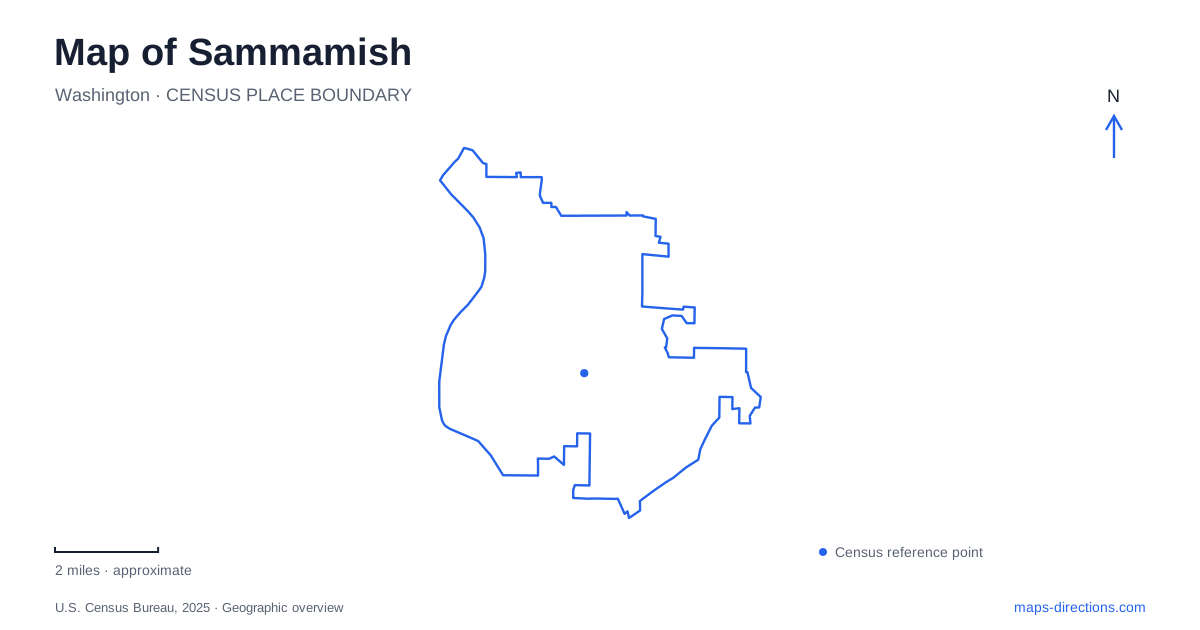
Street tiles load from OpenStreetMap when opened. The blue line shows the 2025 Census boundary.
- State
- Washington
- Population · July 2025
- 66,110
- Land area
- 20.4 sq mi
- Water area
- 3.6 sq mi
Sammamish became an incorporated city in August 1999, but its landscapes preserve a much longer sequence of logging, farming and lakeside recreation. Its green spaces also have different origins. Some were private resorts or working farms; others came through land donations or targeted acquisitions. Understanding those histories helps explain why a map contains both developed recreation parks and quieter preserves, with connections that can cross municipal boundaries.
A regional trail follows the large lake's eastern side
The East Lake Sammamish Trail occupies an 11-mile corridor acquired by King County Parks in 1997. A narrower gravel trail opened in 2006, followed by paved segments completed in stages through 2023. The corridor links the neighboring cities of Redmond and Issaquah along the lake's eastern side, giving it a regional role beyond any single neighborhood.
Its long development history helps interpret older maps and photographs. A gravel surface shown in an earlier image does not describe the entire current route, and one completed segment did not mean that all sections were finished at the same time. The county's chronology documents a gradual transformation into a continuous developed trail. At city scale, this lakeside line provides a strong geographic reference, while routes toward the plateau connect with a different collection of inland parks.
Beaver Lake Park grew from a resort and camp
Beaver Lake Park began as a private resort in the 1930s, known as Four Seasons or Bartel's Resort. A later owner renamed it Andy's Beaver Lake Resort. In 1960, the property was sold to the Catholic Archdiocese of Seattle and used for Camp Cabrini until 1985. King County subsequently acquired it as a park, and ownership passed to the city in 2003.
This sequence explains a particular aspect of Sammamish's recreation landscape: public parkland sometimes developed from places already used for private leisure. The modern park combines sports fields, a playground, picnic facilities and a dog area with its lakeside setting. Its history is therefore different from that of a preserve acquired primarily for habitat and trail connections. The shared lake name should not obscure that distinction.
The preserve is a separate property
Beaver Lake Preserve lies northeast of the park, at 1400 West Beaver Lake Drive Southeast. The road divides the preserve into two portions. Its trail system includes a forest loop and connections toward Soaring Eagle Park and Hazel Wolf Wetlands Preserve, making it part of a wider network of protected land.
The city purchased the preserve in 2002 and added 17 acres from the Kipper family in 2007. That later acquisition enabled the connection with Soaring Eagle Park. This is a useful example of why a relatively small addition can matter on a map: its value lies partly in joining landscapes that would otherwise remain separated. The park and preserve may be grouped together in casual conversation, but their entrances, histories and recreation settings are not interchangeable.
Big Rock's parcels became a connected park system
Big Rock Park Central opened in late spring 2021 after initial improvements to the second parcel in a phased donation. Mary Pigott's agreement ultimately provided 51 acres across the North, Central and South properties. Central contains forest, meadow, a stream and trails connecting with the northern parcel, alongside the historic Reard House, a heritage garden and a treehouse feature.
The parcel names help reveal how the park system developed. “North” and “Central” identify related places with their own access arrangements, rather than directions to two sides of one parking lot. The donation and phased openings also explain why different maps may show different levels of development. The historic house contributes to the site's identity, but its presence on a park map should not be treated as confirmation of an operating house museum.
Evans Creek combines meadow and upland terrain
Evans Creek Preserve sits along Sammamish's northern edge, with much of the established preserve in unincorporated King County. The lower entrance at 4001 224th Avenue Northeast leads toward meadow and wetland terrain with less elevation change. The upper entrance on Sahalee Way reaches forested uplands through a much steeper section. Those approaches offer genuinely different readings of the same landscape.
The trail system's development includes a 0.83-mile pedestrian loop opened in April 2026. Project plans also describe a broader connection toward the Williams Pipeline Trail, a separate alignment from that loop. This is a useful example of why a project map and a walking itinerary serve different purposes. Identify the loop's entrance and consult the city's trail guidance before relying on an additional link shown in a development drawing.
These varied origins give Sammamish a distinctive pattern of open spaces. The lakeshore corridor supplies a regional connection; Beaver Lake's properties preserve different recreation histories; Big Rock reflects a phased gift; and Evans Creek follows terrain across a jurisdictional edge. Their relationships are the substance of the map, showing how public access has been assembled over time rather than appearing as one finished network.
Map and statistics: U.S. Census Bureau, 2025 Gazetteer, January 2025 generalized place boundaries and Vintage 2025 population estimates. Local references: City of Sammamish; King County Parks. Article prepared by Maps & Directions.