Map of Salem
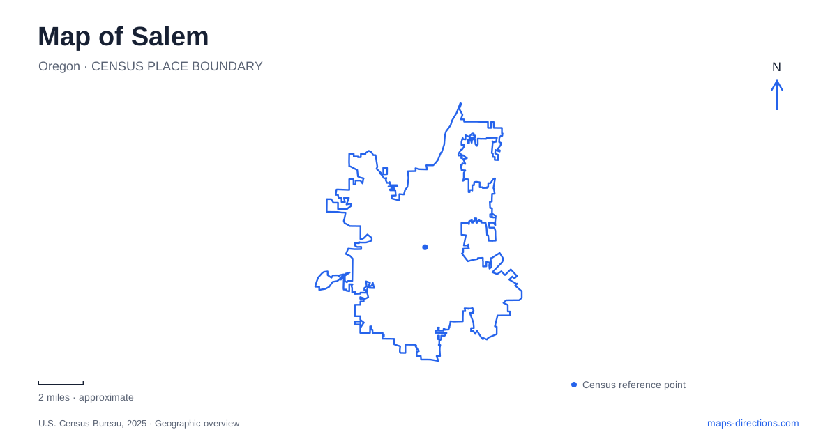
Street tiles load from OpenStreetMap when opened. The blue line shows the 2025 Census boundary.
- State
- Oregon
- Population · July 2025
- 181,779
- Land area
- 49.0 sq mi
- Water area
- 0.6 sq mi
Salem has several overlapping centers: the state government's Capitol grounds, downtown beside the Willamette River, and former industrial and residential properties now preserved as public destinations. The river is especially useful for understanding how these places connect. Footbridges extend the downtown walking network into large parks, while an old woolen mill reveals how a smaller waterway supported manufacturing. Together these landscapes explain a city whose identity includes government, industry, gardens, and river habitats. They also provide a more informative framework for reading a map than a list of attractions without geographical context.
Two crossings with different origins
The Union Street Railroad Bridge began as a transportation link across the Willamette in 1912–13. Its lift section reflected the importance of river shipping at the time, although that mechanism is no longer operational. After rail use ended, the city acquired the structure in 2004 and adapted it for pedestrians and bicycles in 2009.
Today the crossing connects the west-side parks with downtown. Its railway trusses preserve an industrial form while carrying a different kind of movement. This reuse is particularly visible on a map: a former rail alignment now contributes to a route for everyday walking and cycling.
The Peter Courtney Minto Island Bicycle and Pedestrian Bridge serves another connection, extending the downtown riverfront toward Minto-Brown Island Park. Together the two crossings link that park, Riverfront Park, and Wallace Marine Park. For someone exploring Salem without a car, the significance is the connected public landscape they create, rather than either bridge considered alone. Neither should be interpreted as an ordinary through-road crossing for motorists.
From industrial ground to riverfront lawns
Riverfront Park occupies 26 acres beside downtown. Paper, flour, and woolen mills, a coal gasification plant, and an automobile junkyard once occupied the site. Its lawns and event spaces therefore represent a substantial change in land use, converting an industrial waterfront into a civic gathering place.
The Gerry Frank Rotary Amphitheater occupies the park's southeastern end. Completed as part of the first phase of improvements in 2021, it stands on property acquired from Boise Cascade. Its sweeping wooden design draws inspiration from Kalapuya basket weaving. That contemporary structure adds another historical layer to a shoreline already shaped by manufacturing and transport.
Minto-Brown Island Park offers a much larger landscape beyond the bridge. The city describes more than 1,200 acres of open and wooded habitat, with sloughs, observation areas, and trails. Its extensive paths form multiple loops rather than one simple perimeter circuit. On a map of Salem, the contrast between the compact event park and this broad natural area helps explain why two adjacent green spaces can support very different outings.
The Capitol between Court and State
The Oregon State Capitol was dedicated in 1938. Its exterior sculptures and surrounding grounds present the state's public history through monuments and symbols. The building stands between Court Street on the north and State Street on the south, providing a clear reference for locating the government complex within the central street network.
The Capitol is also an operating workplace where legislative hearings and public participation occur. Its location on a visitor map therefore represents more than an architectural stop. A person attending a hearing needs the building's current entry and room information, while someone exploring the grounds is following a different kind of route. Use the legislature’s visitor guidance to identify the entrance for the intended tour or appointment, rather than relying on an older saved access map.
This government setting gives Salem an institutional center distinct from the riverfront. Keeping both in view explains why central destinations extend east from the water instead of concentrating entirely along it.
Water power, wool, and a surviving factory
The Thomas Kay Woolen Mill provides another chapter in the city's development. Established in 1889, the enterprise selected a site with water power previously used by a linseed oil factory. The original main building burned in 1895, and the surviving brick structure was completed the following year. Production continued until 1962.
Preserved within the Willamette Heritage Center, the mill makes manufacturing history tangible through the relationship between buildings, machinery, and water. Its history also records community investment: local supporters helped finance the original venture and its recovery after the fire. This was a major workplace, not simply a picturesque structure beside a stream.
Historic houses within garden landscapes
Bush's Pasture Park and Deepwood Estate Gardens form another important public landscape, covering a combined 96 acres. A city management plan treats their cultural history and natural features together rather than separating the gardens from their setting.
Deepwood's 1894 Queen Anne house is operated as a museum, while its surrounding grounds function as a public park. House tours and garden visits offer different experiences of the same property. Read alongside the mill, Capitol, and river crossings, these preserved landscapes show Salem through working environments, political institutions, domestic architecture, and changing relationships with water.
Map and statistics: U.S. Census Bureau, 2025 Gazetteer, January 2025 generalized place boundaries and Vintage 2025 population estimates. Local references: City of Salem; Oregon Legislature; Willamette Heritage Center; Friends of Deepwood. Article prepared by Maps & Directions.