Map of Saginaw
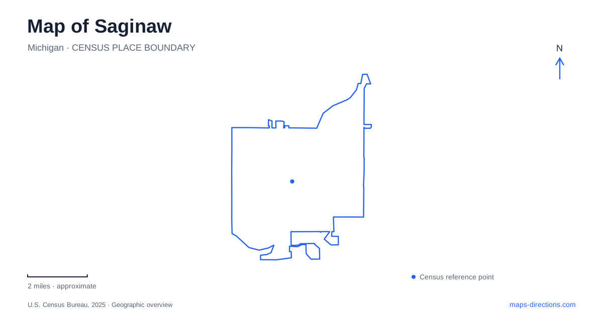
Street tiles load from OpenStreetMap when opened. The blue line shows the 2025 Census boundary.
- State
- Michigan
- Population · July 2025
- 42,863
- Land area
- 17.4 sq mi
- Water area
- 0.8 sq mi
Saginaw has a river running through both its geography and its civic history. The present city joined two previously separate communities in 1890, and their commercial areas still give the map more than one historical center. Court and Hamilton Streets identify the old west-side business district, while the Castle Museum represents a different civic setting across the river. Farther along the waterfront, Ojibway Island and neighboring parks make recreation part of the same landscape that once carried lumber and industrial traffic.
Court and Hamilton as an early anchor
At the intersection of Court and Hamilton Streets, the city places the site of the military fort erected in 1822. The soldiers left the following year, and the abandoned buildings subsequently served traders and farmers. This short military episode helps locate an early settlement nucleus without implying that a surviving fort occupies the corner today. River access mattered from the beginning, long before the familiar brick storefronts appeared.
The district now associated with Old Town contains many multistory Italianate buildings along Court and South Hamilton. Much of this masonry construction followed the lumber boom of the later nineteenth century. Earlier wooden buildings were more vulnerable to the fires common in lumber communities. The mixture of commercial uses and substantial brick architecture is therefore a visible record of both prosperity and rebuilding. It also explains why this part of Saginaw has a coherent streetscape even though individual businesses have changed repeatedly.
Two banks, one industrial economy
The river once separated distinct municipalities. East Saginaw expanded rapidly during the timber era, while the west-side settlement developed around its older commercial streets. The first bridge across the river, the Genesee toll bridge, opened in 1864 according to the city's historical account. That crossing changed the relationship between places previously dependent on less convenient ways to get from one bank to the other.
Lumber shaped much more than the waterfront's appearance. The Castle Museum describes a valley with eighty sawmills by 1870, supported by systems for moving logs over land and water. Salt production also used waste from sawmills to process brine, tying another industry to the timber economy. A river map is consequently a guide to former production and transport relationships as well as modern roads. The city's growth cannot be explained only by looking for the surviving mill buildings.
A castle that began as a post office
The Castle Museum is a useful example of how a prominent building can mislead at first glance. Its French Renaissance Revival design belongs to a post office dedicated in 1898, not a fortified residence. Architect William Martin Aiken associated the design with the valley's early French settlement. The turrets and ornament were an architectural choice for a federal public building.
A major 1937 expansion preserved the Federal Avenue facade but changed other parts of the structure, including wings on South Jefferson and South Warren. The interior was also reorganized for postal work. Later preservation campaigns prevented demolition and helped turn the building into a history museum. Its street frontages therefore reveal a sequence of additions and reuse rather than an untouched nineteenth-century object. This is an especially informative stop for understanding how Saginaw retained a civic landmark while changing its purpose.
A house and garden designed together
At 1126 North Michigan Avenue, the art museum occupies the former Ring family home. The family's wealth came from the lumber business, making the property another expression of the economy visible in Old Town's storefronts. Charles Adams Platt designed the house and gardens as a coordinated composition, carrying a sense of symmetry from the building into the formal landscape.
That relationship makes the grounds part of the museum experience. The garden was not simply added to fill spare land around an existing gallery. Platt also designed a contrasting bosco, or wild garden, whose apparently informal character was carefully planned. The family home opened as a museum in 1948. Comparing this residential setting with the former post office shows two different paths by which private and public buildings became cultural destinations.
The river as public open space
Ojibway Island lies beside Ezra Rust Drive, near Hoyt Park, the Children's Zoo, the Japanese Tea Gardens, and the Andersen Enrichment Center. The grouping gives the southern waterfront a concentration of park and cultural uses. The island itself supplies riverside paths, shaded areas, and fishing opportunities, with bridge and walking access connecting it to the surrounding area.
The Japanese cultural landscape reflects the sister-city relationship with Tokushima, established in 1961. Its presence adds an international chapter to a waterfront often described only through lumber history. A map of Saginaw becomes more useful when these layers are read together: early river settlement at Court and Hamilton, civic architecture around the Castle, residential patronage on North Michigan Avenue, and public recreation around the island. Each contributes a different reason to cross the river or follow its banks.
Map and statistics: U.S. Census Bureau, 2025 Gazetteer, January 2025 generalized place boundaries and Vintage 2025 population estimates. Local references: Saginaw Art Museum; City of Saginaw; Castle Museum. Article prepared by Maps & Directions.