Map of Sacramento
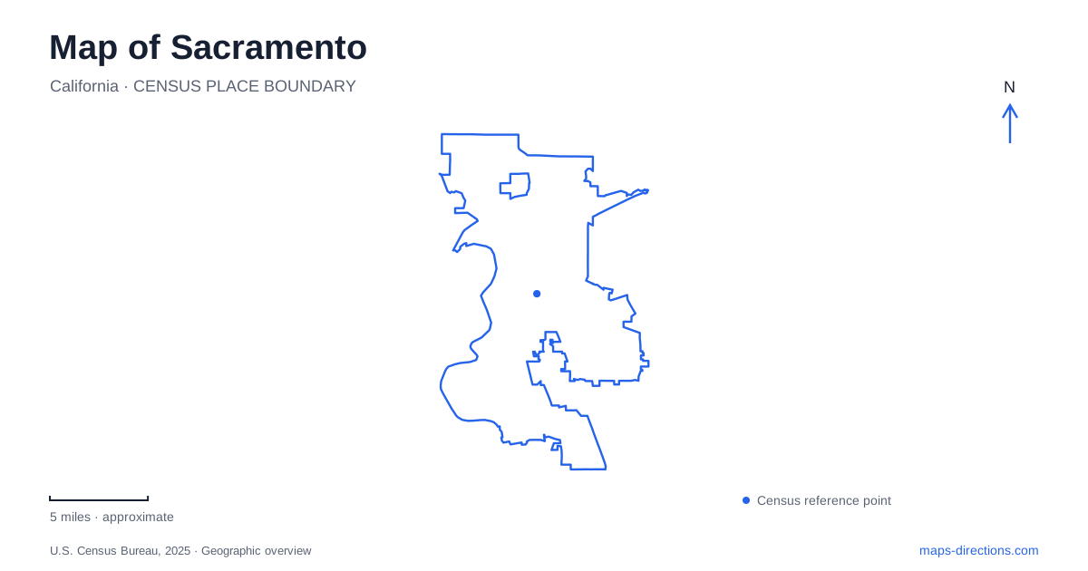
Street tiles load from OpenStreetMap when opened. The blue line shows the 2025 Census boundary.
- State
- California
- Population · July 2025
- 536,449
- Land area
- 98.7 sq mi
- Water area
- 2.1 sq mi
Sacramento's central map combines a historic riverfront, the state government's civic landscape, and a recognizable system of numbered and lettered streets. The American River adds a second water corridor north of the center, meeting the larger river at Discovery Park. Those features provide a useful way to organize a visit: waterfront history, Capitol grounds, inland historic sites, and river recreation belong to connected but distinct parts of the city.
Old Sacramento preserves a commercial waterfront
The state historic park contains an important group of early Gold Rush commercial structures. Among its landmarks are the Eagle Theatre, B. F. Hastings Building, and Big Four Building, associated with the mid-nineteenth-century growth of the riverfront business district. The district's historical significance also includes long-distance communications and transportation, from the Pony Express to the transcontinental railroad and telegraph.
The California State Railroad Museum complex sits within this historic park setting. That relationship matters on a map because the museum and the surrounding district are separate scales of destination. A museum visit may be one stop within a wider walk through the old commercial streets and riverfront, rather than the entire experience of the historic area.
Interstate 5 lies between the waterfront district and much of the central city. The state park's directions identify the J Street exit and the parking structure at Third and J streets as useful approach references. The riverfront is close to downtown, but the freeway and its crossings influence how the two areas connect.
The river and the Capitol create different axes
The Sacramento River defines the western waterfront, with the city of West Sacramento on the opposite bank. Tower Bridge supplies a prominent cross-river connection, while Capitol Mall connects the riverward side of downtown toward the civic center. These relationships make the bridge and the Capitol useful orientation points even for trips that do not include either as a stop.
The numbered and lettered street references become particularly clear around the Capitol. The building's address is 1315 Tenth Street, between L and N streets. This gives a visitor both a north–south street reference and two cross streets. Farther east, the park landscape occupies a substantial area within the surrounding blocks, so the building and its grounds should be read as related but different destinations.
Capitol Park grew beyond its original blocks
The original park occupied four blocks bounded by Tenth, Twelfth, L, and N streets. It later expanded eastward. The State Capitol Commission describes a contrast between the formal geometry near the building and the more naturalistic arrangement in later sections. That change in design can be read through the paths as well as the planting.
The grounds contain trees and plants from many regions, together with memorials and monuments. A California native-plant section developed in the eastern portion after the former Agricultural Pavilion was removed. The museum's tree booklet maps that area near Fifteenth and N streets, including a cactus garden and individual specimens.
This makes a park map different from a simple road map of the civic district. The street grid locates the grounds, while the internal paths organize a landscape of botanical collections and commemorative places. Someone interested in the gardens can plan a meaningful walk without treating the Capitol building as the only feature within the larger green space.
Inland historic sites use another part of the grid
Sutter's Fort State Historic Park is at 2701 L Street. The State Indian Museum stands nearby at Twenty-sixth and K streets. Their proximity makes them a separate historic cluster farther inland from the riverfront and Capitol grounds.
The museum interprets California's diverse Indigenous cultures, including both historical objects and contemporary tribal art. Reading its location alongside the fort helps prevent a one-sided understanding of the area as only a settlement-era site. The two institutions share a neighborhood context while presenting different subjects.
The addresses also show how the central street system can support orientation. Moving from Tenth Street toward the upper twenties is a substantial shift within the grid, even when the same lettered street remains part of the route. A citywide map supplies that relationship; the block view distinguishes the adjacent institutions.
Discovery Park explains the river junction
Discovery Park lies at the meeting of the American River and the river bordering downtown. Its location beside I-5 connects it to the city, while its open landscape belongs to the American River Parkway. The county identifies separate northern and southern approaches, using Garden Highway and Richards Boulevard respectively.
The park also serves a flood-control purpose. It is designed to accept high water and reduce pressure on the American River levees, so its open space cannot be understood only as recreation land. The Jedediah Smith Memorial Trail connects this confluence area to the much longer parkway corridor upstream.
A map of Sacramento becomes more useful when that river function sits alongside the historic and civic geography. The waterfront explains early commerce, the Capitol grounds show planned public space, the inland museum cluster provides another historical perspective, and Discovery Park reveals the continuing influence of the rivers on the city's form.
Map and statistics: U.S. Census Bureau, 2025 Gazetteer, January 2025 generalized place boundaries and Vintage 2025 population estimates. Local references: California State Parks; California State Railroad Museum; California State Capitol Museum; Historic State Capitol Commission; Sacramento County Regional Parks. Article prepared by Maps & Directions.