Map of Royal Oak
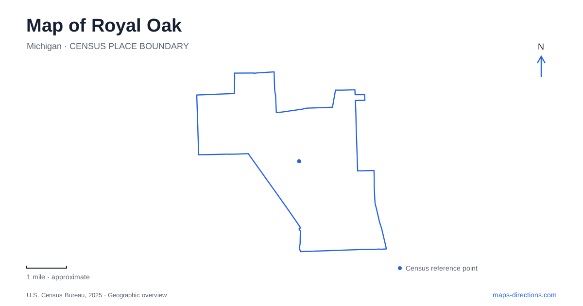
Street tiles load from OpenStreetMap when opened. The blue line shows the 2025 Census boundary.
- State
- Michigan
- Population · July 2025
- 57,583
- Land area
- 11.8 sq mi
- Water area
- 0.0 sq mi
Royal Oak has a compact commercial center and several distinct recreational landscapes outside it. Main Street and Washington Avenue identify the downtown shopping and dining area. South Troy Street brings the civic buildings and Centennial Commons into that setting, while East 11 Mile Road supplies the farmers market address. Farther afield, wooded preserves and larger neighborhood parks create a different kind of outing. The Detroit Zoo, near Woodward Avenue and 10 Mile Road, is another major destination with its own approach and internal layout.
Downtown streets and the civic gathering space
The relationship between Main Street and Washington Avenue is a useful starting point in Royal Oak. City planning describes these streets as a retail loop, with the Center Street area forming part of the southern downtown. Rather than expecting one enormous shopping complex, a visitor encounters individual businesses distributed through adjoining blocks. A restaurant and a performance venue can belong to the same downtown outing without sharing a parking entrance.
Centennial Commons adds public open space at 203 South Troy Street, beside City Hall and the library. It includes seating, picnic options, a stage, a water feature and a veterans memorial. Its placement gives the civic buildings a shared outdoor setting within walking distance of downtown businesses. The name was selected in 2021 to mark the city's hundredth anniversary.
The farmers market lies at 316 East 11 Mile Road. This is a useful northern reference for the downtown visit, particularly when combining a market stop with other errands. The city's market program includes produce and other food vendors as well as separate antiques and collectibles activity. The kind of market taking place depends on the day, so the building's address is stable while the reason to visit can change.
The zoo at Woodward and 10 Mile
The Detroit Zoo's name can obscure its local address: it is at 8450 West 10 Mile Road in Royal Oak. Woodward Avenue and 10 Mile form the essential approach references. The zoo's entry map distinguishes its main entrance, parking areas, parking structure and an events gate used for educational programs.
That arrangement matters particularly for school or group visits. The education instructions direct groups through the 10 Mile Road entrance to a designated loading and unloading point. An ordinary admission visit and an arranged program can therefore involve different procedures inside the same site. The institution supplies those details because its campus is large enough that the street address alone cannot explain every arrival.
For a broader local itinerary, the zoo is best treated as a substantial destination of its own. Downtown meals or shopping may complement the day, but the downtown street grid and the zoo grounds offer very different walking environments. Woodward and 10 Mile provide the transition between a regional attraction and the rest of the city's neighborhood geography.
Woods preserved within the suburbs
Tenhave Woods and Cummingston Park protect heavily wooded natural areas within Royal Oak. The Nature Society helps steward both preserves, where conservation of plant and animal life takes priority over conventional park development. Dogs are not permitted inside these preserves, a meaningful distinction from an ordinary neighborhood walk.
The city describes Tenhave as a combination of beech-maple, oak and swamp forest, while Cummingston is principally mature oak woodland. Those differences give each place its own character despite both appearing as green patches on a regional map. A visit focused on trees or seasonal habitat can therefore be more specific than simply choosing the nearest park.
The Fred A. Erb Arboretum sits behind the senior center at 3500 Marais. Its developing collection of native trees and plants complements the nearby woodland setting. The city has also described a nature walk beginning by the arboretum and continuing into Tenhave, connecting planted collections with a less formal forest environment.
Recreation around 13 Mile and Crooks
Starr Jaycee Park offers a more active outdoor setting in Royal Oak at 13 Mile Road and Crooks Road. Its mature tree canopy surrounds playing fields, a playground, three pavilions and an eighteen-hole disc golf course. The park was dedicated in 1955 and takes its name from the Starr family; the city identifies Orson Starr as an early local manufacturer.
Miniature train rides operated by the Great Lakes Steamers add another distinctive use, with rides offered on selected seasonal weekends. The pavilions also differ in their relationship to the playground and restrooms, which is useful when arranging a group picnic. This combination of sports, shaded gathering places and occasional train activity contrasts with the conservation focus of Tenhave and Cummingston, giving the city's green spaces clearly different roles.
Map and statistics: U.S. Census Bureau, 2025 Gazetteer, January 2025 generalized place boundaries and Vintage 2025 population estimates. Local references: City of Royal Oak; Detroit Zoological Society. Article prepared by Maps & Directions.