Map of Roy
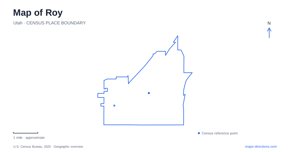
Street tiles load from OpenStreetMap when opened. The blue line shows the 2025 Census boundary.
- State
- Utah
- Population · July 2025
- 38,794
- Land area
- 8.1 sq mi
- Water area
- 0.0 sq mi
Roy brings together three different kinds of movement: a numbered street network, an active commuter railway and a former rail corridor used for recreation. The nearby military installation introduces a fourth geography, where a public museum entrance differs from access to the base itself. Understanding those systems is more useful than assuming that every long north–south line on the map serves the same purpose. The city's general plan traces the settler community to Sand Ridge in 1873, when water was scarce enough that families had to haul it. That account helps explain why later urban growth should not erase the importance of water supply and agricultural land. Today's residential blocks occupy a landscape with a history that began well before commuter trains and freeway interchanges.
Numbered streets and distinct destinations
Addresses such as 4000 South, 5600 South and 1900 West give the map a numerical framework. The city plan uses those roads alongside named routes including Midland Drive and Hinckley Drive. The numbers are especially useful when distinguishing destinations that share a general city label but sit in different parts of the community.
The Southwest Branch of the Weber County Library is at 2039 West 4000 South. FrontRunner's local station is at 4155 South Sandridge Drive. These addresses describe different approaches within the northern part of the city; a library visit and a train departure should not be reduced to one generic civic-center destination.
For Roy visitors, keeping the full street name with the number is particularly helpful. Sandridge Drive is a named access road, whereas South and West form part of the numbered address system. Omitting those elements can remove the very information that distinguishes one destination from another.
Active railway and recreational rail corridor
UTA lists the FrontRunner station on Sandridge Drive as part of its regional commuter-rail service. Its purpose is to connect travelers with other Wasatch Front stations. The parking area is intended for people using transit, so it should not be treated as an unrestricted lot for unrelated activities simply because it appears open on an aerial map.
The Denver and Rio Grande trail is a different feature. The city's parks and trail planning map labels it as a recreational corridor, alongside local parks and other proposed connections. The railway name recalls a former transport use; it does not mean the trail is a walking route along the active passenger tracks.
This distinction is central to reading Roy. The station belongs to an operating transport system, while the trail belongs to the recreation network. A route planner needs to identify the appropriate crossing or trail entrance rather than connecting two visually similar linear features by assumption.
Meadow Creek Pond and the western landscape
The state wildlife agency lists Meadow Creek Pond at 5070 South 4200 West as a community fishing location. City planning material uses the fuller name Roger Phil Burnett Meadow Creek Pond and identifies it as a trailhead for the Howard Slough Parkway.
The longer commemorative name and the shorter pond label refer to the same local destination. Recognizing that avoids the impression that two separate waters exist merely because different maps shorten the wording differently. The site combines a fishing pond, walking space and neighborhood recreation rather than functioning as a large reservoir or boating lake.
The Howard Slough connection also adds a water-related path to a city often understood through its road grid. On a detailed map, that corridor can explain green-space shapes that do not follow the surrounding street blocks. The pond is a useful starting reference, while the actual parkway route needs to be followed on its own terms.
Public museum access beside the base
Hill Aerospace Museum provides an important regional destination beside Roy, but its access should be described precisely. The museum gives its address as 7961 Cottonwood Street, Building 1955, and explicitly states that visitors do not need base access. Its entrance is outside the controlled base perimeter near the northern gate.
That distinction prevents a military-base label from sending a museum visitor to a security checkpoint unnecessarily. It also prevents the opposite misunderstanding: public access to the museum does not imply public access throughout the installation.
The collection occupies several galleries and an outdoor aircraft area. The museum's site map separates the Hadley, Lindquist-Stewart and L.S. Skaggs galleries and marks parking, memorials and education spaces. It is a larger arrangement than a single hangar icon suggests, with indoor and outdoor portions serving different displays.
Existing paths versus a future network
The general plan's recreation map distinguishes existing trails and crossings from proposed ones. That legend matters as much as the linework. A future connection can express a municipal goal without providing a usable path today.
A practical map of Roy therefore pairs the numbered streets with the purpose of each corridor and destination. FrontRunner, the recreational rail trail, Meadow Creek Pond and the museum entrance each require a different reading. Together they reveal the city's local structure while preserving the boundaries between transport, recreation and restricted military land.
Map and statistics: U.S. Census Bureau, 2025 Gazetteer, January 2025 generalized place boundaries and Vintage 2025 population estimates. Local references: Roy City; Weber County Library; Utah Transit Authority; Utah Division of Wildlife Resources; Hill Aerospace Museum. Article prepared by Maps & Directions.