Map of Rowlett
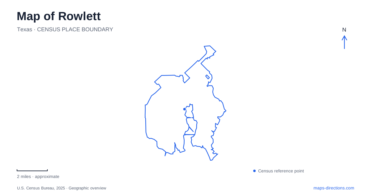
Street tiles load from OpenStreetMap when opened. The blue line shows the 2025 Census boundary.
- State
- Texas
- Population · July 2025
- 67,890
- Land area
- 20.7 sq mi
- Water area
- 0.1 sq mi
Rowlett's relationship with Lake Ray Hubbard is fundamental to its map. The city occupies two peninsulas, and the reservoir creates a long, irregular edge rather than one straight waterfront. Yet the lake does not explain everything. A farming and railroad settlement existed before the modern shoreline, while today's downtown rail station connects that older center with the wider Dallas transit network. Understanding those layers helps distinguish the historic street pattern from the later landscapes of recreation and regional travel.
The lake arrived after the farming community
The municipal history records a post office established in 1880 under the name Morris and a railroad arrival in 1889. Cotton was a major local industry. Incorporation followed in 1952, before the reservoir transformed the area into a lakefront community. These dates explain why the town's story cannot begin with marinas, waterfront homes, or water sports.
The present lake is owned by Dallas and serves as a drinking-water source as well as a recreational setting. That combination makes the shoreline both a local amenity and part of regional infrastructure. On a map of Rowlett, water therefore has two meanings: it shapes the land available for streets and neighborhoods, and it links the community to a much larger water system. The old town center and the reservoir belong to different periods of development even though they now form one urban landscape.
Rail access sits north of Main Street
Downtown Rowlett Station is at 5000 Martin Drive, near Industrial Street and south of Lakeview Parkway, also signed as State Highway 66. DART places it just north of Main Street and serves it with the Blue Line. Those relationships provide a compact set of orientation points: Main Street for the downtown core, Martin Drive for the station, and Lakeview Parkway for the larger road corridor.
The station's design reinforces the lakeside setting. Artist Viola Delgado incorporated cattail forms, blue paving, and undulating panels with images of local people and landscapes. The artwork gives an arriving passenger a visual introduction to the community rather than functioning only as decoration. Rail travel and lake identity meet in the same public space, even though the platform itself is not a waterfront destination. The station is a useful place to understand how the modern regional transport network reaches the older commercial center.
Pecan Grove contains a moved historical house
The city's park inventory lists Pecan Grove Park at 5300 Main Street, with the community center, Wet Zone waterpark, Kids Kingdom playground, trails, and the Coyle House among its facilities. This is a varied recreation campus, not solely a grove of trees or a historic-house property. Each facility contributes a different use within the park setting.
The Coyle House dates to 1918, but its current location is not its original one. Council minutes from January 2009 record its move, together with other historic buildings, from Kirby and Main to Pecan Grove as turnpike work advanced. That relocation is an important part of Rowlett's modern history: transportation construction changed the house's surroundings while preservation retained the building. The current municipal rental page says the house is unavailable for rentals, so its historic presence should not be interpreted as a promise of event booking or unrestricted interior access.
Miller Road separates launch access from a park visit
Paddle Point Park is listed by the city at 6301 Miller Road. Its principal features are a nonmotorized boat launch and floating dock. Lakeside Park, at 3101 C.A. Roan Drive, instead offers a broader set of land-based amenities, including a fishing pier, picnic areas, playground, and trails. The city directs overflow parking from the launch to Lakeside after equipment is unloaded.
This practical relationship explains why the two park names often appear together. They support complementary outings, but they are not identical facilities. A picnic or playground visit calls for Lakeside's grounds; a paddling outing begins with the launch arrangements on Miller Road. The distinction is especially useful around a reservoir whose visible shoreline is much longer than its designated public access points.
A paddling trail is a route across water
The state-designated Paddle Point Creek Paddling Trail is approximately 6.4 miles long, with shorter outings possible. It combines open water and tree-lined shoreline on Lake Ray Hubbard. The state parks agency warns that strong winds can make canoe or kayak navigation difficult, despite the sheltered appearance of some shoreline sections.
The agency also identifies an unimproved emergency take-out near the community center. That designation matters: it is not presented as an ordinary alternative launch. For Rowlett, the paddling route adds a way of seeing the peninsulas from the water, but its distances and access rules differ from those of a walking trail. Keeping the launch, shoreline parks, downtown station, and historic house in their proper settings makes the city's lake-centered map substantially clearer.
Map and statistics: U.S. Census Bureau, 2025 Gazetteer, January 2025 generalized place boundaries and Vintage 2025 population estimates. Local references: City of Rowlett; DART; Texas Parks and Wildlife Department. Article prepared by Maps & Directions.