Map of Round Rock
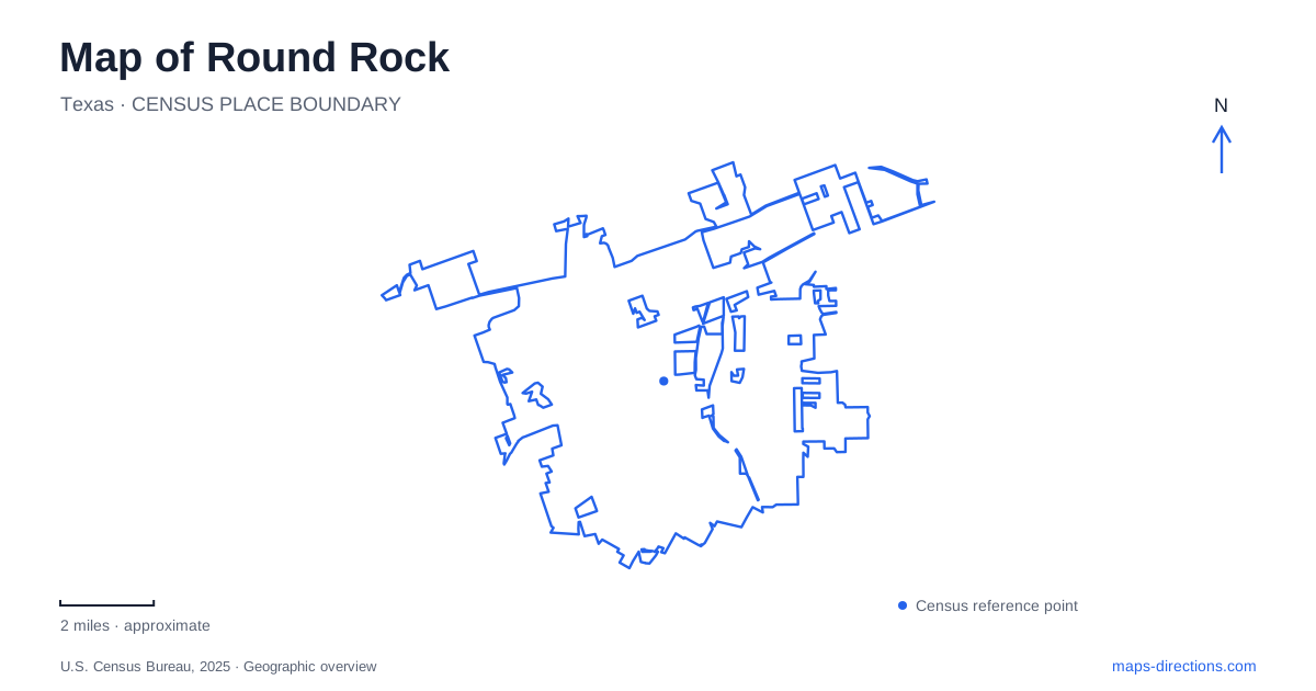
Street tiles load from OpenStreetMap when opened. The blue line shows the 2025 Census boundary.
- State
- Texas
- Population · July 2025
- 141,282
- Land area
- 38.6 sq mi
- Water area
- 0.4 sq mi
Round Rock has two historical centers, and the space between them tells much of the city's early story. The original settlement formed around a low-water crossing of Brushy Creek. A later railroad station drew commerce eastward, creating the district now recognized as downtown. The creek remained part of the landscape through both stages, and modern trails have added another way to experience it. Farther east, a large park and ballpark represent a newer concentration of recreation. These places give the city's map a structure grounded in specific changes over time.
The creek crossing and Old Town
Old Town lies west of Interstate 35 along Chisholm Trail Road. A distinctive, table-shaped stone marked the low-water crossing and supplied the town's name. The crossing linked the settlement to routes used by travelers and cattle drives, giving the creek an economic role as well as a physical presence.
The city's historical collection identifies surviving properties along the trail, including the Harris/Ross House, the former Harris Store and St. Charles Hotel. Their functions reflect the needs of a small settlement serving residents and people passing through: homes, trade and lodging existed close together. Local limestone from the creek area became an important building material as construction developed beyond early temporary shelters.
This is the earliest commercial geography of Round Rock. It occupies a different position from the later Main Street district, and its buildings are best understood in relation to the crossing and trail rather than the railway that subsequently changed the town's center of gravity.
The railroad created New Town
When the International and Great Northern Railroad arrived in 1876, businesses and residents shifted toward the station site to the east. The new commercial area became known as New Town. Today, that is the downtown district, while the older settlement retains the Old Town name.
The movement was substantial enough to change the city's focus without erasing the original neighborhood. The city's history describes later reinvestment in Old Town and a downtown beautification effort during the 1970s that encouraged businesses to restore or reinterpret late-nineteenth-century facades. A historic-looking frontage can therefore reflect several periods of alteration and preservation.
The municipal architectural record also identifies pressed-tin fronts as part of downtown's early-twentieth-century development. Those details connect individual buildings with wider construction fashions. The result is a townscape whose history is visible in materials and street positions, not simply in a date attached to the district as a whole.
Heritage trails follow the water's enduring role
Brushy Creek now supports a recreation connection as well as a historical narrative. The city reported that Heritage Trail West's spiral ramp had opened and that the route improved the link from Chisholm Trail Road toward Mays Street. This is a modern connection across the same general landscape that separates the two historical centers.
Creek-trail planning also distinguishes the established western connection from Heritage Trail East. For Round Rock, those names explain different parts of the path network rather than a single uniform corridor. A long-term trail diagram can combine constructed paths with proposed extensions, so it should not be read as a complete walking itinerary. Use the city's trail information to identify an available entrance, the intended segment and a practical return route.
Play for All has an intentionally varied layout
Play for All Park is also identified by the city as Rabb Park, at 151 North A.W. Grimes Boulevard. Its play areas include a sensory pod, swings, a nature retreat and a sandbox setting. These are deliberately different environments within the same recreation space, allowing an outing to move between different forms of play.
The park's pavilion descriptions make that arrangement concrete. The northern pavilion is near the entrance and sensory area, while the southern pavilion is associated with the swings and nature retreat. The feature names help interpret the park as a collection of connected activity spaces rather than one undivided playground.
The eastern sports landscape
Old Settlers Park and Dell Diamond form another recognizable cluster in Round Rock. The park includes Bright Lake, sports facilities, picnic pavilions and paved paths. The city's trail description connects the ballpark side with the soccer complex, pavilion areas and lake, showing how a large recreation property is organized around several destinations.
Dell Diamond stands at 3400 East Palm Valley Boulevard. The ball club's directions identify that road with Highway 79, linking the venue to the larger east–west corridor. Inside the stadium complex, the ticket office and team store occupy the first-base side, while the surrounding park has a separate range of outdoor activities.
The contrast between this eastern recreation cluster and the creek crossing is part of what makes a map of Round Rock informative. The city grew through successive transportation and community landscapes, each leaving a different pattern of streets, buildings and public spaces.
Map and statistics: U.S. Census Bureau, 2025 Gazetteer, January 2025 generalized place boundaries and Vintage 2025 population estimates. Local references: City of Round Rock; Round Rock Express. Article prepared by Maps & Directions.