Map of Roseville
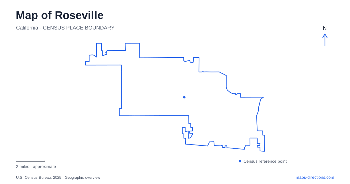
Street tiles load from OpenStreetMap when opened. The blue line shows the 2025 Census boundary.
- State
- California
- Population · July 2025
- 167,302
- Land area
- 44.1 sq mi
- Water area
- 0.0 sq mi
Roseville makes more sense when its railroad junction and creek valleys are read together. The tracks explain the paired commercial districts around the historic center, while waterways lead toward parks and older settlement sites farther east. These are overlapping landscapes: freight infrastructure, Indigenous heritage, neighborhood recreation, and civic redevelopment occupy the same city without following a single street grid. A useful map therefore shows both the large transportation corridors and the smaller ravines that shaped where people lived long before modern subdivisions appeared.
The junction that divided and connected downtown
In 1864, the Central Pacific line advancing from Sacramento crossed a railroad linking Lincoln and Folsom. The crossing was called Junction, an unusually literal description of the settlement's beginnings. Railroad expansion subsequently transformed a small agricultural shipping point into a much larger working town. Incorporation followed in 1909. On the map, the concentration of tracks remains a strong clue to why business streets developed where they did.
Historic Old Town grew around Lincoln, Main, and Church streets, while Vernon Street became another commercial focus. The relationship between these districts is more informative than treating downtown as one square block. Streets facing the railway served a transportation economy, and later civic investment added different reasons to visit the surrounding blocks. The railroad viewing platform near Lincoln and Pacific streets makes the scale of that infrastructure visible from a public vantage point.
The Washington Boulevard pedestrian underpass provides a connection between Old Town and Vernon Street. Opened in 1950 and associated with the name Seawell, it belongs to the history of replacing a problematic railroad crossing. Roseville consequently has a downtown whose pedestrian connections deserve as much attention as its commercial addresses: moving between the two historic districts involves negotiating a railway landscape, not simply continuing along an uninterrupted shopping street.
Vernon Street and the creekside civic landscape
The municipal downtown planning area brings together the Vernon Street commercial corridor, Historic Old Town, and the Douglas Boulevard and Oak Street corridor. Its approximately 158 acres include theaters, the civic center, the train station, Royer Park, and Dry Creek. This mix helps explain why a downtown visit can combine buildings and open space without leaving the historic core.
Royer Park and the creek belong in the same mental picture as the storefronts. The city's 2018 trail connection extended the existing Miners Ravine route from Sierra College Boulevard into Royer Park. That gave the park a role beyond being a green patch beside downtown: it became part of a longer corridor linking neighborhoods with the center. A route planned around the creek can therefore reveal connections that are less obvious on a driving map dominated by arterial roads.
A much older landscape along Strap Ravine
East of downtown, the Maidu Historic Site preserves evidence of a Nisenan settlement beside Strap Ravine. The city acquired the thirty-acre parcel in 1973, incorporating it into Maidu Regional Park. Bedrock mortars and petroglyphs are central to the site, making the ground itself part of the historical record rather than merely the setting for an indoor collection.
The preservation story also involves local people. Myron Zents worked with Nisenan elder Hickey Murray, parks staff, and the Native community to protect the place. An interpretive center opened in 2001, followed by a larger museum in 2010 with exhibits developed jointly with the local Native community. For Roseville visitors, this adds a different timescale to a city often introduced through its railway history. The ravine landscape should be understood as a cultural place with continuing community connections, not as an incidental nature stop between commercial destinations.
Following the water without confusing the projects
Dry Creek is part of a watershed that includes Secret Ravine, Miners Ravine, False Ravine, Antelope Creek, Cirby Creek, and Linda Creek. Municipal open-space documentation identifies the main creek as a migration corridor for Chinook salmon and steelhead, with several tributaries offering potential habitat. The branching pattern on a map thus represents ecological connections as well as recreational opportunities.
Roseville expanded its paved trail network in 2026 with the completed first phase of Dry Creek Greenway East, between Darling Way and Rocky Ridge Drive. The opening included a new trailhead at 645 Riverside Avenue. This nearly two-mile segment adds a substantial route along the southern creek system, while the next phase toward Old Auburn Road remains a separate project in design. Distinguishing completed paths from planned alignments is particularly useful here because project maps show a larger eventual network.
Taken together, the rail junction, paired downtown districts, Strap Ravine, and connected creek parks give Roseville a recognizable structure. The historical center is one starting point; the waterways provide another, revealing how cultural sites and everyday neighborhood paths fit into the wider city.
Map and statistics: U.S. Census Bureau, 2025 Gazetteer, January 2025 generalized place boundaries and Vintage 2025 population estimates. Local references: City of Roseville. Article prepared by Maps & Directions.