Map of Rosemead
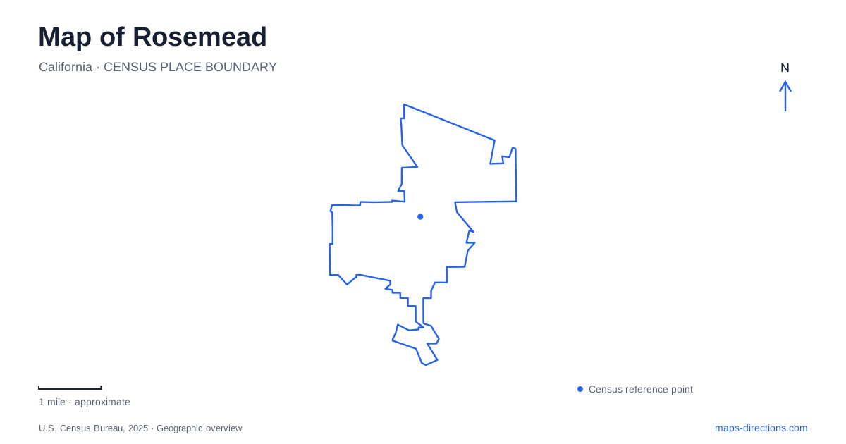
Street tiles load from OpenStreetMap when opened. The blue line shows the 2025 Census boundary.
- State
- California
- Population · July 2025
- 49,410
- Land area
- 5.2 sq mi
- Water area
- 0.0 sq mi
Rosemead occupies a compact part of the San Gabriel Valley, but its landmarks do not gather around a single traditional downtown square. Valley Boulevard provides a civic and historical corridor, Garvey Avenue serves another group of community facilities, and smaller streets lead into neighborhood recreation areas. Interstate 10 crosses the city east to west, while State Route 60 runs through its southern portion. These freeways explain regional access, but the surface streets carry the more useful detail for a local visit.
Valley Boulevard as a civic reference
The county library at 8800 Valley Boulevard stands next to City Hall. The library moved to this location in May 1967, after earlier homes that included a room in Savannah School and a renovated school building. Its origins go back to the Savannah Branch established in 1916. Following those successive addresses would reveal the movement of a public service from a school setting into a dedicated civic building.
The present location is also home to the Asian Pacific Resource Center. This special collection covers Asian American and Pacific Islander American experiences through books, films, music, newspapers and other materials. Its historical newspaper holdings include records connected with Japanese American incarceration during World War II. For someone interested in Rosemead beyond its road network, the library is therefore both an everyday service and a regional cultural research destination.
A map can place the library accurately without conveying that second role. Treating it as a cultural stop, rather than only a convenient civic landmark, adds another dimension to the Valley Boulevard corridor. The resource center is within the library; it is not a separately located museum requiring another journey across town.
Savannah's surviving historical landscape
Savannah Memorial Park is at 9263 Valley Boulevard. Despite its name, it is a historic cemetery, not a recreation park with playing fields. California's Office of Historic Preservation recognizes it as Historical Landmark 1046 for its association with the Euro-American settlers who founded nearby El Monte in the early 1850s. The burial ground connects the modern street corridor with a settlement geography older than the present municipal boundaries.
That distinction matters when reading Rosemead's history. People and places associated with neighboring communities can appear in local landmarks because the region developed before today's city lines existed. The cemetery should be approached as a place of remembrance. Its presence among commercial development is one of the clearest signs that the modern boulevard overlays several different periods of land use.
Ranch names and the Dinsmoor property
The city's name derives from Leonard Rose's horse-breeding property, called Rose's Meadow. John and Harriet Guess also established the Savannah ranch, on the site associated with today's Savannah School. Small farms and poultry and rabbit ranches were part of the area's later agricultural landscape. Incorporation in 1959 came after this long period of rural settlement and development.
The Dinsmoor House at 9642 Steele Street provides a surviving domestic landmark from that earlier landscape. Adelbert Dinsmoor built the home in the late 1920s. The municipality subsequently acquired it as a bicentennial preservation project. Check the municipal facility information for the house museum and outdoor garden separately; a garden booking does not establish access to the historic interior. It remains a useful historical location on a map, but an operating house tour should not be inferred from the museum label.
The several meanings of Garvey
Garvey is attached to different destinations in Rosemead. The community center at 9108 Garvey Avenue hosts senior activities, classes and meetings. Garvey Park, by contrast, uses 7933 Emerson Place as its address. The park has sports courts, ball fields, play areas and a gymnasium. Its aquatic facility, Splash Zone, is listed at 3233 Kelburn Avenue, providing another street reference within the recreation complex.
These names describe connected civic purposes, not a single building on Garvey Avenue. For an appointment or class, the community-center address is the meaningful destination. For a game or a park gathering, Emerson Place is the relevant reference. The different street addresses make the relationship clearer than simply searching for the shared name and selecting the first result.
Neighborhood-scale open spaces
The park at 4343 Encinita Avenue includes a half-mile fitness trail, while Zapopan Park occupies 3018 North Charlotte Avenue. These smaller-scale destinations complement the Garvey complex and the cultural stops on Valley Boulevard. They also show how public space is distributed through residential streets rather than concentrated along the freeway corridors.
A useful map of Rosemead therefore combines several layers: the freeways for regional orientation, Valley Boulevard for civic institutions and the historic cemetery, Steele Street for the preserved house, and the separate park addresses for recreation. The result is a city understood through actual places and their histories, rather than through a single road interchange.
Map and statistics: U.S. Census Bureau, 2025 Gazetteer, January 2025 generalized place boundaries and Vintage 2025 population estimates. Local references: City of Rosemead; LA County Library; California Office of Historic Preservation; Los Angeles County. Article prepared by Maps & Directions.