Map of Romeoville
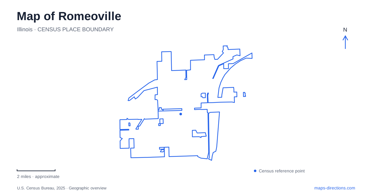
Street tiles load from OpenStreetMap when opened. The blue line shows the 2025 Census boundary.
- State
- Illinois
- Population · July 2025
- 41,281
- Land area
- 19.4 sq mi
- Water area
- 1.0 sq mi
Romeoville developed through several kinds of movement: river travel, canal construction, railway shipments, and later highway access. Those layers are still useful for reading its map. The Des Plaines River and its island landscape explain an early regional setting, while the old town, quarries, and expanding residential areas belong to later periods. Romeo Road provides a particularly helpful line along which to compare public destinations on different sides of that story.
Romeo, the canals, and the stone industry
The Canal Commission laid out a planned town called Romeo in 1835. Its plat was recorded that September, before Will County was formed. The community's name referred to Shakespeare's character, giving the earlier town a distinct identity before it adopted the longer name used today.
Canal excavation, farming, and quarrying all contributed to its development. The village history identifies Bruce, Santa Fe, and Consumer as quarries operating in the late 1880s. Limestone served road construction, buildings, and agricultural uses, so the quarry landscape supported several markets rather than a single local project. The nickname Stone City reflected the importance of that work.
Residents voted to incorporate and change the name to Romeoville in January 1895. Construction of the Chicago Sanitary and Ship Canal brought another wave of workers during the same decade. Looking at waterways and transport corridors together therefore reveals the practical setting in which the incorporated village emerged.
The natural river and constructed canals should be read as separate features. Their proximity does not make them interchangeable: one is part of the river system that supported earlier travel, while the others record large engineering projects and the labor communities that accompanied them.
An island with a museum and living habitats
Isle a la Cache lies on Romeo Road, also called 135th Street, east of Route 53. The Des Plaines River passes along both sides of the island. That detail can be easy to overlook when a road map emphasizes the crossing and compresses the channels into narrow lines.
The Forest Preserve District of Will County protects forest, prairie, wetland, and river-corridor habitats here. A canoe and kayak launch provides access to the river, and a short natural-surface trail supports a different kind of outing from the longer paved routes nearby. The preserve's compact walking experience and its role as a regional connection serve different purposes.
The museum at 501 East Romeo Road interprets eighteenth-century Illinois Country, including the interaction of French voyageurs and Potawatomi communities during the fur trade. Exhibits use objects such as birch-bark canoes and beaver pelts to explain that economy, while a walk-in wigwam presents another part of the cultural setting.
For a map of Romeoville, the museum adds meaning to the island itself. Water was a travel route and a source of resources long before the modern road crossing. The interpretive setting encourages a visitor to understand the river as part of people's daily lives, rather than merely the blue boundary around a park.
Beyond the short island walk
The preserve connects by way of 135th Street to the Centennial Trail/Veterans Memorial Trail and the I&M Canal Trail. The Forest Preserve District distinguishes the paved Centennial route from the crushed-limestone canal route. Those surface differences, along with the much shorter nature trail on the island, are useful when choosing the scale and character of an outing.
The island is therefore a starting point for several experiences: a museum visit, a short walk among habitats, a river launch, or a connection toward longer trails. A regional trail map is more informative for the last of these than a close-up view limited to the museum grounds.
Residential expansion and the western park setting
Romeoville entered another major stage in 1957, when more than 600 acres of farmland were annexed for the Hampton Park subdivision. The village's budget history identifies this as a turning point in residential growth. Its modern road framework includes Interstate 55, Interstate 355, Route 53, and Weber Road, which help situate that broader suburban landscape beyond the old river-and-canal focus.
Deer Crossing Park, at 1050 West Romeo Road, supplies a different public setting from the island preserve. The municipal inventory lists an amphitheater, pavilion, playground, nature areas, and trails within its 14.5 acres. It combines gathering and play facilities with outdoor space on the western part of the Romeo Road corridor.
Comparing these places gives Romeoville a clear geographical sequence without reducing it to one attraction. The river island preserves cultural and natural history; the canals and quarries explain industrial development; Hampton Park marks a period of residential expansion; and municipal parks serve the community that grew from those changes.
Map and statistics: U.S. Census Bureau, 2025 Gazetteer, January 2025 generalized place boundaries and Vintage 2025 population estimates. Local references: Village of Romeoville; Forest Preserve District of Will County. Article prepared by Maps & Directions.