Map of Rome
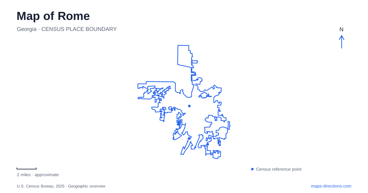
Street tiles load from OpenStreetMap when opened. The blue line shows the 2025 Census boundary.
- State
- Georgia
- Population · July 2025
- 38,934
- Land area
- 31.8 sq mi
- Water area
- 0.8 sq mi
Rome, Georgia, developed where the Etowah and Oostanaula rivers meet to form the Coosa. That confluence gives the city a geographic structure more distinctive than a simple downtown-and-suburbs pattern. Broad Street, the Between the Rivers district, riverfront recreation areas and wooded hills occupy different positions around the waterways. The rivers supported trade, while the higher ground provided sites for landmarks and later public spaces. Together they explain why a useful local map needs to show both water connections and changes in elevation.
Between the rivers is a literal description
The historic district between the Etowah and Oostanaula includes the area associated with the city's founding in 1834. Its surviving nineteenth- and early-twentieth-century buildings reflect recovery and development after Civil War destruction. The district's name is therefore a direct geographic guide as well as a heritage label: it identifies land defined by two separate river edges.
The area history center at 305 Broad Street offers interpretation within this established commercial setting. Rome's founding date should not be mistaken for the beginning of human history here. The surrounding land had a substantial Cherokee history before forced removal in the 1830s. The downtown story and the Indigenous history of the river valley need to be understood together, even though they are interpreted at different sites.
The clocktower began as water infrastructure
The landmark on Neely Hill was first conceived as a water tower. Construction began in 1871, with an iron tank enclosed by a ten-sided brick structure. The project addressed the practical problem of supplying enough water for firefighting, rather than beginning as a purely ornamental monument. Clockworks and a bell followed in 1872, turning the utility structure into the recognizable skyline feature.
The local tourism authority describes an internal stair of 107 steps and a tank with a capacity of 250,000 gallons. Those details explain the building's unusual proportions and the difference between seeing it from the street and climbing it during an organized opening. In Rome, a prominent architectural symbol is also a record of nineteenth-century municipal engineering. Its hilltop position mattered to the water system before it became a defining view of the city.
A Cherokee home beside the Oostanaula
Chieftains Museum, also known as the Major Ridge Home, stands at 501 Riverside Parkway NE. The museum interprets the Ridge family and nineteenth-century Cherokee history, including the events leading to the Trail of Tears. Its grounds include gardens and outdoor interpretation beside the river, connecting the house to a wider landscape rather than presenting it as an isolated artifact.
The Cherokee Nation's account identifies Major Ridge with the Treaty Party and the signing of the 1835 Treaty of New Echota. That contested treaty became central to the removal of Cherokee people from their southeastern homelands. The site's significance extends beyond architecture to political decisions, displacement and the consequences for a nation. Its riverbank location and surviving archaeological evidence also help explain the former property as a place of residence, work and transportation.
Riverfront paths and hill trails are different networks
The municipal trail directory for Rome describes the riverfront greenway as a collection of segments, with multiple trailheads and connections still developing. It should not be assumed that every line in the long-term vision already forms a finished loop. Ridge Ferry Park provides a major recreation setting along the river, while Jackson Hill has unpaved, rolling trails associated with a wooded historic landscape.
One especially useful access distinction concerns the Mount Berry Trail. Although it follows river views and hillsides along college property, the city explicitly states that there is no public access from the college campus. Its trailhead parking is on Coligni Way behind the post office. A destination's relationship to institutional land does not necessarily identify the correct public entrance. That distinction can prevent an otherwise plausible map search from ending at the wrong approach.
Connections continue to change
Jackson Hill Trail Connection planning identifies a route along Burwell Creek beneath Riverside Parkway. That alignment illustrates a way of linking trail sections without requiring pedestrians to cross roadway traffic. A construction bid or design drawing records the project's development, while the city's trail-access information establishes the route available for a walk. Identify the actual crossing and return path before combining this corridor with an outing on adjoining trails.
Rome's hills are also interpreted in the Meditation Garden near the lower entrance to Myrtle Hill Cemetery on Branham Avenue. Seven raised landforms represent the hills, and winding paths symbolize the rivers. The garden translates the larger geography into a small designed landscape. From that symbolic view to the engineered clocktower and riverbank museum, the city's landmarks show how terrain, infrastructure and history occupy the same map while telling distinct stories.
Map and statistics: U.S. Census Bureau, 2025 Gazetteer, January 2025 generalized place boundaries and Vintage 2025 population estimates. Local references: Advisory Council on Historic Preservation; Georgia’s Rome Office of Tourism; Rome Area History Center; Friends of Chieftains; Cherokee Nation; City of Rome; City of Rome / Floyd County. Article prepared by Maps & Directions.