Map of Rohnert Park
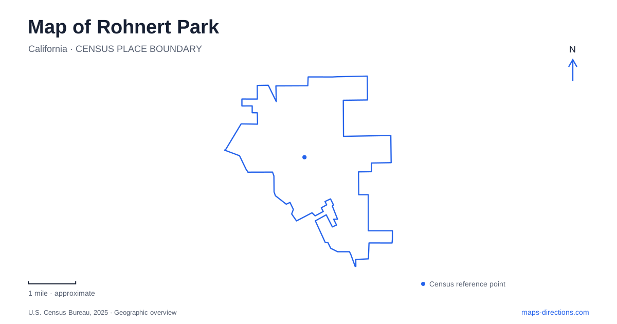
Street tiles load from OpenStreetMap when opened. The blue line shows the 2025 Census boundary.
- State
- California
- Population · July 2025
- 44,811
- Land area
- 7.3 sq mi
- Water area
- 0.0 sq mi
Rohnert Park has several overlapping networks that become clearer when viewed together. Roads and the SMART railway organize regional travel. Creek corridors connect neighborhoods with Sonoma State University and the wider Laguna de Santa Rosa watershed. Eastward, the open terrain around Crane Creek offers a different landscape from the developed streets. A useful map should retain those distinctions while showing how the campus, city, and regional park fit into the same area.
A railway stop on Enterprise Drive
The local SMART station is at 900 Enterprise Drive. It provides connections with Sonoma County Transit and includes bicycle facilities. Cotati has a separate station farther along the railway corridor, so the two station names should not be treated as interchangeable references to the same platform.
For a Rohnert Park visit, the railway supplies a regional arrival point rather than a complete route to every destination. Enterprise Drive locates that arrival within the street network. The onward portion might involve a transit connection, walking, or cycling, depending on the destination. This is especially relevant for a university event: the station and the campus are separate places, and a rail journey needs an onward plan as well as a timetable. SMART's station information can be paired with the city or campus map to understand that final portion.
Copeland Creek crosses the university landscape
Copeland Creek flows from Sonoma Mountain through the university campus and onward across urban areas into the Laguna de Santa Rosa. It is therefore more than a landscaped channel beside a path. It connects upland, campus, and city environments within one watershed.
The university's Creeks in Common initiative uses part of this corridor for environmental learning and restoration. Its campus area includes riparian habitat, the Kenneth Stocking Native Plant Garden, and an agroecology garden. Those uses make the creek a working educational landscape as well as an outdoor setting.
Looking at Rohnert Park through this water route changes the emphasis of the map. Street boundaries divide parcels, but the creek carries water through them. A campus garden and a downstream urban reach are connected even when they have different owners and surroundings. That relationship explains why restoration work on the university grounds can be discussed as part of a larger watershed effort rather than only campus beautification.
Plant communities beside the creek
The Kenneth Stocking Native Plant Garden is organized into fifteen plant communities representing California's major floristic regions. Its groupings include oak woodland, chaparral, grassland, freshwater marsh, redwood forest, and vernal pool environments. A butterfly garden overlaps several of those areas.
This is a place where a detailed garden plan adds information that a general map cannot. Adjacent planted areas deliberately represent different habitats rather than a single naturally occurring plant community. The layout allows comparisons between species and growing conditions across the state. Paths and seating provide places to observe those differences, and the university identifies Lot G as a parking reference for the nature corridor. The garden's educational purpose makes it distinct from a conventional ornamental bed or a large regional hiking preserve.
Music venues occupy another part of campus life
The Green Music Center gives Sonoma State a prominent performing-arts destination. Weill Hall has a rear wall that can open onto the terraced Weill Lawn, allowing the indoor stage and outdoor audience area to function together for selected performances.
For Rohnert Park, this creates a cultural venue with a spatial arrangement worth understanding before arrival. A lawn ticket and a seat inside the hall correspond to different parts of one performance setting. The general university address on East Cotati Avenue locates the campus, but event directions and the venue seating plan clarify the intended arrival and audience area. The creek gardens and concert facilities may share a university setting, yet they offer very different reasons to visit and should be planned accordingly.
Crane Creek's hills and the proposed connection
Crane Creek Regional Park lies east of the city, with rolling grasslands, oaks, and a network of trails. The county park map identifies the Creek, Lupine, Fiddleneck, and Sunset routes, offering several ways to explore the slopes rather than one obligatory circuit. Its terrain contrasts with the flatter campus and urban corridors.
The county also describes a proposed expansion and a future Copeland Creek Trail connection through the university area to the regional park. That proposal is important to distinguish from an established continuous route. An attractive line on a planning map does not establish present public access across the intervening land.
A Rohnert Park itinerary can combine these landscapes, but each should retain its own approach: Enterprise Drive for the train, campus information for gardens or performances, and the county park map for the hills. The proposed connection explains an intended relationship between them while leaving the existing routes clear.
Map and statistics: U.S. Census Bureau, 2025 Gazetteer, January 2025 generalized place boundaries and Vintage 2025 population estimates. Local references: Sonoma-Marin Area Rail Transit; Sonoma State University; Sonoma State University Green Music Center; Sonoma County Regional Parks. Article prepared by Maps & Directions.