Map of Rogers
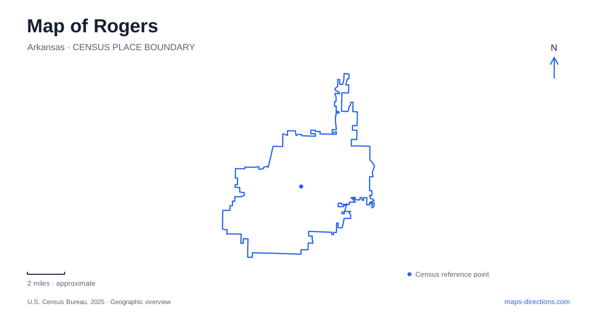
Street tiles load from OpenStreetMap when opened. The blue line shows the 2025 Census boundary.
- State
- Arkansas
- Population · July 2025
- 76,956
- Land area
- 38.4 sq mi
- Water area
- 0.2 sq mi
Rogers grew around a railroad, and that beginning remains visible in the shape of its historic center. The tracks organize downtown, while parks and trails extend the experience east toward Lake Atalanta. A separate uptown entertainment area contains the Walmart AMP, and Highway 12 leads into a much larger landscape around Beaver Lake. Understanding these different scales helps connect the compact railroad town with the city and region that developed around it.
A town formed beside the tracks
The first train reached the site on May 10, 1881, and the new town incorporated later that month. An early depot served passengers and freight near First and Chestnut streets. In 1883, a larger passenger depot was built beside the tracks between Elm and Poplar streets. Those locations show how rail service established an organizing line through the settlement rather than arriving after an established downtown had already formed.
The modern Railyard Park reinterprets that inherited geography. Its design sought to connect spaces on both sides of the railway, creating public plazas where the track corridor had long acted as a dividing line. Completed in 2021, the park includes Frisco Plaza, a play area, a splash pad, and Butterfield Stage. Its water-tower forms give the downtown landscape a recognizable contemporary feature while retaining a name tied to the city's beginnings.
A map of Rogers becomes more informative when the park and the historic street grid appear together. The performance space and plazas occupy the same broader district where rail travel once concentrated commerce. Their present use illustrates how a transportation landscape can become a place for gathering without losing the physical evidence of its origin.
Second Street's museum buildings
The historical museum's main exhibition galleries are in the Hailey Building at 313 South Second Street. The Hawkins House and Key Wing Education Center occupy 322 South Second Street. These neighboring addresses form a small museum campus rather than a single building with every activity inside it.
The Hawkins House was built in 1895 at Second and Cherry streets. Three generations of the family lived there over seventy-nine years, and its restoration presents the house with furnishings reflecting the period around 1900. Nearby Vera's Victorian Garden adds an outdoor extension to the domestic-history setting. The house makes the railroad-era town easier to imagine at the scale of a household, in contrast to the civic scale of the nearby tracks and plazas.
The Hailey Building introduces another chapter. Its South Second Street premises were constructed in 1947 for an expanding Ford dealership. The former automotive showroom now houses historical exhibitions, linking the building's own past to the changing transportation story interpreted inside. In Rogers, the museum campus itself supplies evidence of both residential life and commercial adaptation.
Lake Atalanta's relief and trail choices
East of downtown, Lake Atalanta Park contains a thirty-seven-acre spring-fed lake within a much larger park. The lake was built in 1936 through the Works Progress Administration and named for Atalanta Gregory, whose family donated much of the land. The park's terrain includes more than two hundred feet of elevation change, so the green area on the map is not a uniformly level landscape.
Paved paths and lakeside boardwalk sections provide one kind of outing; soft-surface hiking and cycling trails provide another. The city's trail map divides the mountain-bike system into five zones with differing difficulty and directional guidance. Those distinctions are useful when comparing a waterside walk with a ride through steeper terrain. The Railyard Bike Park connects toward the lake through paved and off-road routes, extending the downtown recreation sequence beyond the central plazas.
Uptown music and the route toward Beaver Lake
The Walmart AMP is at 5079 West Northgate Road. It belongs to the uptown entertainment landscape identified by the city, while Butterfield Stage belongs to the historic downtown park. Both are performance destinations in Rogers, but their different street addresses reflect different urban settings. A concert itinerary should begin with the venue itself, since the broader entertainment identity spans more than one district.
Beyond the urban trail network, Hobbs State Park–Conservation Area occupies rolling forest along Beaver Lake's southern shore. Its visitor center is at 20201 East Highway 12 and interprets the area's natural resources and history. The park includes hiking, cycling, and equestrian routes within a conservation landscape in the White River watershed. This is a regional excursion rather than an extension of Lake Atalanta's neighborhood paths. A complete map of Rogers shows that transition clearly, from rail-oriented streets to local lake trails and then to the forested reaches of Highway 12.
Map and statistics: U.S. Census Bureau, 2025 Gazetteer, January 2025 generalized place boundaries and Vintage 2025 population estimates. Local references: Rogers Historical Museum; City of Rogers; Walton Arts Center; Arkansas Tourism / Arkansas State Parks. Article prepared by Maps & Directions.