Map of Rockwall
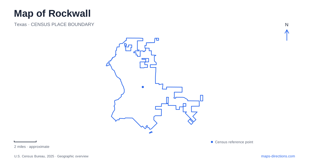
Street tiles load from OpenStreetMap when opened. The blue line shows the 2025 Census boundary.
- State
- Texas
- Population · July 2025
- 53,980
- Land area
- 29.6 sq mi
- Water area
- 0.5 sq mi
Rockwall has two distinct public faces: the older downtown square and the lakeside setting at The Harbor. The former developed around an upland town plat, while the latter looks across Lake Ray Hubbard, a reservoir created more than a century later. Interstate 30 connects the city with Dallas to the west. Understanding these different periods of growth makes the map more useful: the historic center, modern waterfront, and inland park grounds are complementary destinations rather than parts of one continuous downtown promenade.
The square predates the lake
The original town plat was filed in April 1854, placing the public square and surrounding streets on a hill overlooking the East Fork of the Trinity River. That relationship is important because the expansive water seen today was not the landscape around which the nineteenth-century town was first laid out. Downtown's compact blocks belong to an older settlement pattern above the river country.
The historic courthouse square remains a central reference for Rockwall. Nearby shops and restaurants occupy the established commercial district, while San Jacinto Plaza supplies a separate downtown gathering and performance space. A lakeside restaurant address and a downtown business address may both be described as central visitor attractions, but they lead to different settings. The square is best read through its buildings and intersecting streets; The Harbor is organized around the shoreline and views.
The reservoir changed the regional geography
Lake Ray Hubbard occupies the East Fork Trinity River basin and extends across four counties. The City of Dallas owns its dam, and Dallas Water Utilities operates the reservoir for purposes including water supply, flood control, and recreation. Deliberate impoundment began in December 1968, with the dam completed the following January. These details explain why a lake associated visually with this city is also part of a much larger regional water system.
The Harbor occupies a hillside above the water and combines commercial premises with public recreational space. The city's venue listing distinguishes an upper plaza, lower plaza, and the Brad Griggs Amphitheater. Their arrangement gives the waterfront a layered character rather than the form of a single level street. Summer Lee Drive is the useful road reference for this destination. The amphitheater and plazas serve gatherings on land; the presence of water alongside them does not make every part of the waterfront a boat-launch facility.
The formation beneath the city
The name Rockwall comes from stone formations encountered by settlers digging a well in the early 1850s. The museum's historical account records repeated geological investigations identifying natural sandstone dykes. Although the appearance prompted speculation about an ancient constructed wall, a visitor guide should not present that speculation as established archaeology.
The formations are largely underground. Reconstructed sections can be seen on the historical museum grounds and by the old courthouse, allowing visitors to examine examples without entering excavation sites. In March 2025, the city announced acquisition of the historic Canup-family site for a possible future display, explicitly stating that the formation remained buried and the property was closed. That proposal is not evidence of a completed public excavation attraction. The accessible displays are the appropriate landmarks to place on an ordinary sightseeing map.
Historic houses gathered at Harry Myers Park
The county historical foundation's museum is at 901 East Washington Street, within the Harry Myers Park setting. Its collection of buildings brings together structures that originally stood elsewhere. The Bailey House, dating to around 1909, moved from 301 North Goliad Street to the museum grounds in 2017. The Manson-LaMoreaux-Hartman House came from 106 West Washington Street during the 1980s after use by medical practitioners.
For a map of Rockwall, these relocations matter because the houses illustrate local history without preserving their original street positions. The museum groups them for interpretation, while their former addresses describe another layer of the town. A reconstructed stone section stands between the two houses, connecting the domestic exhibits with the geology that supplied the city's name.
Recreation beyond the shoreline
Harry Myers Park also supports active recreation, including walking trails, fishing ponds, playgrounds, a dog park, and disc golf. The municipal disc golf course was redesigned with course designer John Houck to provide different challenges for experienced and recreational players. This broader park landscape offers a different outing from either the small downtown blocks or the waterfront plazas.
The most informative view of Rockwall keeps all three landscapes visible. The courthouse district reflects the nineteenth-century hilltop settlement, the museum and park assemble local heritage with recreation, and The Harbor faces a twentieth-century reservoir. Together they explain why streets, water, and historical labels fit the city in several different ways.
Map and statistics: U.S. Census Bureau, 2025 Gazetteer, January 2025 generalized place boundaries and Vintage 2025 population estimates. Local references: City of Rockwall; Texas Water Development Board; Historical Foundation Museum. Article prepared by Maps & Directions.