Map of Rocklin
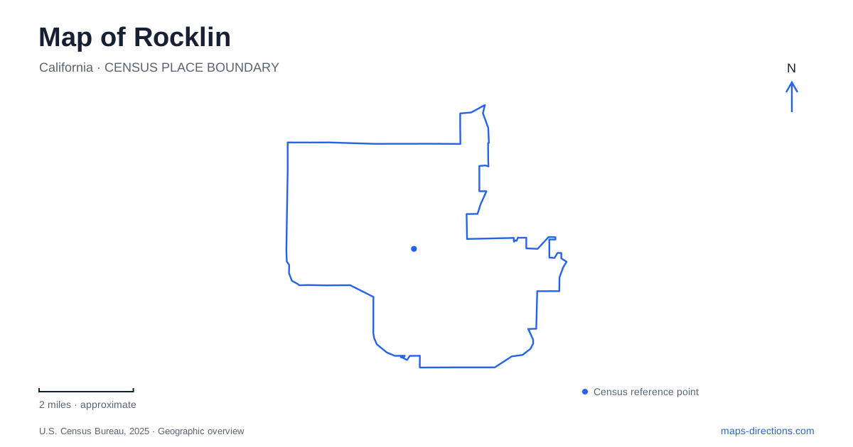
Street tiles load from OpenStreetMap when opened. The blue line shows the 2025 Census boundary.
- State
- California
- Population · July 2025
- 76,821
- Land area
- 19.8 sq mi
- Water area
- 0.0 sq mi
Rocklin's landscape makes more sense when its granite industry and railroad history are read together. Quarrying and rail service developed alongside one another in the nineteenth century, establishing a compact working center whose remnants still shape local landmarks. Today, former industrial ground supports recreation, a historical museum occupies an older house, and creek corridors and oak woodland provide different kinds of open space. The college campus adds another substantial destination in the foothill landscape.
Granite beside the railroad
The railroad reached the area in 1864, around the time granite extraction began to develop. By 1910, the city counted twenty-two working quarries. Rail access allowed heavy stone to leave the area for construction elsewhere, connecting a local geological resource to a much larger building industry. The quarries and tracks were therefore parts of the same economic system, not unrelated features that happened to occupy neighboring land.
The historic commercial streets reflected this working geography. Front Street and Railroad Avenue supported businesses around the railroad, while the road once called Granite Avenue became a major local reference. City historical accounts describe destructive fires on both sides of the tracks in the 1890s. Reading those streets on a modern map helps locate the older center beneath subsequent redevelopment and changes in use.
A house museum and a quarry reused
The history museum is at 3895 Rocklin Road, in the Fletcher-Moon House across from City Hall near San Francisco Street. The domestic scale of the building offers a useful counterpoint to the heavy industry represented in local history. Artifacts inside connect the larger story of stone and railroads with people who lived and worked in the community.
Quarry Park is at 4000 Rocklin Road, close enough to belong to the same historic-center sequence. Its amphitheater supports performances, while Quarry Park Adventures uses the former quarry setting for activities including climbing, rappelling, and zip lines. The excavated stone landscape is thus part of the experience itself. Its distinctive form comes from earlier extraction, even though the present purpose is entertainment and outdoor recreation.
These sites can be understood together without treating them as a single attraction. The house museum interprets the community's past, while the quarry demonstrates how a place shaped by industry can acquire a new public role. Their relationship makes this corridor particularly revealing for someone interested in why local places look the way they do.
Antelope Creek and community recreation
Johnson-Springview Park, at 5480 Fifth Street, combines heritage oaks and Antelope Creek with a concentration of recreation facilities. Baseball and softball fields, tennis courts, a disc golf course, a skate park, and a roller hockey area occupy the same broader grounds as picnic spaces and pathways. The community center and parks office also stand here.
The creek and mature trees give the park a different character from the quarry landscape. Instead of exposed excavation and vertical adventure elements, the setting brings together open ground, shade, watercourse, and organized sports. On a map of Rocklin, this is a substantial community recreation area whose internal layout matters as much as its outer boundary. A visit to the disc golf course, for example, involves a different part of the grounds from a meeting at the community center.
The Whitney ranch legacy
North of the original center, the Whitney family's Spring Valley Ranch began in 1855. The city describes an extensive agricultural operation with sheep, varied crops, roads, granite bridges, barns, and housing for ranch workers and their families. Its scale helps explain why the history of the northern landscape differs from that of the compact railroad and quarry district.
The ranch was later subdivided as suburban development expanded northeast from Sacramento. The Whitney name therefore carries a connection to a much larger former landholding, rather than referring only to a present-day neighborhood or park. This historical layer helps interpret modern place names without assuming that every location sharing the name belongs to one continuous public property.
Sierra College and Secret Ravine
Sierra College occupies 311 acres at 5100 Sierra College Boulevard. Its Natural History Museum is in Sewell Hall, Building S, on the western side of the campus. The museum's own directions caution that a broad map search can instead lead toward the stadium side. Locating the science building makes the intended destination clearer within a campus containing many separate facilities.
Beyond the building, the nature area includes oak woodland, riparian forest, and paths associated with Secret Ravine Creek. The science club and faculty developed the nature trail in the 1960s, linking outdoor study with the campus's educational role. Rocklin's geography can consequently be read through several distinct landscapes: stone extraction around the historic core, community recreation along Antelope Creek, former ranchland to the north, and a college where foothill habitat forms part of the learning environment.
Map and statistics: U.S. Census Bureau, 2025 Gazetteer, January 2025 generalized place boundaries and Vintage 2025 population estimates. Local references: City of Rocklin; Rocklin Historical Society; Sierra College. Article prepared by Maps & Directions.