Map of Rio Rancho
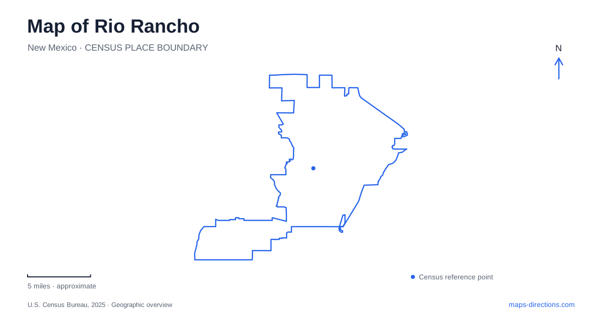
Street tiles load from OpenStreetMap when opened. The blue line shows the 2025 Census boundary.
- State
- New Mexico
- Population · July 2025
- 114,419
- Land area
- 103.4 sq mi
- Water area
- 0.3 sq mi
Rio Rancho's public places are spread across several distinct settings. City Center groups government, events, and outdoor gathering space around a planned civic district. Pinetree Road brings a library, veterans park, and demonstration garden together in a smaller neighborhood setting. Other libraries and trails serve different parts of the city. This pattern reflects a community whose modern development began with a large land purchase in 1961, rather than with one compact nineteenth-century commercial square.
A planned civic center north of Paseo del Volcan
The City Centre planning area lies north of Paseo del Volcan, east of Unser Boulevard, and west of Broadmoor Boulevard. Those three roads provide a useful frame for the district. City Hall and the events center are among its established buildings, while the nearby Campus Centre area contains university, community college, and medical facilities. The grouping brings several major public and institutional functions into one part of the wider urban map.
Campus Park, at 2516 King Boulevard NE, lies directly west of City Hall. Its Sky Room Amphitheater and outdoor gathering spaces support performances and city events. King Boulevard can be reached from Unser Boulevard or Paseo del Volcan, giving visitors a clear approach to the park within the larger civic district. The park's first phase opened in 2021, adding another recreation setting to the public landscape.
For Rio Rancho, this is an example of deliberately building a civic center over time. The district's identity comes from the relationship between public buildings, education and health facilities, and gathering space. It is useful to read the whole road frame before focusing on one venue, because the institutions occupy separate sites within a planned area rather than rooms in one municipal complex.
Pinetree Road combines learning, memory, and gardening
At 950 Pinetree Road SE, the Esther Bone Memorial Library shares a setting with a veterans park and the Water Wise Demonstration Garden. The garden sits between the library and the memorial park. This cluster supports a very different kind of visit from the large events district: a library program, a quiet outdoor pause, or an examination of plants suited to the high desert.
The garden is a partnership involving Sandoval County Master Gardeners and the city's conservation and parks staff. Its demonstrations include water-efficient planting, drip and bubbler irrigation, timed watering, and mulch. The point is practical education about how planted landscapes can respond to local conditions. The site received an International Master Gardener award in 2009, reflecting its role as a teaching garden rather than merely decorative landscaping beside a public building.
A Rio Rancho map becomes more revealing when these neighboring facilities are considered together. Their shared address area creates a small public cluster with several uses, while the garden explains something about the environment surrounding the city. It is a place where the broader issue of water use can be examined through specific planting and irrigation choices at a manageable scale.
Library addresses locate other community centers
The Loma Colorado Main Library is at 755 Loma Colorado Boulevard NE. The HUB at Enchanted Hills uses 7845 Enchanted Hills Boulevard NE. Along with Esther Bone, these addresses show how cultural and educational services are distributed across the community. The names correspond to different areas and should be retained when selecting a program or arranging a meeting.
This distribution also provides useful anchors for everyday navigation. Pinetree Road, Loma Colorado Boulevard, and Enchanted Hills Boulevard identify three separate settings with public services. For Rio Rancho residents and visitors, choosing the appropriate library can make a local outing more coherent, especially when pairing it with nearby parks or other appointments. The main library designation describes a role within the system, while the street address establishes the actual journey.
The bosque offers a different landscape framework
The city's open-space system includes the bosque, where management combines restoration, recreation, education, and preservation. Public trail references include the Bosque Trail at Riverside Drive and Allegheny Drive, Willow Creek Trail from Willow Creek Road, and Trailhead Trail near Corrales Road and Grey Hawk Drive. These names and intersections provide several ways to locate the river-associated landscape on a city map.
The bosque should be understood as a managed natural area with multiple access locations, rather than as a single neighborhood park. That distinction complements the civic and library geography: some destinations are buildings, others are planned gathering grounds, and others are entrances to a wider ecological corridor. Rio Rancho offers all three. Organizing an outing around one of these settings gives the trip a specific purpose while showing how public life is spread across the city's developing landscape.
Map and statistics: U.S. Census Bureau, 2025 Gazetteer, January 2025 generalized place boundaries and Vintage 2025 population estimates. Local references: City of Rio Rancho. Article prepared by Maps & Directions.