Map of Richardson
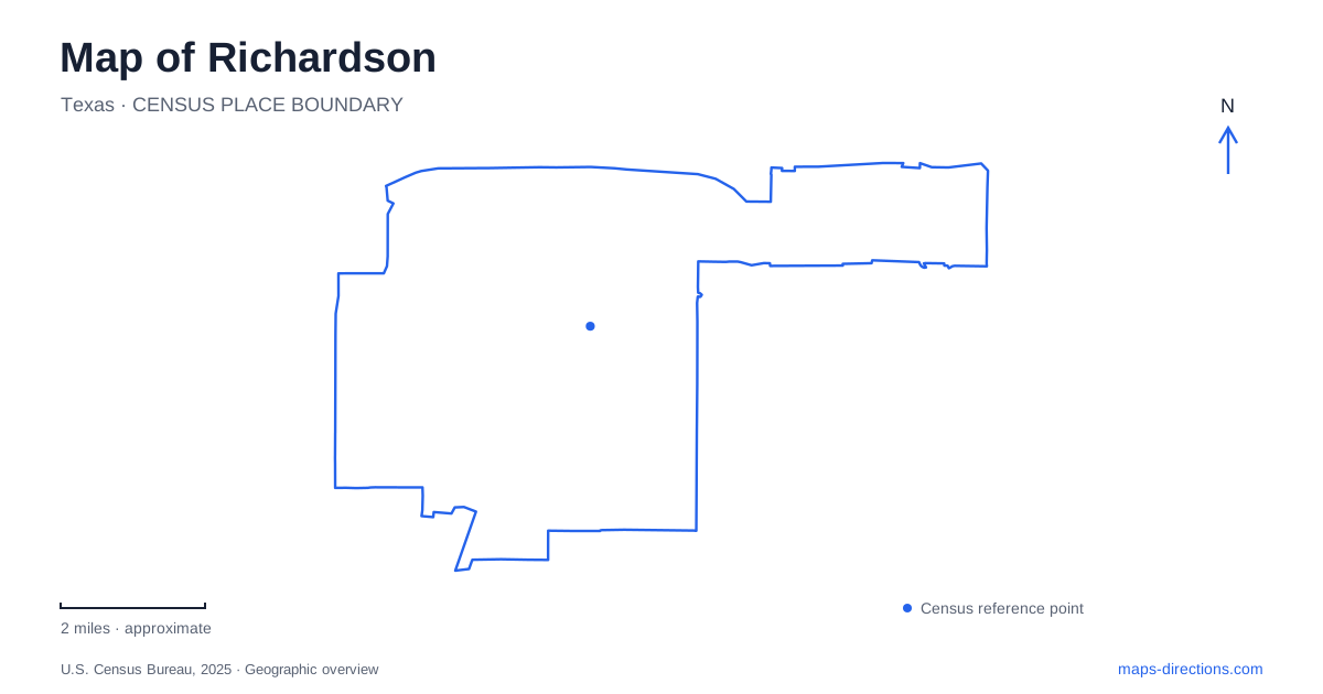
Street tiles load from OpenStreetMap when opened. The blue line shows the 2025 Census boundary.
- State
- Texas
- Population · July 2025
- 118,542
- Land area
- 28.6 sq mi
- Water area
- 0.1 sq mi
Richardson contains several distinct urban patterns: older commercial neighborhoods near Main Street, rail stations along major corridors, a university campus, and preserved creek woodland beside newer development. The useful map brings these patterns into relation rather than treating every destination as part of one downtown. Greenville Avenue, Campbell Road, Lookout Drive, and Plano Road provide different reference lines, each associated with places that contribute a particular part of the city's character.
Five neighborhoods within the CORE District
The city's economic development office groups Chinatown, Downtown, Heights, Interurban, and Lockwood within the CORE District. Each name describes a different strand of the area's development. Downtown follows Main Street, while Chinatown occupies Greenville Avenue north of Main. Their relationship gives the older commercial center more shape than a single downtown marker.
Heights developed as the city's first shopping center in the 1950s. Interurban was an industrial and manufacturing area, and Lockwood contains buildings adapted for newer restaurant and beverage uses. These histories explain why the district includes both conventional shopping-center space and former working buildings with different layouts.
A Richardson itinerary focused on food or local businesses can use those neighborhood names to explore different settings within the same general district. Main and Greenville establish the initial street relationship; the other neighborhood labels identify places whose buildings reflect distinct phases of commercial growth. The district's variety comes from those differences rather than from a uniform retail plan.
Rail stations add their own street geography
Arapaho Center station is at 1051 North Greenville Avenue near Arapaho Road. DART describes a pedestrian walkway beneath Greenville connecting the rail station and bus facilities. This underpass is an important local feature because the transit interchange occupies more than one side of a substantial road.
The station's design also incorporates local history. Colored paving includes historical symbols, and Hans Van de Bovenkamp's red aluminum sculpture, Gateway, marks the setting. These features turn an interchange into a recognizable place and offer visual references for someone arriving by rail.
Galatyn Park station has a different position, at North Central Expressway near Lookout Drive. DART lists its address as 2300 North Central Expressway. The two stations therefore organize different parts of Richardson: Arapaho Center around Greenville and Arapaho, and Galatyn around the expressway and Lookout. Their road contexts help relate transit arrivals to nearby destinations without assuming that the station names define entire neighborhoods.
University buildings beyond the general campus address
The University of Texas at Dallas uses 800 West Campbell Road as its general street address, while its visitor center is at 2830 Rutford Avenue. Both addresses are useful, but they describe different points within the same institutional setting. Campbell supplies the broader city orientation and Rutford identifies a particular visitor destination.
The university's current directions also identify a Silver Line station just north of campus and the Comet Cruiser shuttle with stops around the grounds. This adds a rail approach to the campus geography alongside the familiar road address. A campus visit can therefore begin from a different edge depending on the chosen transport mode.
For a map of Richardson, the university is a large destination with internal streets and buildings rather than a single roadside facility. The visitor center and northern station establish two concrete arrival references. From either, the campus building map supplies the next level of detail for an appointment or event.
Spring Creek preserves a woodland corridor
Spring Creek Nature Area lies just south of CityLine and contains more than one hundred acres of hardwood forest. The city traces its public preservation to a 1991 land donation and an adjoining acquisition in 2015 that more than doubled the area. Its history reaches further back to Jacob Routh, who farmed surrounding land while leaving this forest uncleared.
The nature area's corners contain granite entrance portals with leaf-shaped openings and sculpture. A perimeter route surrounds the preserve, while interior trails lead into the woodland. These designed edges mark the transition between developed surroundings and retained habitat.
Foxboro Park on North Plano Road provides another connection. From parking along Braeburn Drive, the Spring Creek Trail passes beneath Plano Road into the nature area. A further trail connection reaches Galatyn Woodland Preserve to the south. These links show a connected green landscape crossing road barriers rather than a set of unrelated park parcels.
The woodland corridor adds depth to a Richardson map otherwise dominated by commercial roads and transit. Main Street's older districts, the university, and the creek trails each explain a different part of the city. Keeping their named streets, stations, and connections visible makes those relationships easy to follow while preserving the character of each setting.
Map and statistics: U.S. Census Bureau, 2025 Gazetteer, January 2025 generalized place boundaries and Vintage 2025 population estimates. Local references: City of Richardson Economic Development; DART; University of Texas at Dallas; City of Richardson. Article prepared by Maps & Directions.